a treasure-trove of literature
treasure found hidden with no evidence of ownership
(and our other authors) or get HELP Reading, Downloading and Converting files)
or
SEARCH the entire site with Google Site Search
|
Project Gutenberg
Australia a treasure-trove of literature treasure found hidden with no evidence of ownership |
BROWSE the site for other works by this author (and our other authors) or get HELP Reading, Downloading and Converting files) or SEARCH the entire site with Google Site Search |
Title: Charles Sturt - His Life and Journeys of Exploration
Author: J. H. L. Cumpston
* A Project Gutenberg of Australia eBook *
eBook No.: 0700391h.html
Language:  English
Date first posted: March 2007
Date most recently updated: March 2007

Project Gutenberg of Australia eBooks are created from printed editions
which are in the public domain in Australia, unless a copyright notice
is included. We do NOT keep any eBooks in compliance with a particular
paper edition.

Copyright laws are changing all over the world. Be sure to check the
copyright laws for your country before downloading or redistributing this
file.

This eBook is made available at no cost and with almost no restrictions
whatsoever. You may copy it, give it away or re-use it under the terms
of the Project Gutenberg of Australia License which may be viewed online at
http://gutenberg.net.au/licence.html
GO TO Project Gutenberg of Australia HOME PAGE
Anybody might have found it, but His whisper came to me. --The Explorer: Kipling.
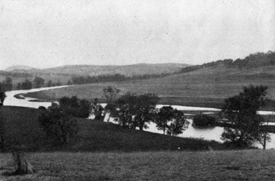
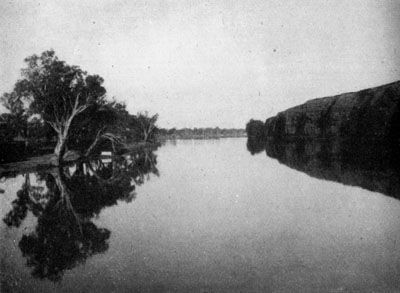
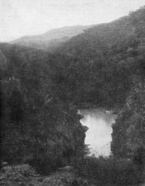
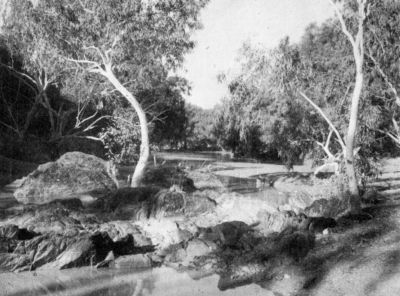
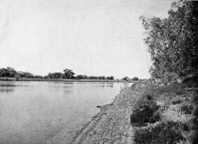
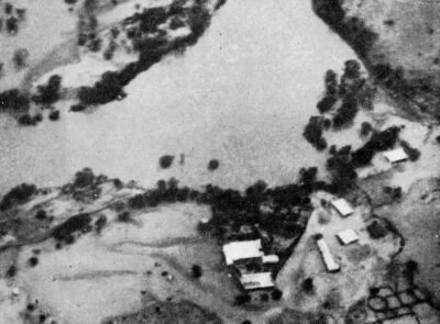
Murray Mouth showing also Goolwa Channel
CONTENTS
Preface
Introduction
I The Early Years
II First Years in Sydney
III The Macquarie Marshes
IV The Second Expedition
V Norfolk Island and England
VI Life in New South Wales
VII First Visit to South Australia
VIII The Period of Governor Gawler
IX The Period of Governor Grey
XThe Central Australian Expedition
XI End of Life in South Australia
XII Last Years in England
XIII Tributes and Memorials
Epilogue
Appendix A
Appendix B
Appendix C
Appendix D
References
Acknowledgments
Acknowledgments of Illustrations
Index
ILLUSTRATIONS
1. Murray Mouth showing also Goolwa
Channel,
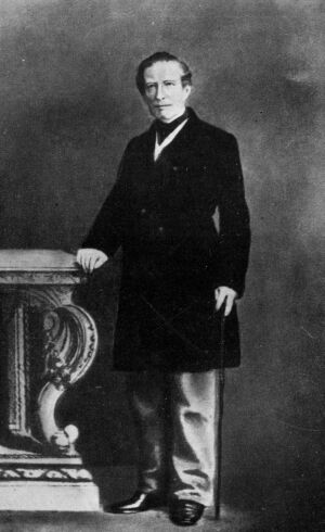
2. Captain Charles Sturt
3. Governor Ralph Darling5
4. Sir Thomas Mitchell
5. The Macquarie Marshes from the Air
6. The Bluff End of Cookbundoon
7. Title-page of book presented to Dr Gibson
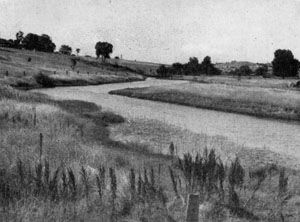
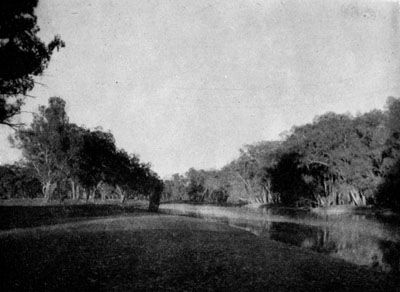
8. Meadow Creek at Gunning
9. The Devil's Pass, Mundoonen Range
10. A Remarkable Hill called Pouni, Mt
Bowning
11. Dunderalligo Creek
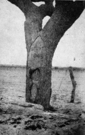
12. Sturt Monument at Gundagai
13. The Murrumbidgee from Jugiong Hill
14. Billabong near Wagga
15. Cypress Ridge near Narrandera
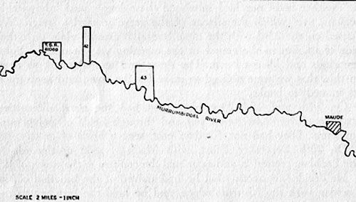
16. The Murrumbidgee between Hay and Maude
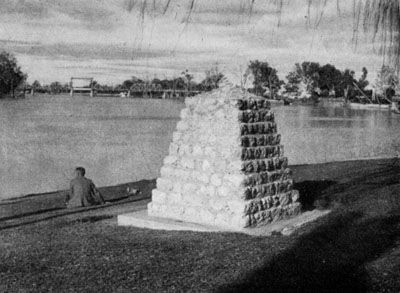
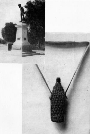
17. Sturt Monument at Mildura
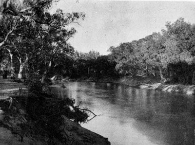
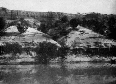
18. Murray River Cliffs near Tareena
19. Fossil Cliffs on Murray River
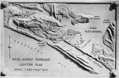
20. Relief Plaque on Pylon at Goolwa Barrage
21. Monument to Sturt and Barker on Hindmarsh
Island
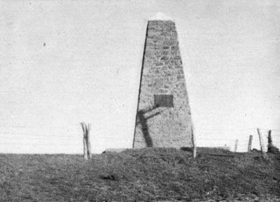
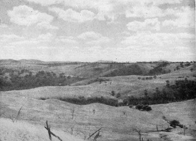
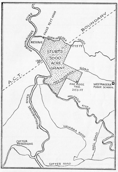
22. Sturt's Land at Ginnindera, near Canberra
23. Northern Boundary of Sturt's Grant, Ginnindera
Creek
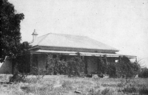
24. Sturt's Home at Varroville
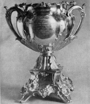
25. Silver Vase presented by Survey Staff
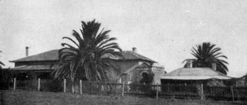
26. Sturt's Home at Grange, Adelaide
27. Sturt in Middle Life
28. Departure from Adelaide of Central Australian
Expedition
29. Country East of Broken Hill from the Air: Stephen
Creek Timber in Background
30. Plain from Old Fowler's Gap Hotel
31. A Rocky Glen - Depot Glen
31a. A Pond shaded by Trees and Cliffs - Depot
Glen
32. Preservation Creek where Sturt camped, showing
considerable recent silting
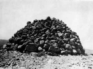
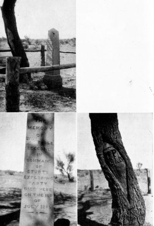
33. Cairn on Mount Poole
34. Poole's Grave at Preservation Creek
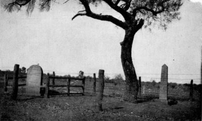
35. Cemetery at Preservation Creek which includes
Poole's Grave
36. Typical Dry Sandy Bed of Creek
37. Sturt's Stony Desert
38. Goyder's Lagoon
39. The Diamantina Plain
40. Kuddaree Waterhole, Mulligan River
41. Tree at Fort Grey
42. Looking North over Cooper Creek showing
Innamincka Police Station
43. Cooper Creek at Nappa Merri Station
44. Title-page of book presented to Sturt's son,
Charles
45. Sturt in the Years of his Retirement
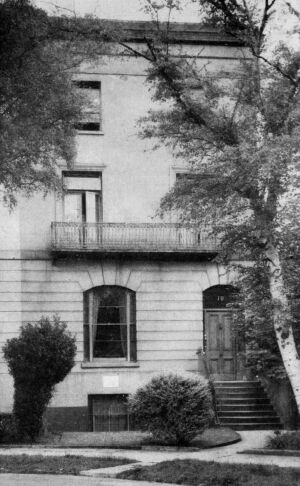
46. Sturt's Last Home in Cheltenham
47. Statue to Sturt in Adelaide
48. Water-bottle carried by Sturt on his Last
Expedition
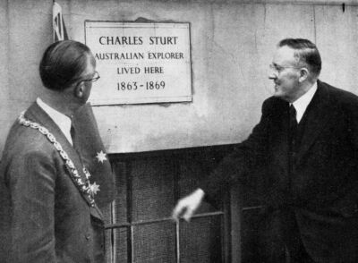
49. Mr Beasley Unveiling Tablet on Sturt's Last
Home
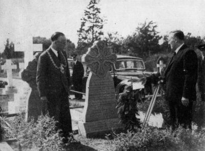
50. Mr Beasley Placing Wreath on Sturt's Grave,
1948
MAPS
The Inland Rivers as known in 1828
Routes followed on the First Expedition
Plan of Beemery "Island"
Locality of the Depot on the Murrumbidgee
The Inland Rivers as known in 1830
Location of Sturt's Original Grant near
Canberra
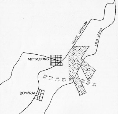
Sturt's Mittagong Property
Sturt's Land at Grange
Route North from Broken Hill
Portion of Counsel Tracing
Route North from Milparinka
Route North-west to Simpson Desert
Routes of the Three Expeditions
Key to Abbreviations:
Life: Life of Charles Sturt by Mrs. N. G. Sturt. Smith, Elder and Co. 1899.
H.R.A.: Historical Records of Australia. Pub. by Commonwealth Government.
Mit. Lib.: Mitchell Library Papers.
Sturt Papers: Papers in the possession of Sturt's grandson, Captain G. C. N. Sturt, which were presented to Rhodes House Library, Oxford, on 24th November, 1948.
Two Exp.: Two Expeditions into the Interior of South Australia during the years 1828, 1829, 1830, 1831 Charles Sturt. Pub. Smith Elders 1833.
Narr. Cent.: Narrative of an Expedition into Central Australia: Charles Sturt. Pub. T. and W. Boone, 1849.
Archiv., S.A.: Archives Department, Adelaide.
R.G.S.S.A.: Proceedings of the Royal Geographical Society, South Australian Branch.
R.A.H.S.: Transactions of the Royal Australian Historical Society, N.S.W.
ebook producer's note:
The chapter notes in the book appeared at the end of the book and they have been reproduced at the end of this ebook. However, in this ebook the notes have also been placed in square brackets at the end of the paragraph in which they are referenced. The reference method [c-n] refers to the chapter number and the note number within the chapter.
Notes which appeared in the book at the bottom of a page appear in round brackets at the end of the paragraph in which they are referenced. The reference method is an asterisk.
There is this difference between science and history: each scientific discovery brings new knowledge: by contrast, facts uncovered and recorded by the historian were invariably known to some people at some time: sometimes widely known and well recorded at the time.
But these facts may have become obscured or forgotten, or even as recorded may have acquired a new interest or significance.
Therefore, while there is in the story now presented nothing that is literally new; and although the story of Sturt's life has been told with skill and affection by his daughter-in-law, Mrs. Napier (Beatrix M.) Sturt, there is some justification for this new attempt to tell the story.
Mrs. Sturt's Life of Charles Sturt was published fifty years ago, has long been out of print, and copies are difficult to obtain, except in libraries. This is even more true of Sturt's own publications describing his expeditions down the Macquarie and Murray Rivers, and into Central Australia.
For these reasons the present generation of Australians cannot easily learn the story of one who played a courageous and altogether notable part for twenty-five of the most fateful years of the early period of our nation's history.
Also, even if the public had easy access to these books, it is difficult to relate the routes followed by Sturt to modern place-names, and the story is much more interesting when it can be followed step by step on a modern map.
Mrs. Sturt, also, was under a great disadvantage in never having visited Australia.
But the main consideration which, in the author's opinion, justifies the presentation of this "twice told tale" at this time, is that while the beliefs, ideals and aspirations which for centuries have inspired man's nobler efforts have become temporarily submerged in the struggle for survival, a book like this, which tells the story of a man whose ideal was service, and who was prepared to die in that service, might be timely, and might even be welcomed by a large body of young readers.
Canberra 1951
While it is true, as already stated, that this book contains little that is new, yet documents have come to light, letters have been collected; and through these, and the other varied channels by which history is revealed, information beyond that available fifty years ago can now be consulted.
The continuous and patient work of the Royal Historical and Royal Geographical Societies, and of many individuals, has determined points of detail and settled topographical locations, so that the principal task in a work of this kind is the assembling of material already available.
One point should be stated here. In naming places, particularly streams, Sturt used the old style of possessive adjectives, for example, Cooper's Creek: geographers have, however, agreed that this style shall be replaced by the simple name, such as Cooper Creek. This modern style has, therefore, been followed throughout. That it has, occasionally, unfortunate results, must be recognised, for example, "Flood Creek" conveys a wrong impression concerning the origin of the name.
The maps in this volume are not cartographically accurate, but they do convey correct information adequate for the general reader.
About the middle of May 1827 the ship Mariner was forging eastward with long lunges driven by a strong cold wind under a wet dead sky: no one on board without previous knowledge would have guessed that the bright land of their new life was then to the north of them.
Standing by the port rail of the quarterdeck was one man who knew it; and whose memories and forebodings were stirred by the knowledge. For him the warm sunlight of Cape Town was fading to a pleasant dream, the sullen rollers a depressing illusion of immobility and desolation, and the solitary albatross a symbol of life spent in ceaseless movement with an uncertain goal and an unknown destiny.
These things affected his thoughts and produced a mental depression which was to recur more than once in later life.
He was a professional soldier--a captain of the 39th Regiment of Foot--and as he looked back to the west he reviewed the past and all that he was leaving. His career as a soldier began when, at the age of eighteen years, he had, through the patronage of the Prince Regent, been gazetted ensign in the 39th Regiment. Service in the Pyrenees against the French was followed by service in Canada against the Americans, soon ended by the hurried recall of the regiment after Napoleon's escape from Elba. As they arrived in France after Waterloo the regiment served as part of the army of occupation in France until the end of 1818.
He had had, therefore, five years of varied experience--the first two on service under active warfare conditions, the last three on garrison duty.
From 1818 to 1825 the regiment was on duty in Ireland, without incident especially affecting his personal career but involving long delay in military promotion. He was twenty-eight years old when he, at last, became Lieutenant; and, at thirty, he became Captain. Then, removed from Ireland to Chatham, he was sent in charge of a detachment of the regiment as guard over convicts on this present voyage to New South Wales, which had begun in December, 1826.
He remembered his boyhood and his family life. He could barely remember his childhood in India as he had been, in his fifth year, sent with his elder sister to England to live with their mother's sisters. A happy childhood lasted until his fifteenth year when,, on his parents' return to England, he was sent to Harrow. Memories of his happy days with his uncle Charles, who taught him the management of small boats; with his sister Susan, with his cousin Isaac Wood, were clouded by the unhappiness and misfortunes of his father, Napier Sturt.
Napier Sturt was a judge in Bengal under the East India Company, and it was shortly after his marriage that the prospects of easy wealth, which was the main attraction to India, had been greatly reduced by the impeachment of Warren Hastings. His second son, Charles, was born on 28th April, 1795, in the, very month of Hastings' acquittal.
A large family--there were eight sons--unsuccessful speculation, failure of an Indian bank, gravely affected the economic position of the family and saddened the family life.
He remembered with quiet satisfaction that in respect of family and ancestry he was, in the standard of those times, of "good birth." The Sturts and the Napiers were Dorsetshire county families of standing. But he remembered that his grandmother was a confirmed gambler for high stakes and that all her fifteen children, including his own father, were distinguished for good looks, fine manners, and the fatal habit of being in debt.
All this passed through his mind as he stood there. He, a soldier without influence, for whom promotion had already been very slow, was posted on service in a lonely outpost at a time when there seemed no possibility of war, with its chances of quick promotion, and no prospect of promotion otherwise. He was in his thirty-third year, with no hope of marriage on his pay. And he had already in his mind prejudged and condemned this new country which, as yet, he still could not see--he condemned it because of the uninteresting nature of the military service there; and because of the character of the population--the majority being convicts.
He admitted later that these prejudices were formed in complete ignorance of the real conditions, but his depression as he shivered in his great coat was real enough.
The master of the ship, sensing this, came over from the other side of the deck and told him that within the next few days they would have turned the corner and would be moving northward into, if the glass did not lie, calmer seas and warmer weather. And so it was; within a few days the ship was moving northwards under full sail driven by a southerly breeze, yielding easily to the gentle Pacific swell, and the young army officer, well forward on the forecastle deck, enjoying the warm sun, was examining all that he could see of this new country.
Behind the flat, heavily-timbered coast were the ranges, sometimes coming down to the sea, sometimes very distant, but always dominating the landscape. No one on board could tell him what was behind the ranges, but he wondered with that wonder which was to be the consuming passion of his life.
For two or three days the weather remained bright and fresh, but, on the morning of 23rd May* the wind changed to a light north-easterly breeze, and on a crisp bright autumn morning the ship turned in between South Head with its Macquarie Tower and the bold, flat face of North Head. The ship moved gently up the Harbour, taking in sail after sail until she came to anchor in Sydney Cove, and Charles Sturt came to the country which was to be his home for twenty-six years, and his major interest for life. With him came his faithful soldier-servant Joseph Harris, who "would never leave him."**
(* Both Mrs. Sturt and Sturt himself give other dates; but this date is correct.)
(** See Appendix D, Note 1.)
Sturt wrote of his own feeling on this occasion:
[1-1]"With mingled feelings I gazed for the first time on the bold cliffs at the entrance to Port Jackson, nor did I anticipate anything equal to the scene as we sailed up that noble and extensive basin. The fact was, I had not conceived, from anything I had read or heard that, in that remote region, so extensive a town could have been reared in so brief a period. It is the very triumph of human skill and industry over Nature.
[1-1. Life p.22.]
"In a climate so soft that man scarcely requires a dwelling, and so enchanting that few have left it but with regret, the spirits must needs be acted upon, and the heart feel lighter. Such, indeed, I have myself found to be the case; nor have I ever been happier than when roving through the woods or wandering along one of the silent and beautiful bays for which the harbour of Port Jackson is celebrated."
He never lost this admiration and affection for Australia.
This young man, whose name will be always part of Australian history, was 5 feet 10¾ inches in height, and had brown hair, bright blue eyes, an aquiline nose, and sensitive, rather humorous mouth.
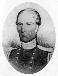
^Captain Charles Sturt
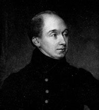
^Governor Ralph Darling
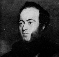
^Sir THomas Mitchell
It may be assumed that, having reported himself to his commanding officer, Colonel Lindesay, disposed of his detachment of soldiers, delivered the convicts, and taken up his quarters in barracks, he made his duty call on the Governor, General Ralph Darling.
From that moment he could not escape the obligation of making a decision as to where his sympathies and loyalties would be; from that moment he was drawn, even if he did not fully realize it at first, into the net of Civil Service officialism and intrigue in which his personal interests suffered, and from which he was never again entirely free.
His call on the Governor would have been made straight into a familiar "army" atmosphere. With the Governor he would have met Darling's two brothers-in-law, Henry and William Dumaresq--all three of them army officers, Henry being now Clerk to the Executive Council; and he would soon have realized that Darling was facing his difficult task with a very rigid official attitude. For Darling's task was difficult: his instructions were to develop the more democratic system of local autonomy introduced in 1824 and to encourage local civil responsibility. In this he failed to please either those who were opposed to change, or those who demanded even greater changes. Sturt may have heard of the memorial presented to Darling on his arrival in 1825, telling him in rather forcible terms that there were locally-born Australians who were fired by a rather self-assertive local patriotism and who, for example, urged in one memorial to the Home[2-1] Government that the mere circumstance of having been born in New South Wales should not preclude them from receiving grants of land. He would have watched the proceedings when Governor Darling took the unusual course in October, 1827, of instituting libel proceedings against Wardell of the "Australian" newspaper.
[2-1 H.R.A. XII. xiii: XII. 147.]
There is no indication that he was, during the first six months of his residence, moved by any of these happenings to ally himself with any of the factions.
Nor is there any indication that he was affected by the social revolution in Europe: Waterloo was only twelve years away, and all Europe, except France, was obsessed with the fear that the "terror" would spread to other countries. Sturt's youth and early manhood saw the gathering of the waters for that great tidal wave of common humanity which was to swell increasingly through, and beyond, the nineteenth century. The first drops of spray from this were being felt in Sydney when he arrived. At this stage there was in him a striking singleness of purpose. But by November, 1827, he had become Military Secretary to the Governor, and this allegiance kept him strictly within the limits of loyalty to Govern. men t House.
In this official capacity he appears only once. On 23rd March 1828, he wrote, by direction, to Captain Robison enquiring[2-2] whether, in letters to England, Robison had made charges against the Governor and, if so, requesting him to furnish copies of the charges. Sturt was not further concerned officially in this matter although Darling felt justified, in April, 1828, in reporting acidly to the authorities in England that Captain Robison's continuance[2-3] in the service could not fail to prove in the last degree injurious to it.
[2-2 H.R.A. XIV. 106.]
[2-3 H.R.A. XIV. 111.]
Other evidence suggests that none of these local matters held any attraction for Sturt, but although he was an officer trained for military career, it is easy to imagine him, with others all round him seeking prosperity by novel means and speculating heavily is livestock ventures, examining his future prospects with some anxiety He had been fourteen years in the army, was thirty-two years old the probability of promotion was small, and the prospect of marriage remote. His mind turned to other possibilities. Writing to his cousin Isaac Wood on 10th November, 1827, he said:
[2-4] "The Governor-General has appointed me his military secretary but in February I take an expedition into the interior to ascertain the level of the inland plains and to determine the supposed existence of an inland sea. This will not be unattended with danger however, it is a most important trust, and if I succeed, as I anticipate, I shall earn some credit. The field of professional ambition is closed upon the soldier during his service in New South Wales though in no case could a career more honourable than that of discovery have been open to me when I landed on Australian shores."
[2-4 Life p.24.]
It seems clear from this evidence that within the first six month of Sturt's life in New South Wales he had decided that exploration was not only attractive for its own sake but offered opportunities for gaining some credit which might prove of material, advantage.
The sequence of events at this period is interesting. Macquarie encouraged by Colonial Secretary Earl Bathurst, had pushed an active policy of exploration of the country behind the coastal ranges Oxley, in 1817, had followed the Lachlan River in its westward and southward course, and had been stopped by marshes. The following year he had followed the Macquarie River northward until he was stopped by the great marsh near Buckinguy and he was confident that, at that point, he was "in the immediate vicinity of an inland sea, most probably a shoal one, and gradually decreasing or being filled up by the immense depositions from the waters flowing into it from the higher lands." Evans of his party had found the Castlereagh flowing north and west.
Next was the Hume-Hovell expedition to the south in 1824 during which were crossed the Murrumbidgee and Murray flowing west, and the Goulburn flowing north.
Then, in 1827, Cunningham travelled north as far as the Darling Downs, crossing the Namoi, Gwydir, Macintyre and Dumaresq Rivers, all flowing toward the centre of the continent.
In view of all this, it is easy to understand that Darling, reporting to Colonial. Secretary Goderich the return of Cunningham and the important results of his expedition, should say:5
[2-5] "I would observe that Mr. Cunningham appears desirous to render the result of his expedition confirmatory of a favourite hypothesis, the existence of an inland sea. This opinion has lately become so general from the reports of the natives that I propose, as soon as the season permits, to endeavour to ascertain the facts."
[2-5 H.R.A. XIII. 619.]
The date of this despatch was 12th November, 1827. The date of Sturt's letter to his cousin was 10th November, 1827: the connection is obvious. But nothing was done at that time.
In May, 1828, Darling received a despatch from London containing a proposal from a Mr. Ballantyne to land on the west coast of Australia about 20 degrees south and, using camels, to cross to the settlement on the east coast. Darling condemned the proposal as not justifying the expense, difficulty, and hazard, and he added:
[2-6] "I have had it in contemplation for some time past to employ an officer in this service who has expressed a strong desire to undertake it: but I have been prevented detaching him by the want of officers to carry on the duties of the garrison. I entertain the hope, however, that circumstances will soon permit of my availing myself of his services."
[2-6 H.R.A. XIV. 199.]
[2-7]Sturt's "strong desire" was sufficiently obvious to be mentioned in the official records of the 39th Regiment, where it is stated that General Darling yielded to the repeated entreaties of Captain Sturt and permitted him to proceed for the purpose of prosecuting the discoveries already commenced by other travellers.
[2-7 Archiv.: S.A. A.663.]
It is hardly surprising that, with exploration and talk of new country constantly before him, Sturt, too, should have his imagination excited. It may not have been an unimportant consideration that Oxley, Hume and Hovell had all been materially rewarded for their services.
The proposal for an expedition dragged on for twelve months, and then, although Sturt was not sent to discover an inland sea, or to follow Ballantyne's proposed route, he was, as Darling advised Sir George Murray on 19th November, 1828, sent on an expedition to ascertain the course and fate of the River Macquarie.
[2-8]Darling advised Murray that Sturt, from his scientific knowledge, appeared to be fully competent to the undertaking and was "ardently devoted to it." Darling thought there was every chance of Sturt's success; but, although he had been in the colony for some time, he had had little opportunity of becoming familiar with the country. Darling stated that, for this reason, he had attached Mr. Hamilton Hume, "an experienced traveller," to the expedition.
[2-8 H.R.A. XIV. 471.]
Sturt's first year in Australia altered his whole life: the change from the rigid conventions of army and county life to the exciting freedom of an unknown continent bred in his active mind a complex of impulses--a love of exploration for its own sake, a desire for the "credit" it would bring, a search for economic security, although never any lust for wealth, a fervent devotion to this country, and running curiously through it all, the lure of the inland sea, an illusive phantasy nagging at his mind for seventeen years until, by an effort of will, on the edge of the Simpson Desert, he freed himself from the illusion and allowed the dream to fade--yet not altogether die, for there were recurrent flickerings as late as 1854 (see Ch. 10--"Could this bank have been over any inland waters?"). But through all this was a dominant motive:
"A wish to contribute to the public good led me to undertake those journeys which have cost me so much. I should exceedingly regret if it were thought I had volunteered hazardous and important undertakings for the love of adventure alone."
His whole life was evidence that this was not vain boasting.
It is of interest to record here the reactions of the civil officials. The person most interested officially was the Surveyor-General Oxley. Macquarie had, ten years before,[2-9] described him as intriguing and discontented. Oxley was one of the party actively hostile to Darling[2-10] and the latter wrote of him that "he is a very clever man; but has been too little controlled and I am satisfied will never submit to the drudgery of carrying on the details of his department." It is, however, to be noted that Darling followed up this comment by recommending his brother-in-law for appointment as Deputy Surveyor-General, as he was desirous of having a person in the Department who would be some check on the indulgence of any disposition which might be felt to favour one party or to oppose another. The date of this letter was 4th September, 1826.
[2-9 Ellis Macquarie p.494.]
[2-10 H.R.A. XII. 256, 535.]
But other influences were at work, and T. L. Mitchell was, on 13th January, 1827, appointed assistant to Mr. Oxley with reversion of the appointment as Surveyor-General. Mitchell arrived in Sydney on 23rd September, 1827, and, on Oxley's death on 25th May, 1828, became Surveyor-General.
It is recorded that Oxley was opposed to private exploring parties, but there is no record of his attitude towards Sturt.
Mitchell's attitude was soon declared. Sturt wrote to him on 30th September, 1828, asking his advice about the forthcoming expedition, particularly as to the route to be followed, adding: "I am endeavouring to obtain information, but from no one would I rather receive it than from you."
Mitchell replied on the same day that, as he had clearly understood from His Majesty's Government that he was likely to be employed on a journey into the interior, it was not very natural that he should welcome the employment of another person on a service which had been considered to belong to the office of his predecessor, but he added: "to you individually, however, I shall be glad to contribute any assistance or advice in my power."
It was ten years since Oxley had done his exploring, and those who had been active in the meantime, Hume and Cunningham, did not belong to the Survey staff.
Here, however, is the earliest indication of the jealousy that was to develop, on Mitchell's side, into hostility.
[2-11 Mit. Lib. A.295.17.21. Note: the point in the text for this reference could not be found.]
From Sturt's letter to Mitchell on 30th September it is clear that the Governor had by that time decided that Sturt should lead an expedition into the interior; but actually he left it to Sturt to submit a plan of operation, and, for this, careful consideration of alternatives was necessary.
[3-1]Governor King in 1800 had reported that the existence of a sea or strait running from the Gulf of Carpentaria into the southern ocean was a very favourite idea in New South Wales; but Flinders had disproved this by sailing up to the head of Spencer's Gulf.
[3-1 Wood: Discovery of Australia p.500.]
[3-2]Then Macquarie had sent Oxley to follow the Lachlan River, hoping he would be able to trace it to the south-west coast of Australia. However, as already stated, after being baffled by both the Lachlan and the Macquarie, Oxley definitely favoured the idea of an inland sea: but, as he presumed that the Lachlan simply faded out by evaporation and soil absorption, while the Macquarie marshes were on the edge of the inland sea, it is to be assumed that Oxley's advice, so far as Sturt might have sought it, would be to concentrate on the area round the Macquarie River.
[3-2 Ellis: Macquarie p.493.]
The latest advice available to Darling was that of Cunningham, who favoured the theory of an inland sea.
But how did Sturt react to all this? In the letter of 30th September to Mitchell asking his advice, he said:
[3-3] "The Governor has at length allowed me to prepare for the interior. The Governor appears to favour an expedition to the west of Wellington Valley to determine whether our interior still lies under water, and I am inclined to favour it also. I am, however, divided as to taking a southerly or a northerly course, and it is on this point I would more particularly desire your advice, for should you favour the latter, it would be necessary for me to start from Moreton Bay, whereas the former course would oblige me to follow the Murrumbidgee, which I think runs parallel to the Macquarie."
[3-3 Mit. Lib. A.295.17.21.]
The Inland Rivers as known in 1828
This is sufficient to indicate the current ignorance of the geography of the interior. During October Sturt must have received official advice of his commission to lead an expedition, for, on 4th November, 1828, he wrote to the Colonial Secretary[3-4] formally accepting the commission to lead an expedition to determine the fate of the Macquarie by tracing it as far as possible beyond the point to which the late Surveyor-General went, and by pushing into the interior on a westerly course to ascertain if there were any high lands in that direction; it being supposed the country westward was an unbroken land and under water. He then went on to discuss his route. In order to understand his dilemma it is necessary to remember that the fixed idea at the time was that the Castlereagh and Macquarie Rivers flowed north-westward into an inland sea. If, therefore, Sturt, starting from Oxley's last point, were to journey westward he could reasonably expect to be very soon stopped by extensive marshes or the inland sea itself.
[3-4 Sturt Papers.]
Both Darling and Sturt for this reason thought at first that it would be well to follow up the Macquarie marshes northward along their eastern rather than the western margin.
What considerations influenced the discussions during October are not known, but in his letter of acceptance of 4th November Sturt discussed the possibility of finding an uninterrupted flow of the river westward and continuing along this into a level and uncertain country in the interior, his movements being guided by circumstances. But he had to consider the other alternative: "it may not be prudent to risk the health of my men by too long a continuance in the swamps and...in the event of my being unable to penetrate westward I deem it very probable that I shall make Moreton Bay, if after successive attempts to turn the marshes I find they still extend to the northward."
It is difficult to-day to imagine such complete ignorance that the possibility of meeting great marshes or an inland sea anywhere between Nyngan and Goondiwindi could be contemplated.
As an interesting sidelight on the official discussions there is a marginal note on this letter written, presumably, by Darling:
"Quite out of the question he would never reach Moreton Bay."
The discussions were finally concluded with an official minute by Darling (9th November) to Colonial Secretary Macleay directing that Sturt should endeavour to get round the marshes by the westward, as nothing whatever was known of that north-west country, and that Sturt should establish a base to the north of Wellington Valley abandoning ideas of eastward excursions.
Darling directed that instructions should be prepared and Sturt's requisition for supplies were approved. As the experience gained on this expedition very materially influenced Sturt's methods and practice on his later expeditions, and as there is real interest in examining the equipment of such an expedition in those early days, the official instructions issued to Sturt, and the supplies requisitioned by him, are printed in full as an appendix (Appendix B).
Some aspects of the equipment call for comment; there was no spare saddle-horse for either Sturt or Hume, no saddle-horses for the men, only five "breakers" for water, and the clothing must have been of singularly good quality. It is noted, however, that some alterations were made in these numbers, as, in addition to two saddle-horses, there were two for Sturt's own use, and the expedition had seven pack horses and eight pack bullocks.
As they expected to meet large bodies of water they took a boat "of the lightest construction," with sprit sail complete, carried on a light four-wheeled carriage drawn by two bullocks.
It was assumed, correctly, that because of the long drought which began in 1826 and continued with increasing severity until after the expedition had returned, that the marshes, by the water-logged condition of which Oxley had been stopped, would be very much drier and that the difficulties Oxley had met "would be found to be greatly diminished, if not altogether removed."
It is necessary here to mention one point. Sturt himself has left on record that, in respect of longitude observations he was only self-taught, that he went into the interior to explore, not to survey, and he admits the possibility of errors in his observations. This has to be remembered in respect of all his expeditions: there is evidence, too, of occasional printer's errors in his published works: it is, therefore, advisable to rely principally upon topographical features in any identification of places actually visited.
Having received his final instructions on 9th November, Sturt left Sydney the next day. He followed the old road over the Blue Mountains, stopping on the way at Dr. Harris' residence (Sheane) and Sir John Jamieson's place (Regents Ville), overtaking, on the mountains, his men who had been sent ahead.
The party reached Bathurst on 22nd November, having taken twelve days from Sydney.
Here Hume joined them and the party was complete: it included Harris, the faithful servant who had been with him ever since the days of duty in Ireland, the soldiers Fraser* and Hopkinson, and the prisoner Clayton--these four were to be with him again on his journey down the Murray a year later.
(*See Appendix D, Note 1.)
At Wellington Valley an outpost depot had been established in 1826 for the control of bushrangers*; this settlement was on the right bank of the Bell about two miles above the junction of that stream with the Macquarie. Sturt had been instructed to complete all his preparations here with the assistance of the Superintendent, Mr. Maxwell, who was to supply trained bullocks.)
(* Macquarie had first used the term "bushrangers" to describe runaway convicts who were ranging the bush; the term did not at first mean armed robber, though it soon came to have that meaning because of the methods adopted by the runaway convicts.)
The party left Wellington on 7th December, and moved north along the eastern bank of the Macquarie, calling at Gobawlin (Gobalyan) and Dibilamble at the junction of the Tabragar* with the Macquarie.
(* Now spelt Talbragar.)
At Dibilamble they crossed to the western bank of the river to preserve as much as possible the direct line to Mt. Harris. On their northward journey they detoured (12th December) to the west to visit Lake Buddah, finding it abounding in fish, although it had neither inlet nor outlet: Sturt correctly supposed the fish came in during floods. Returning to the river they reached the "cataract" somewhere in the vicinity of what is now known as Rocky Point; here they crossed to the eastern bank, the local aborigines helping with the handling of stores. During this crossing the expedition's barometer was broken.
They reached Mt. Harris on 20th December, having passed the site of the present town of Warren about 16th or 17th December. At Mt. Harris they found the remains of Oxley's camp, and Sturt indulged in those very transient gloomy reflections which seemed to have recurred from time to time on the occasion of each of his expeditions, and he wondered whether he would succeed or fail.*
(* In his published account of this journey, Sturt states: "Only a week before I left Sydney I had followed Mr. Oxley to the tomb." But Oxley died on 26th May.)
After two days at Mt. Harris because of sickness amongst the men, the party moved to Mt. Foster, where they camped (22nd December): the camp being, with reasonable probability, about where Travelling Stock Reserve 27240 is now. Although this was nominally a "base" camp it was, in practice, very little so used. From here Sturt sent two men back with despatches and instructions to bring relief supplies to Mt. Harris to await the return of the main party.
Now began the real business of the expedition--the attack on the marshes. On 23rd December they moved quietly northwards until they were stopped by reeds, through which they forced their way back to the river. Here they were near Buckinguy, probably across the river from Portion II, Parish of Wundabungay.
The immense lake through which Oxley could not travel was thus, at this early stage in their journey, found to be: "a large and blasted plain, on which the sun's rays fell with intense heat." the ground itself, parched to an extreme degree, showing in many places deep and dangerous clefts.
The party remained at this camp from 23rd to 26th December. While the party was stationary, Sturt and Hume rode westwards to the Marra Creek, passing all the time through reed beds.
On the 26th the party moved a short distance northwards and camped again amongst the reeds. The site of this camp cannot be identified. From this camp Sturt, on 26th December, taking two men and a week's provisions, launched his boat: but after proceeding with very great difficulty for about eight miles he was completely stopped by reeds in shallow marshes and had to return to camp at the end of the second day. It is possible that he was on the Monkeygar Creek. While Sturt was away with the boat Hume had scouted to the northward and had returned to the camp with the news that twelve miles to the north he had found a serpentine sheet of water which he was sure was the channel of the river; but beyond this was a still more extensive marsh. Sturt then moved (28th December) the whole camp to this new part of the river. Here he again launched the boat, but after two miles in a natural channel the reeds made any further progress by boat quite impossible. This was the end of all boat excursions, for although they dragged the boat with them for many days they never again used it.
Hope of water travel on the Macquarie having vanished, Sturt decided that his only course was to force a land journey to the northern end of the marshes, and also commence his survey of the western interior. Examination of all available evidence suggests that they were now on the Macquarie near Willan, probably Portion 17, Parish of Wullamgambone.
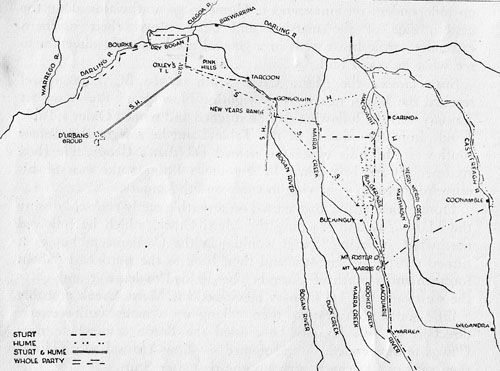
Sturt and Hume, each with two men, set out on 31st December on independent reconnaissances: Hume to go northwards along the eastern side of the marshes and circle round their northern extremity, while Sturt went in a general north-westerly direction to see what he could find.
Sturt crossed the Marra Creek south of the Big Lagoon and reached the Bogan near Cowga, sighting New Year's Range on 1st January. On the following day he reached and named Oxley's Table Land: from the summit of the Table Land he saw in the distant south-west the hills which he named D'Urban's Group. He then returned to the base camp by a route a little to the east of his outward journey--arriving in camp on 5th January.
Hume, meanwhile, had started on a north-easterly course, crossing the Marthaguy and reaching the Merri Creek, which he followed northward, believing that it would join the Castlereagh; but as it turned sharply to the west and then back to the north-east (about fourteen miles north of Carinda) he decided to leave it and go to the westward. On 3rd January he crossed the Marra Creek probably a little south of Yarrawin, then, taking up a more south-westerly direction; on 4th January he crossed the Bogan somewhere near Cowga and ascended--and named--New Year's Range. Hume then returned to camp, arriving one day after Sturt.
One of Sturt's very rare inaccuracies may be mentioned here.
[3-5] In his Narrative of an Expedition into Central Australia Sturt said:
[3-5 Narr. Cent.: 1.15.]
"The New Year's Creek of my first expedition, so called by my friend Mr. Hamilton Hume, because he crossed it on that day." But this was written in 1848, and Sturt's memory was at fault, for, whereas Sturt himself crossed New Year's Creek (the Bogan) on 1st January, Hume did not cross it until 4th January.
When Sturt and Hume compared notes they found that they had established that there was a northern limit to the marshes and no recognisable outlet for the Macquarie River, that, to use Sturt's own words:
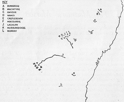
Routes followed on the First Expedition
"My journey had enabled me to put at rest forever a question of much previous doubt. Of whatever extent the marshes of the Macquarie might be, it was evident they were not connected with the Lachlan. I had gained a knowledge of more than 100 miles of the western interior, and had ascertained that no sea, indeed that little water, existed on its surface. Although I had passed over much barren ground, I had likewise noticed soil that was far from poor. Yet, upon the whole, the space I traversed is unlikely to become the haunt of civilized man, or will become so in isolated spots as a chain of connection to a more fertile country; if a country exist to the westward."
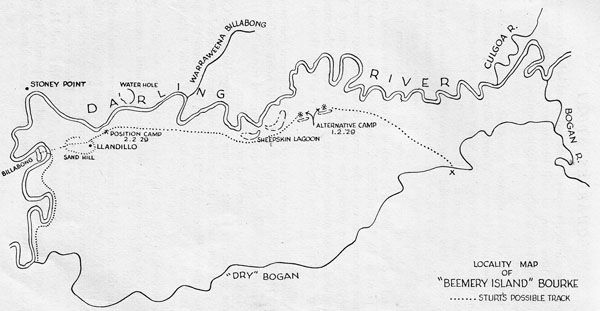
Plan of Beemery "Island" showing point of discovery of River Darling.
The accuracy of his judgment is notable. A journey to-day anywhere in the area between Warren, Brewarrina, Bourke and Nyngan bears out, in every mile, every word of that verdict of the first white man to see it.
Also, when they compared their respective routes, Sturt and Hume agreed that their tracks must have been very near each other at the Bogan River. This left open the remote possibility that the lower reaches of the Macquarie had been between the two routes and had been missed by both of them. This was too important a point to be' undecided, and it was also necessary to gain more information as to the nature of the "distant interior": their provisions were getting low and there was no time to lose. They decided to go north along the eastern side of the marshes and turn west as soon as they could force a way through the reeds.
The story of this journey in its geographical aspects can quickly be told. Hume, with the party, moved slowly north and camped on Bulgeraga Creek, while Sturt made a hurried trip to Mt. Harris hoping to find that supplies had arrived there.
On the second day Hume took the party along Bulgeraga Creek till that creek lost itself in the marshes and then continued northwards for another fifteen miles. This would bring them to a point almost due west of Quilbone (perhaps about Portion 3 Parish of Molle).
Here Sturt joined them and immediately took the whole party westwards, forcing their way through the reeds and emerging on to a vast plain.
Leaving this plain (13th January) they went westward to Marra Creek (Sturt's Duck Creek) reaching it at about Narrawin, followed it northerly for seven miles, then turned westward, reaching the Bogan due east of New Year's Range: just before reaching the Bogan they crossed, on the same day, both Sturt's and Hume's tracks of the previous journeys, as they had anticipated. The party camped (17th January) on a water-hole under New Year's Range. From this camp Sturt and Hume made a short journey southerly over the claypan to the neighbourhood of Stony Hills, north-east of Coolabah, returning to the camp the following day to find one of the men, Norman,* missing.
(*See p. 24.)
From this camp the party moved back to the Bogan to a point where a bar of red granite crosses the river. The actual point of contact would be somewhere between Gongolgon and Pink Hills. They followed down the Bogan to a point almost due east of Oxley's Tableland to which they moved on 23rd January. Here the main party camped while Sturt and Hume made a journey to D'Urban's Group. The nature of this group of hills and of Oxley's Table Land evoked in Sturt's mind the concept of these ranges being like islands in the midst of the ocean, "only wanting the sea to lave the base." The inland sea was never far from his mind.
At this point Sturt abandoned all idea of journeys further westward--the water problem had been acute for days. On his return to the camp Sturt moved the whole party (31st January) back to the Bogan to the point where that river turned westward along the course now known as the "dry Bogan": this course they followed westward, and, leaving this river bed in a general northerly direction, came suddenly, on 2nd February, on the great watercourse of the Darling--a "noble river" the water of which was unhappily salt.
"I found it extremely salt, being apparently a mixture of sea and fresh water. Whence this arose, whether from local causes, or from a communication with some inland sea, I knew not, but the discovery was certainly a blow for which I was not prepared."
The point at which Sturt discovered the Darling can be determined with reasonable approximation. It is indicated by three features, a reef of rocks near a considerable loop in the river, a distance of approximately four or five miles from the Darling--dry Bogan junction, and Sturt's comment:
"If I might hazard an opinion from appearance, to whatever part of the interior it leads its source must be far to the northeast or north."
The rock bar which appears to answer Sturt's description was probably at a place described in some of the old records as St. Vincent's Point which was very close to what is now known as Stony Point--the critical point at which the Darling turns sharply from a set westerly course to a permanently south-westerly one.
After crossing the "dry" Bogan the route followed by Sturt is shown in the sketch prepared by Mr. W. K. Glover, of Llandillo Station. This route accords so closely with the description given by Sturt that it may be accepted, in view of Mr. Glover's comprehensive knowledge of the locality, as being reasonably accurate.
Sturt first pitched camp on the Darling at the point where the Llandillo pumping plant is now located about three miles upstream from Stoney Point (the point of first contact is about 8 or 9 miles upstream from Stoney Point): and the point at which Hume found fresh water is, as shown, approximately two miles south of Stoney Point. In "traversing a deep bight" the party must have passed very close to Llandillo homestead, which is located on the sandhill crossed by Hume.
They followed the Darling downstream--passing the site of Bourke about 4th February--until 9th February, when they turned back, having reached a point a little south of Redbank.* Before they left this end point of their journey Hume carved his initials on a tree: these were seen by Mitchell in 1835 and the place was pointed by Mitchell as 53 degrees E. of S. from D'Urban's Group. At this turning point Sturt named the river the "Darling": "to pay by this trifling mark of respect some part of the gratitude I owe to the present Governor of the Colony."
(* See Appendix, Note. 2.)
They had found the water too salt to drink throughout the whole course of their journey down the Darling: "I certainly thought we were rapidly approaching some inland sea": but before they left the Darling he knew that the saltness was due to springs of salt water in the bed of the river.
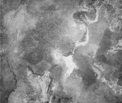
The Macquarie Marshes from the Air.
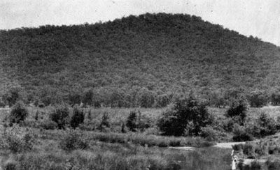
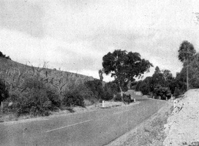
The Bluff End of Cookbundoon.
Title-page of book presented to Dr Gibson.
This lack of water was pressing heavily on them--there had been no rain since they left Mt. Foster--and Sturt felt obliged to return at once to their base. This they did by their outward route without incident--except that on 14th February they had to stop to make some slight repairs to the boat carriage--this boat that was never to be used. On reaching the western edge of the marshes Sturt and Hume rode northward to examine the country in that direction, finding that the reeds gradually disappeared.
On 22nd February they reached camp at. Mt. Harris to find supplies awaiting them: the Macquarie had wholly ceased to flow and now consisted of a chain of ponds.
The party remained in camp until 7th March, Sturt completing his despatches to the Governor.
During this period two short journeys were made.
Hume rode westward more than forty miles, crossing the Marra and the Bogan. He returned reporting that the country was well watered.
Sturt himself made a short journey round the south-west angle of the marshes, and going northwards got to the bottom of the first great marsh (Willan), thus, with all their previous journeys, completing the circuit of the marshes and replacing mystery by knowledge.
There remained one task--a rapid exploration of the country to the north of the eastern aspect of the marshes. Sturt records that they were "determined to make for the Castlereagh agreeably to our instructions." This is perhaps too liberal an interpretation of paragraph nine of the instructions (see p. 170), but it was an obvious objective.
The party left Mt. Harris on 7th Marsh on an E.N.E. course, crossing the Marthaguy a little south of Gradgery, the Merri just south of Upper Neinby, and reached the Castlereagh probably between Riverside and Coonamble. They followed slowly down the Castlereagh from 10th to 29th March: on the latter date they reached the junction of the Castlereagh with the Darling. Sturt was quite sure it was the Darling:
"A single glimpse was sufficient to tell us it was the Darling. At a distance of more than ninety miles nearer its source, this singular river still preserved its character, so strikingly, that it was impossible not to have recognized it in a moment."
At this point Sturt had to consider his future movements. He crossed the Darling and rode north-west, finding nothing but a boundless plain, nothing to encourage him to proceed. There was still no rain--so he started on the return to Sydney. Their point of departure was the junction of the Lower Marthaguy and a creek running northwards from the Macquarie marshes; about a mile-and--half south of this they crossed the tracks made by Hume on his first westward journey, which were still visible.
Working their way southwards, still following the creek bed (which is named on Sturt's maps "the Macquarie Rivulet") they cut their own tracks made on the outward journey to the Darling, and thence down the eastern side of the marshes, reaching Mt. Harris on 7th April. Moving quietly up the Macquarie they reached Wellington on 21st April after an absence of four months and two weeks.
This period of four and a half months was one of sheer hard work unrelieved by any dramatic incident.
One of the men, Norman, was lost in the bush for nearly three days, being without food or water for the whole period: Sturt set fire to the cypress and he was thus guided back to camp. The incident was important, not only in keeping the others from wandering, but in the effect it had on Sturt's precautions in later expeditions.
For food they were dependent entirely on their own supplies: native game was absent, even the aborigines had been driven from this drought-stricken area. As Sturt said:
"How could an European expect to find food in deserts through which the savage wandered in vain?"
The problem of water supply can be appreciated by anyone who has been through this country. To take a party of eleven men with eleven horses and ten bullocks over the country between Warren, Brewarrina, and Bourke in midsummer, after a three years' drought, with every foot of the journey unknown country, would test the qualities of any leader.
"So long had the drought continued, that the vegetable kingdom was almost annihilated, and minor' vegetation had disappeared: the largest forest trees were drooping, and many were dead."
They had to rely on surface water rapidly drying up--even the Bogan was a chain of pools steadily shrinking. Each day water was a recurring anxiety.
"Mr. Hume and myself wandered over upwards of 600 miles more than the main body of the expedition in our constant and anxious search for water."
But, as a good leader, he never left himself without a safe retreat; and, while on occasion his life line may have been stretched to its limit, it never broke.
They were greatly troubled with flies "which settled on us in thousands," and disappeared at sunset: it is the same to-day.
In his encounters with wild aborigines, for Sturt a new experience, he had the great advantage of Hume's life-long familiarity with native customs and mental reactions. Around the Macquarie and across the plains they met few aborigines: with these, patience and a friendly approach were sufficient. On the Darling the natives were more numerous.
"The paths of the natives on either side of the river were like well-trodden roads."
At first these natives, taken by surprise, were hostile and set fire to the scrub; but again friendly advances were sufficient. These Darling River natives were suffering from "a violent cutaneous disease that was sweeping them off in great numbers." When the party was again on the Darling near the Castlereagh junction more natives were met, and, again, relations were quite friendly.
From this expedition Sturt formulated the principles governing contact with wild aborigines.
"The great point is not to alarm their natural timidity; to exercise patience in your intercourse with them; to treat them kindly; and to watch them with suspicion, especially at night. Never permit your men to steal away from the camp, but keep them as compact as possible; and at every station so arrange your drays and provisions that they may serve as a defence in case of your being attacked."
While they may not seem much now when the whole of this country can be covered easily by car, yet, at the time, the results of this expedition were very important.
For forty years there had been vague speculations as to the nature of the "interior": these speculations had absorbed an element of mystery, and even of gloom, by Oxley's discovery of "marshes" as the fate of two main rivers flowing westward. Even if there were no suggestions of bunyips, dragons, or other terrors in the swamps, there was a settled conviction that the interior offered no land for settlement, no prospect of expansion for the pastoral industry that was already rapidly developing.
Sturt, in one sweep, cleared away all these clouds of mystery. The marshes of the Macquarie had been shown to be nothing more than an ordinary marsh or swamp: true it was large, but it had no influence on the country to the westward which, so far from being a shallow sea, was "in itself a table land to all intents and purposes."
The Macquarie was found to continue as a small stream from the north end of the marshes. More than one hundred miles of new country west of the Macquarie had been traversed and its nature determined.
The course of all the rivers in that area--the Namoi, Gwydir, Dumaresq, Castlereagh, Macquarie, and Bogan, and their identity as tributaries of the Darling, had been decided.
Immediately and inevitably came the question--what happens to the Lachlan marshes? Is the country to the south of that covered by Sturt of the same character? What is the course of the Darling below Sturt's last point of contact?
In his manuscript journal of this 1828 expedition Sturt gives his opinion on the fate of the Darling:
[3-6] "Considering the advantages that would probably accrue to the colony should the Darling be found to discharge itself on the South Coast, it is to be hoped that such expectations will eventually be realised; but I fear this river traverses a vast extent of country ere it reaches the sea, if indeed it ever reaches it, for I apprehend that it is turned by high lands, and the union of many rivers in the south-east angle of the island from its original course, to the northward and westward."
[3-6 Mit. Lib. A.1933.]
Sturt appended a map at the end of this journal showing the "supposed course of the Darling." After joining with the Murrumbidgee the river, on this map, turns, just north of 35 degrees S., in a sharp loop and runs away to the north-west.
Sturt had done more than replace an exciting mystery by commonplace fact, and, literally, bring the whole matter down to earth; he had given the people of this young land a new conception of continental dignity which was the, beginning of a vigorous and healthy national pride.
And he had done something to himself:
"The Darling River must be considered as the boundary line to all inland discoveries from the eastward. Any judgment or opinion of the interior to the westward of that stream would be extremely premature and uncertain.
"My knowledge of the interior is too limited to justify me in any conclusion with regard to the central parts of Australia. An ample field is open to enterprise and to ambition, and it is to be hoped that some more decisive measures will be carried into effect, both for the sake of the colony and of geography, to fill up the blank upon the face of the chart of Australia, and to remove from us the reproach of indifference and inaction."
He had surrendered himself to that absorbing interest in the "central parts of Australia," to which he was bound for life. Darling, in his despatch (24th April, 1829) to the Secretary of State, reporting the results of this expedition, commended Sturt's leadership and emphasized the [3-7] "judicious manner and patience and zeal which do him infinite credit."
[3-7 H.R.A. XIV. 607, 721.]
This praise was fully justified.
Sturt rejoined his regiment in Sydney on 27th April, 1829, but was restless under the challenge of the still unsolved riddle of the interior. The records of the 39th Regiment state that he "again most particularly requested permission to proceed once more for the purpose of exploring the country in another direction."
Evidently some decision had been taken by September, 1829, for on 17th of that month Sturt wrote to Hamilton Hume a letter of considerable interest: from this letter it seems that both the Governor and Sturt hoped that Hume would again go with Sturt. Sturt wrote indicating his plans:1
[4-1] "I hope my plans will meet your approval: they will lead us direct to the place you wished to make for from Mount Harris, and towards your old route. You will see that we must descend the Darling in boats...as, however, I trust we shall again journey together I will not here enter into particulars."
[4-1 Hume: Overland Journey 1824; 1873 Ed.]
It is obvious that speculation as to the interior was still very confused. While Sturt, realising that its saltness was due to brine springs in the bed of the river, had given up his idea that the Darling discharged into an inland ("Mediterranean" he called it) sea, he still thought it doubtful whether it continued southerly to the ocean or "turned westerly and ran into the heart of the interior."
[4-2] About this time, however, Darling received information that there was a "large lagoon in the neighbourhood of St. Vincent's Gulf."* It is clear that, after the discussions which must certainly have been held, the Governor decided that Sturt should follow the Murrumbidgee down to determine whether it terminated in a marsh, as was considered "not improbable," or united with the Darling, or emptied itself into the sea on the southern coast of the Colony.
[4-2 R.G.S.S.A. VIII 49.]
(* This was Lake Alexandrina.)
Should it be found to terminate in a marsh, Sturt was to proceed overland to the Darling and follow that stream down "as far as circumstances may render desirable."
The first object was to trace the course of the Murrumbidgee, as, if that stream should join the Darling, the combination of these two "considerable rivers" would form a navigable stream opening a direct and, perhaps, easy communication between Sydney and these distant parts of the colony: and, if it should be found, as was not improbable, that the joint stream discharged into the "large lagoon" on the coast there might be direct communication with the sea, although Darling's information at that time was that there was no outlet from this lagoon to St. Vincent's Gulf.
The above represents the substance of Darling's despatch (21st November, 1829) to Colonial Secretary Murray announcing the departure of Sturt's second expedition.
The expedition was based on the plan of following the Murrumbidgee by land as far as practicable, and then launching the boat, continuing by water until they were stopped: it is reasonably certain that Sturt did not anticipate that the boat journey would be as long as it proved to be. The plan of the journey being similar to that of the first expedition, the arrangements were of the same pattern. Instead, however, of a light boat, a whale boat, 25 feet long, with a beam of 5 feet, was first built, dismantled, and, during the land journey, transported in sections.
On this journey more fire arms were taken than on the first expedition, and a small still was carried, for the distillation of water in the event of finding the water of the Darling salt as it was on the previous journey.
Hume did not join the expedition, and the main party consisted of:
Sturt and George Macleay.
Harris, Hopkinson, Fraser and Clayton, who had all been on the first
expedition.
Two convicts, Mulholland and MacNamee.
And a small supporting land party.
The expedition left Sydney on 3rd November, 1829. Sturt has recorded the gloomy reflections that seem to have recurred at the outset of each expedition: but this time transient and not very serious:
"I found myself on that delightful morning leading my horses through the gates of those barracks whose precincts I might never again enter, and whose inmates I might never again behold assembled in military array.
"Yet although the chance of misfortune flashed across my mind, I was never lighter at heart, or more joyous in spirit:"
A.--THE OVERLAND JOURNEY
3rd November to 26th December
From Sydney to Gundagai it is possible to follow the expedition's route in terms of the present Hume Highway. Following on Hume's overland journey to Port Phillip five years before, settlers had pushed out with their sheep and had established themselves at Yass, Jugiong, and as far as Gundagai: 'at least one overland party had taken cattle into Victoria, crossing the Murrumbidgee at Gundagai. To this point, therefore, there were primitive tracks to follow--tracks which, naturally, kept close to water.
Sturt, with his party, followed the present Hume Highway to Liverpool, the Cross Roads past Carnes Hill to the old Cowpastures Road, along which they travelled, having the Raby Estate on the right and Varroville, Sturt's home later, about three miles to their left. Near Narellan they would have a choice of roads to Macleay's property at Brownlow Hill in the angle between the Hunter Rivulet and Nepean River. From Brownlow Hill the track kept to the west of the Hunter Rivulet, passing through The Oaks village and, crossing the Stonequarry Creek, entered the present town of Picton from the west just beside the present bridge.
From Picton the road followed practically the present highway through Myrtle Creek, Tahmoor, Bargo, to just south of Yerrinbool where, instead of turning sharply to the right, towards Aylmerton, it kept straight on over the Mittagong Range, leaving the present town of Mittagong about one mile to the west and joining the present highway at Bong Bong. n this section Sturt passed through the property he was later to own.
From Bong Bong the route was that of the present road through Moss Vale and Sutton Forest to the Cross Roads. From this point the old road went south-westwards through the Wombat Brush to the junction of Paddy's River and the Wollondilly River near the present village of Canyonleigh.
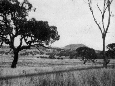
Thence they followed the valley of the Wollondilly, passing Lockyersleigh, and the site of Old Towrang on the south bank of the river, crossing a loop of the river, and camping on the river "under the bluff end of Cookbundoon" at Murray's Flats.
The next morning, 16th November, they moved up the Wollondilly River across to the flats known as Mulwaree Ponds between the city of Goulburn and the War Memorial, and followed these flats along to Dr. Gibson's property Tirranna--thirteen days from Sydney to Goulburn.
Tirranna is readily identifiable, as the property is still owned by the Gibson family. From Tirranna, four miles south of Goulburn, the route was westerly over the hills to near the point where the road to Canberra leaves the Hume Highway, and from there the track was, for practical purposes, the same as the present Highway. Sturt comments on-, the Breadalbane Plains, mentions Redall's farm, and notes particularly the "large white masses of quartz rock"--still plainly to be seen to the north of the road.
[4-3] Redall's farm was named Mut-mut-billy--the name still existing as that of a creek in this region. From these plains the Cullerin Range was crossed, and, on the other side of this range, they visited J. K. Hume's* station (Woolowardalla) "on the banks of the Lorn" (Fish River). Leaving Hume's place they camped on Meadow Creek at Gunning. Then to Yass, crossing the Mundoonen Range by a pass which, Sturt said: "is not inappropriately called the Devil's Pass."
[4-3 A month in the bush of Australia. National Library Pamphlets, Vol. IX.]
(* Hamilton Hume's brother.)
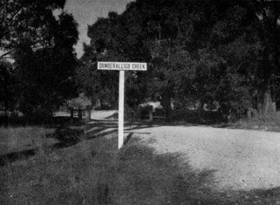
At Yass they stayed with Mr. Henry O'Brien at his property on what is now known as O'Brien's Creek and Yass River. After spending a day quietly there they continued their journey, Mr. O'Brien presenting them with eight wethers which were to provide them with a welcome change of diet; and also sending with them an aborigine to guide them to the Murrumbidgee. Then, passing "a remarkable hill called Pouni" (Mt. Bowning) they called at the station of Hume's father (Bowning), and here they left the route of the present highway, turning to the north-west along the present road to Binalong, intending to visit Underaliga, a station occupied by Dr. Harris. This Underaliga[4-4] was almost certainly the place known later as Dunderalligo located near the position of the present Goondah railway station. This brought them on to the head of Jugiong Creek, which they followed down to the point at which the present Hume Highway crosses it by a bridge--which is also the point at which Jugiong Creek joins the Murrumbidgee. This hill is a landmark on the journey. Sturt describes it in his usual terse, accurate way:
[4-4 Information supplied by the Under-Secretary, Lands Department, N.S.W.]
"The Murrumbidgee came down to the foot of this little hill from the south: from the hill on which the hut stands it runs away westward, almost in a direct line."
The hill is easily identifiable--it rises immediately ahead as the Jugiong bridge is crossed going south.
They camped in the middle of the Jugiong plain at about the position of the old cemetery.
This was Sturt's first sight of the Murrumbidgee and his delight at the contrast between it and the Macquarie was great:
"Instead of a river which had almost ceased to flow I now looked down upon a stream, whose current it would have been difficult to breast, and whose waters, foaming among rocks, or circling in eddies, gave early promise of a reckless course."
They followed the river round the bend past the present township of Jugiong, turning over the hills by a steep pass on to the plain from which Cooney's Creek rises. From here, keeping to the east of the present Hume Highway, they made their way over the undulating country till they came down into Muttama Creek Valley, which they followed till they came to where Mingay railway station now stands. From this point they followed along approximately the present private road to Mingay homestead. Here at that time a Mr. Warby* had a station: at this place, which was their last contact with settlement, they stayed that night. The following day Mr. Warby piloted them to the river at Gundagai, probably following the present route of the Hume Highway from near Mingay railway station. Here Sturt had to make a decision. This is the point at which their route, having, from Sydney, been south-west, and known, became definitely west and quite unknown.
(* Sturt spells it Whaby.)
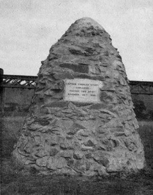
Mr. Warby had assured Sturt that he could not take the carts westward along the river on the north bank because of the rough country, so Sturt decided to cross to the south bank which looked much easier. Copying the method Hume had used on his overland journey, Sturt lashed tarpaulins around the dray body and thus ferried his stores across. The point of crossing can be fixed with reasonable certainty as very near to the present railway bridge--actually the cairn which has been erected there as a monument is very properly located. The date shown on the cairn is, however, wrong--the date was 28th, not 30th November.
In view of the prevalence of nettles on these river flats even to-day, it is of interest to note that, during this crossing, Mulholland, being naked after swimming the river, was severely stung by them.
On 29th November they began their journey westward along the south bank of the river, but had gone only seven miles when the country became impassable for the drays, while the north bank seemed better: so they crossed back to the north bank, which they never again left throughout the rest of the land journey. This crossing was a little to the east of Nangus--the exact point cannot be determined; the only direct evidence is that of the Hon. James Gormley, who has recorded:
[4-5] "When I went to Nangus in 1844 several of the aborigines pointed out Sturt's place of crossing to me."
[4-5 R.A.H.S. 11.39.]
For the next two days progress was slow because of rain, but they managed to travel as far as a "plain which the natives called Pondebadgery." This was Wantabadgery, where they rested for a day, the men catching a number of codfish, the largest of which weighed forty pounds. From Wantabadgery they crossed a range of hills to the westward--very probably along the route of the present road, as Sturt's description would fit this route well enough--coming down to a chain of ponds and serpentine sheet of water. During this day they rose at one point sufficiently high to obtain an extensive view and took bearings on "a solitary double hill bearing S.82 degrees W. distant twelve miles, and another singular elevation that bore S.32 degrees W. called by the natives Kengal." There has been considerable speculation as to the identity of these two peaks; but there can be no certainty.
It seems probable that "the singular elevation" is The Rock, but if this is so it is difficult to identify the point from which the compass bearing was taken. It may be noted that this name [4-6] "Kengal" appears as the name of one of the eminences sighted by Sturt from D'Urban's Group on his previous expedition. The day after these observations had been taken they entered a forest consisting of box-trees, casuarinae, and cypresses on a light, sandy soil, in which both horses and bullocks sank so deep that their labour was greatly increased.
[4-6 Two Exp. 1.212.]
The combination of a serpentine sheet of water and loose sandy soil suggests that they came down from the vicinity of Oura on the 5th December, reaching the sandy flats of Wagga Wagga on that or the following day. If this be so, there is an error or misprint in the compass bearings. The point is not of great importance.
As they proceeded down the river the country became much flatter--they ascended a granite hill (Mt. Arthur) from which they identified a "double hill bearing S.10 degrees W." which was Mt. Galore.
Sturt continued his journey westward, noting the sandhills [4-7] near Berembed Weir, ascending an "inconsiderable elevation" (Bundidgerry Hill), reaching the site of Narrandera on 10th December, and on 11th December "the country on the opposite side of the river had all the features of that to the north of it, but a plain of such extent suddenly opened upon us to the southward, that I halted at once in order to examine it."
[4-7 The author is indebted to Mr. H. B. Rowlands, of Narrandera, for information concerning the section between Mt. Arthur and Narrandera.]
Sturt called this plain "Hamilton's Plains," but that name has been forgotten. The plain is that which is crossed by Yanco Creek, and the spot at which Sturt made his camp on 11th December is on, or very near, Portion 8 Parish of Cudgel, this being the only place at which this plain comes close to the south bank for about half-a-mile: elsewhere the edge of the plain is some considerable distance from the river. This is, on an air-line, between six and seven miles west of Narrandera. Having examined this plain on 12th December they continued their westward journey on 13th December. They had passed all high lands and the interior to the westward presented an unbroken level to the eye. Still low ranges continued to their right and the cypress ridges became more frequent and denser. Now began a fortnight of weary toil. Some extracts from Sturt's own account will give the picture:
"Our route during the day was over as melancholy a tract as ever was travelled. The plains to the north and north-west bounded the horizon--not a tree of any kind was visible upon them. It was equally open to the south, and it appeared as if the river was decoying us into a desert, there to leave us in difficulty and in distress. It is impossible for me to describe the kind of country we were now traversing, or the dreariness of the view it presented.
"Neither beast nor bird inhabited these lonely and inhospitable regions, over which the silence of the grave seemed to reign. We started on the 23rd with the same boundlessness of plain on either side of us, but in the course of the morning we got upon a light, tenacious and blistered soil. The drays and animals sank so deep in this, that we were obliged to make for the river, and keep upon its immediate banks."
On 24th and 25th December they had the same difficulties, struggling over light rotten soil and through fields of polygonum junceum. They had not, for days past, seen a blade of grass.
On 25th December, Sturt, with Macleay, rode northwards to the Lachlan, crossed it, and examined the country to the north of it.* He decided, correctly, that he had arrived at the junction of the Lachlan with the Murrumbidgee, and he held the first key to the solution of the riddle of the rivers.
(* The aborigines, in 1836, told Mitchell of this visit of Sturt to, and across, the Lachlan.)
The exact point of his contact with the Lachlan is indefinite, but is unimportant. The next day, 26th December, brought the necessity for a critical decision:
"On the 26th we traversed plains of the same wearisome description. The wheels of the drays sank up to their axle-trees, and the horses above their fetlocks at every step. In several instances, the force of both teams was put to one dray, to extricate it from the bed into which it had sunk. I was checked in my advance by high reeds spreading as far as the eye can reach, under which the soil is so soft that the drays stuck fast and the cattle knocked up."
They had wandered a little north, away from the river, and had got into the Lachlan marshes--the sponge-like delta into which the Lachlan fans out before seeping its way into the Murrumbidgee.
Here was the Macquarie puzzle all over again, recognized at once by Harris, Fraser, Hopkinson and Clayton as an unwelcome event.
Sturt sent Macleay scouting forward, and, on hearing that the reeds stretched as far as Macleay could see, the party turned south and camped on the Murrumbidgee banks.
The Locality of the Depot on the Murrumbidgee.
Next morning Sturt pushed through the reeds until he could see the open country on the other side, country of a nature similar to that over which they had been travelling for days. There was need for an immediate decision. His instructions were that, if the Murrumbidgee ended in a marsh, he was to go straight across country to regain the Darling.
But did these reed-beds represent the end of the Murrumbidgee?
He had already identified, at least provisionally, the Lachlan, and would be justified in assuming that these reed-beds were of the Lachlan, rather than of the Murrumbidgee.
He could have settled the point by scouting around the reed-beds as he had done on the Macquarie. Actually he did this: he and Macleay rode along the Murrumbidgee banks for some miles. He found that river still deep, its current still rapid, and its banks still high--the whole picture quite different from the flat marshes of the Macquarie. Moreover he was now at least one hundred miles west of all known river courses, including his own first contact with the Darling. He felt convinced from all the evidence that the Murrumbidgee would continue as a river. He had vague information from the local aborigines near Narrandera that there was another stream to the south "to which the Murrumbidgee was but a creek, and that we could gain it in four days."
He had the Darling to the north flowing south-west, the Murray to the south flowing west, and he was on a river flowing strongly to the west, he had good reason for presuming that they must all converge--and, possibly, meet at some point. He could have decided the issue by keeping on with the journey by land, but the nature of the country and the wearied state of his cattle induced his decision to launch the boat and continue the journey by water. When this decision was made, and the party was in camp assembling the boat, he wrote despatches, and also a friendly letter to Hamilton Hume (4th January, 1830) telling him of the dilemma, and of his decision:
[4-8] "Where I shall wander to God only knows. I have little doubt, however, that I shall ultimately make the coast."
[4-8 Life p.58; Hume Overland Journey 1824.]
The party was in camp from 26th December, 1829, to 6th January, 1830, assembling the boat they had hauled from Sydney; and, as this was not large enough to hold all their stores, they felled a local tree and built a small skiff.
There has been much examination of evidence, and considerable speculation concerning the location of this depot, as Sturt called his camp. In his own printed account Sturt gives its position as either twelve or fifteen miles (he gives both figures) above the point where the Lachlan joins the Murrumbidgee. As it is not even possible to identify, with any certainty, the point which Sturt would have accepted as this point of junction, the site of the depot must remain always uncertain.
[4-9] Following the windings of the river twelve miles would be about Portion 42, Parish of Toopuntul. n the other hand topographical features suggest a position near to Travelling Stock Reserve 41069. It would be not unreasonable to say that the "depot" was somewhere near this Travelling Stock Reserve: but it would be unreasonable, on any present evidence, to be more definite. This position is about sixteen miles west of Maude on an air-line.
[4-9 Valuable advice has been given by the Under-Secretary, Lands Department, N.S.W., and Mr. R. B. Ronald, of Nap Nap Station.]
B.--DOWN THE RIVERS TO THE SEA
7th January to 11th February, 1830
All preparations having been completed by 6th January, Sturt selected his party (whose names have been given above), gave instructions to the supporting party, under the control of Robert Harris, to remain at the depot for one week and then return to Goulburn. They killed the last remaining sheep and everything was ready by the evening of the 6th January.
On the morning of the 7th January they said farewell to the returning party and "embarked on the bosom of that stream along the banks of which we had journeyed for so many miles--whether ever to return being a point of the greatest uncertainty."
From the 7th to the 14th January they were travelling down the Murrumbidgee. After passing the presumed mouth of the Lachlan the skiff was holed by striking a sunken log and immediately sank. Some hours were spent in recovering the articles which had been thrown out as the skiff sank: but the worst damage was the mixing of fresh water with the brine in the casks of meat: this was to affect their food supply to a serious degree.
Meadow Creek at Gunning.
The Devil's Pass, Mundoonen Range.
A Remarkable Hill called Pouni, Mt Bowning.
Dunderalligo Creek.
They passed and noted the stream near Balranald connecting with the Yanga Lake. During the last days of this week on the Murrumbidgee the river was contracting, its banks were not so high; and Sturt began to worry that it was going to be a case of the Macquarie and marshes all over again. On 12th and 13th January the channel became increasingly blocked by trees which had been swept down by floods, and whose branches frequently interlocked making passage by the boat very difficult. On the 14th January there was a dramatic change:
"On a sudden, the river took a general southern direction, but, in its tortuous course, swept round to every point of the compass with the greatest irregularity. We were carried at a fearful rate down its gloomy and contracted banks. At 3 p.m. Hopkinson called out that we were approaching a junction, and in less than a minute afterwards we were hurried into a broad and noble river."
They had reached the Murray, and Sturt now held the second key to the riddle of the rivers: the ring was closing fast--the upper Darling, Macquarie, Lachlan, Murrumbidgee, and now the Murray--no longer mysteries, but very unromantic realities.
Sturt was happy; his deductions were being proved, his decision to launch the boats was justified, and they were on a navigable stream, the "high road" either to the south coast or to some important outlet.
From 14th to 21st January they continued down the Murray without incident; Sturt noting that at every creek junction there was an extensive sandbank.
On the 19th January, after having been through a critical meeting with a large tribe of natives, which ended in friendly relations, one man "remarkable for personal strength and stature (see Ch 4: '...who proved to be the remarkable savage I have previously noticed.') showed especially friendly attentions."
About 21st January, in the Redcliffs region, the banks suddenly acquired a perpendicular and waterworn appearance.
On 22nd January, they had great difficulties in the rapids of the Merbein rocks, but got through without damage--the natives watching the proceedings from the banks: then round the Cowanna Bend which Sturt noted.
The party, therefore, passed the site of Mildura on 22nd January.
At this stage the northward trend of the river was puzzling Sturt.
On 23rd January, with a wide river and a fair wind, they hoisted the sail for the first time, and were travelling quickly when, without warning, they saw, ahead, a long sandspit projecting into the river crowded with natives showing every sign of hostility. Just as it seemed probable the party would slip past without trouble, the boat ran aground on the sandbank. The natives crowded up, becoming more excited, and sharp fight at very close quarters was inevitable. At the climax of the tension the "remarkable man" whom they had met on the 19th January appeared on the southern bank, jumped into the river, swam over to the sandbank, and rushing to the foremost native "seizing him by the throat, he pushed him backwards and, forcing all who were in the water upon the bank, he trod its margin with a vehemence and an agitation that were exceedingly striking."
Gradually the natives became quiet. This crisis over, the boat was pushed into deeper water, and, behind the sandspit was a new and beautiful stream, coming apparently from the north. Up this stream they rowed for some miles, then, hoisting the Union Jack and giving three cheers, they sailed again down to the junction. Sturt was satisfied that he was on the Darling "from whose banks I had been twice forced to retire."
Sturt now held the third key to the riddle of the rivers, and the ring was complete, except for the section of the Darling, south of Redbank, from the point where Sturt had left it in 1829. Until this section had been actually travelled (which was not until 1844) there could be no final certainty that this new stream was actually the Darling.
At this junction Sturt named the main stream the Murray River, in honour of Sir George Murray, the Secretary of State for the Colonies: He intended the name to apply to the stream after its junction with the Murrumbidgee, preserving the names already given to the various streams which combined to form the main river. Had this intention been observed the river would have been the "Hume" as far as the Murrumbidgee junction, and the "Murray" below that.
However, by common use, the stream is now known as the Murray throughout, although the map of New South Wales published by the Lands Department of that State in 1933, gives the name of the river as "Murray or Hume River."
There is an ironical aspect about this naming. Sturt named the river the "Murray" in accord with Darling's known wishes, but also because of Sturt's own admiration for Murray as a soldier. But it is recorded of Murray by his subordinates that, as Secretary of State, they had never met with any public officer so totally inefficient.[4-10]
[4-10 Mills: The Colonization of Australia, p.10.]
In his published account of this expedition Sturt states that he placed the junction of these streams at longitude 140° 56' East; but as there is some definite evidence that he did not take any observations on the spot at the time, it seems probable that this longitude was arrived at by calculation later.
The point has some interest in view of the fact that the eastern boundary of the new province of South Australia was fixed at 141° East.
For further discussion of this point, see Appendix D, Note 3.
Before leaving their camp at the Darling junction they had burnt the skiff, and cut the still into copper crescents as presents for the natives.
From 23rd January, when they left the mouth of the Darling at Wentworth, until 8th February, when they passed Murray Bridge, their journey was comparatively uneventful.
On 24th January they passed without trouble the Cadell Rocks below Wentworth. On 26th they passed the outlet stream connecting Lake Victoria with the Murray, and Sturt named it the Rufus River, after Macleay's red head.
Next day, 27th, they saw, and named, the Lindesay River after the Colonel commanding Sturt's own (39th) Regiment: and on 28th they had passed the border between Victoria and South Australia--near Tareena. Sturt described the cliffs in this region: "singular in character, and varied in form: they had the most beautiful columnar regularity: they showed like falls of muddy water that had suddenly been petrified."
On 29th the sharp bend to the southward, in the neighbourhood of Renmark and Berri, gave Sturt great satisfaction: but this was tempered by the beginning of anxiety about the men: their salt meat had been spoiled as already told, they would not eat the river fish which "without sauce or butter is insipid enough," and wildfowl or land game was not easily obtained: the men had little else than flour to eat, and were showing signs of fatigue.
On 30th January they were between Loxton and Pyap and here Sturt noted the beginning of the fossil formation which was to become so distinctive a feature of the river in its lower reaches. At about nine miles from its commencement, where it was only about a foot high, this fossil bank rose to a height of more than 150 feet.
By the end of the day on 31st January they had reached Overland Corner, and, on 3rd February, had turned the North-west Bend at Morgan, having shortly before been told by an old native that the river would soon turn southward to the sea.
On 4th February they had seen some seagulls, and on this day also they were again joined by the old native who, at Morgan, had told them of the change in the direction of the river.
On 6th February they were told by some natives that they were not far from the sea.
Continuing their journey steadily they camped in the neighbourhood of Murray Bridge on 8th February.
On the morning of 9th February they proceeded down the river. At a turn of the stream a solitary rock of coarse red granite rose above the waters, and formed an island in its centre.
"After pulling a mile or two, we found a clear horizon to the south, I, consequently, landed to survey the country. I still retained a strong impression in my mind that some change was at hand, and, on this occasion, I was not disappointed; but the view was one for which I was not altogether prepared. We had, at length, arrived at the termination of the Murray. Immediately below me was a beautiful lake, which appeared to be a fitting reservoir for the noble stream which led us to it. Even while gazing on this fine scene I could not but regret that the Murray had thus terminated; for I immediately foresaw that, in all probability, we should be disappointed in finding any practicable communication between the lake and the ocean, as it was evident that the former was not much influenced by tides."
They camped on the night of 9th February on the eastern side of the outlet of the Murray into the lake; and, on the 10th, sailed with a fair wind to the north shore of Hindmarsh Island, where they camped--the sound of the surf coming gratefully to their ears, for it told them they were near the goal they had so long been seeking, and they promised themselves: "a view of the boundless ocean on the morrow."
This seems to throw some doubt on the literal accuracy of the inscription on the monument on Hindmarsh Island:
"Hereabouts, in February, 1830, Sturt first saw the waters of Encounter Bay."
It was next day, 11th February, that, having reached a spot near the Goolwa Barrage after a fatiguing day of hauling the boat over mud shoals, they finally ended their long boat journey, and walked across the sandhills to the sea. There remained for Sturt only one more task--to determine the ultimate fate of the great body of water that came down the Murray: how did it reach the sea?
The photograph showing the islands in the lake shows clearly the problem facing Sturt. Next morning this was settled. On 12th February Sturt, Macleay, and Fraser walked along the long western promontory to the outlet from the lake to the sea.
Here was the last key, and the riddle of the rivers was a riddle no longer. The nature of the country in New South Wales from the coast to the Darling either was known, or could be assumed with reasonable certainty: and the fate of all the inland rivers was established, with a possible reservation about the unknown section of the Darling.
THE RETURN JOURNEY
12th February to 25th May
Now Sturt had to face the long journey back. His men were very weak, his food supplies were low, he could not count on a relief ship, and there was nothing to be gained by landing and going overland to St. Vincent's Gulf; the men were too weak and the chance of being seen by a vessel were too remote.* There was no alternative to the long pull back: the natives around the lake were very hostile, and they must go without delay. They had taken 36 days on the downstream journey, they must expect a longer journey pulling upstream: they had reason for thinking that the natives might be more hostile than they had been on the downstream journey; indeed they found this expected hostility.
(* See Appendix D, Note 4.)
The homeward journey began as soon as Sturt had returned on the morning of 12th February. Before leaving, Sturt buried a bottle containing a record of their visit: this bottle has never been found: also before leaving, Sturt named the lake "Lake Alexandrina" after the young heiress to the throne. After she became Queen Victoria, Sturt would have had the name changed to Lake Victoria, but this was never adopted*; in Sturt's Narrative of an Expedition into Central Australia, however, he speaks of this lake as Lake Victoria although in other places he uses this name properly for the Lake Victoria which is an overflow from the Murray west of the Darling in New South Wales.
* [4-11] On 15th March, 1843, Sturt wrote to Lord Stanley proposing that the name be changed to "Lake Victoria." On 15th August, 1843, Stanley advised Grey that Sturt was free to change the name if he wished.
[4-11 Public Records Office, London; 1415 South Australia.]
At starting on the 12th February they were fortunate in having a favourable wind, which lasted until 17th February, carrying them without any pulling, across the lake and up the river as far as Swan Reach, travelling up-stream in five days the distance which had taken seven days coming down.
From there, however, it was steady pulling without any relief. Sturt and Macleay both took turns at the oars, and the men became progressively weaker. For fifty-three days this journey continued.
When the wind failed, and the endless pulling had to be faced, they cleaned the boat and then started. From dawn till seven or even nine, o'clock in the evening with an hour for their flour and water lunch, was the daily programme. Occasionally a wild duck or a few fish relieved their monotonous diet. The small amount of sugar had ended on the 17th February, and by 8th March the small residue of salted provisions had also gone.
They reached Morgan on 21st February and, the course now being eastward, the men felt that, at least, they were headed homeward.
On 4th March they passed the mouth of the Darling, their apprehension of renewed trouble with the natives here being unfounded, as the locality was totally deserted. On 16th March they returned to the Murrumbidgee: "to our great joy we turned our boat into the gloomy and narrow channel."
They were troubled in the Murrumbidgee, having difficulty with the short bends cluttered up with fallen timber. They tried poles instead of oars, without success. But here they shot a swan which gave them all a good meal. On 23rd March they reached the depot from which they had launched their boats: there was nothing, it was entirely deserted. The men, who had been expecting relief supplies were gravely depressed--and the hope of relief which had kept them going to this point vanished. Now began the last gruelling section of their long journey.
The intricate navigation of the Murrumbidgee had been infinitely more distressing than the hard pulling up the open reaches of the Murray, for they were obliged to haul the boat up between numberless trunks of trees, an operation that exhausted the men much more than rowing: the river had fallen below its former level and rocks and logs were now exposed above the water.
To make things even worse as they toiled upstream from the depot the flood water came down, the river rising six feet in one night. For seventeen days from the depot they endured this ordeal, the men passing even beyond the limits of endurance, but never complaining; until, on 11th April they reached their old camp opposite Hamilton's Plains (Narrandera) and here they stopped.
Their provisions were nearly finished, and would have been altogether so if they had not been so fortunate as to kill several swans.
Sturt decided to abandon the boat and finish the journey on land: but as the provisions were so short, and the men so weak, he sent Hopkinson and Mulholland forward on foot to Wantabadgery, believing that Robert Harris would be there with relief supplies.
In the meantime the rest of the party remained in camp. The two men left on 12th April and returned on the 18th April. In camp the last ounce of flour had been served out and all preparations made for a desperate forward move by the main party. The two men, however, had returned with supplies and Sturt's worries were ended. These two men had gone eastward 90 miles on foot, in three days; and had returned over' the same distance with bullock drays in four days. This, considering the extremely exhausted condition of the men before they started, was a remarkable example of endurance.
"They were both of them in a state which beggars description. Their knees and ankles were dreadfully swollen and their limbs so painful, that as soon as they arrived in camp they sank under their efforts, but they met us with smiling countenances, and expressed their satisfaction at having arrived so seasonably to our relief."
Sturt was thus able to save all his equipment and records, most of which he had arranged to bury before they started out on foot: the whole party left camp on 20th April, reaching Wantabadgery on 28th. Sturt had sent Macleay forward on 20th April, from their Narrandera camp with despatches for the Governor. The main party left Wantabadgery on 5th May, passing through Yass on 12th, and, travelling easily, reached Sydney on 25th May.
D--RESULTS OF THE EXPEDITION
The story which has been told in this chapter is that of a journey remarkable in itself, and notable for its place in the development of Australia.
Sturt had now revealed himself as a great leader: two difficult expeditions had been completed with conspicuous success and without accident. That four of the men who had been five months with him under the difficult conditions of his first expedition should willingly join him on the second is evidence which needs no comment. Hume could not, because of other commitments, join in this expedition, but there is evidence enough that, for both Hume and Macleay, the friendship which Sturt formed during these expeditions was never afterwards lessened or broken.
Eight men confined in a boat only 25ft long all day, every day, for 95 days require something more than normal human relations: leadership of unusual quality is essential. This leadership Sturt, greatly helped by Macleay, gave them. The last seventeen days of the boat journey, 150 miles by land but far more by water, was a nightmare for men starved of food as to quantity, and weakened by the scurvy-inducing quality of what food they had. All were desperate, Macnamee, at the end, temporarily insane.
"Their arms appeared to be nerveless; their faces became haggard, their persons emaciated, their spirits wholly sunk; nature was so completely overcome, that from mere exhaustion they frequently fell asleep during their painful and almost ceaseless exertions."
Yet Sturt could assure the Governor officially that during the whole of the journey the men were cheerful, zealous, and obedient:
The quality of the leadership which gave such results cannot be doubted.
Sturt had now shown that meticulous care for detail which marked all his work. Day after day down the rivers he charted every bend with the compass bearing and approximate length of every reach: the successive sheets of this chart still exist, and their accuracy is extraordinary. He had already shown on the first expedition an unusual capacity for forming reliable deductions based on the nature of the country over which he travelled. This quality was again evident: He had noted that, while the Murray itself was navigable, its sea-mouth was not, the onshore wind in Encounter Bay and the surf on the bar making any seaport impossible: he had noted the long arm of Lake Alexandrina leading into Currency Creek and regretted that he was not able to explore the possibility of this being a connection with St. Vincent's Gulf.
He had noted with quick and appreciative eye the possibilities of the Murray Valley near its mouth:
"It contains land that is of the very richest kind--soil that is the pure accumulation of vegetable matter, and is black as ebony. If its hundreds of thousands of acres were practically available, I should not hesitate to pronounce it one of the richest spots of equal extent on earth, and highly favoured in other respects. It is, however, certain that any part of the valley would require much labour before it could be brought under cultivation."
He had noted and recorded the change from the black soil plains, to the high red cliffs, and then to the fossil beds emerging from the water level and rising to cliffs 150 feet high of solid fossil accumulation. He concluded that a current of water must have swept this vast accumulation of shells from the extreme north of the continent, that they must have been at first under water and been raised by some upheaval and:
"I am brought to conclude that in former times the sea washed the western base of the dividing range...and when the mass of land, now lying waste and unproductive, became exposed, the rivers, which until then had pursued a regular course to the ocean, having no channel beyond their original termination, overflowed the almost level country into which they now fall; or, filling some extensive concavity, have contributed, by successive depositions, to the formation of those marshes of which so much has been said."
These conclusions were not the result of any casual observation or superficial reasoning: they were not far from the truth. In summing up the results of the expedition Sturt stated, overmodestly, that the expedition had returned to Sydney without any splendid discovery to gild its proceedings; and that the labours and dangers it had encountered were considered as nothing more than ordinary occurrences. He felt disappointed that his researches had not benefitted the Colony, as he had found only a barren tract of country to the westward: he felt, however, that from a geographical point of view nothing could have been more satisfactory than the results of the expedition, excepting a knowledge of the country to the northward between the Murray and the Darling.
Macleay reached Sydney at some date before 6th May. Governor Darling caused a notice in the form of a Government Order* dated 10th May, 1830, to be published in the Sydney Gazette. This notice, after stating concisely the results of the expedition, adds:
"Thus has Captain Sturt added largely, and in a highly important degree, to the knowledge previously possessed of the interior."
(* This Order contains a curious mistake: it states that Sturt took twenty-one days from leaving Sydney to launching his boats; actually he took fifty-eight days. It is also to be noted that in this Order, the modern spelling of Murrumbidgee is used, whereas Sturt, in his story, published three years later, speaks of it always as the "Morumbidgee.")
"The opportunity of recording a second time the services rendered to the Colony by Captain Sturt, is as gratifying to the Government which directed the undertaking, as it is creditable to the individual who so successfully conducted it to its termination.
"It is an additional cause of satisfaction to find that everyone, according to his sphere of action, has a claim to a proportionate degree of applause. All were exposed alike to the same privations, and fatigue, and everyone submitted with patience, manifesting the most anxious desire for the success of the expedition."
This order appeared fifteen days before Sturt himself arrived in Sydney.
The date of this public tribute locally was 10th May, 1830: but it was not until 17th February, 1831, that Darling sent official advice to London. Even then it was brief and stated that, as Sturt had been sent, immediately after his return, to Norfolk Island, Darling had not been able to transmit a complete report of the expedition. The despatch ends on this curious note:
[4-12] "If interested in this matter, you will find a sketch of his operations in a Government Order in the enclosed Gazette, and I shall be glad to find that the result is satisfactory to you."
[4-12 H.R.A. XVI. 89.]
[4-13] Darling followed this with a longer despatch, dated 14th April, 1831, forwarding Sturt's own report on the expedition. In this despatch he explained that the transmission of the report had been delayed as Sturt, thinking that the original report had not been prepared with the accuracy which was necessary for submission to His Majesty's Government, had wished to revise and correct it. He had, however, been too exhausted before being sent to Norfolk Island to undertake this revision.
[4-13 H.R.A. XVI. 242.]
The Inland Rivers as known in 1830.
Darling warmly commended Sturt's qualities and leadership and concluded his despatch:
"I beg respectfully to express my hope that His Majesty's Government will consider that his zeal and the important services he has rendered give him a just claim to promotion. It has been as well merited in the present instance as it could have been on any occasion, and such a mark of favour would not only be gratefully appreciated by the individual in question, but would act as a stimulus to rouse others to exertion."
Before this official recognition, however, had come unofficial public recognition as soon as George Macleay had arrived in Sydney.
On 6th May the Sydney Gazette after recording the results of the expedition, added this tribute:
"Captain Sturt has inscribed his name in indelible characters upon the records of our history, and will occupy a respectable rank among those heroic men to whom the world is indebted for geographical knowledge."
Beyond the actual geographical results of Sturt's two expeditions, there had been other, intangible, consequences.
When Sturt arrived in Sydney he came to a community of prisoners, not prisoners at law, but prisoners of circumstance, geographical and social prisoners in a limited territory within which a small oligarchy had assumed the rights of "eminent domain," and had pre-empted all the valuable land.
The harpings of Oxley and Cunningham on "impenetrable marshes" and "inland seas" had discouraged individual enterprise and expansion.
Within three years of his arrival, and within twelve months of concentrated activity, Sturt had substituted reality for mystery, had brought precious water, rivers, navigable waterways, and land--land unowned, land for the taking, land! It was not "land," it was an empire, beyond even the appetite of the oligarchs.
In replacing a narrow coastal complex by a continental consciousness Sturt had shattered the horizon--all horizons--and the task in which Bligh, Macquarie, Darling had each, in turn, been only partially successful, had been by him almost completed. He had brought freedom, freedom de facto if not yet de jure or de lege, freedom of action, freedom of movement, freedom of opportunity, and the prospect of freedom from oligarchs.
It is noteworthy that a traveller, visiting these parts just two years after Sturt's journey, recorded that nine stations had been taken up covering forty-eight miles downstream from Warby's at Gundagai. (See Appendix D, Note 5.)
But his very success excited hostility, especially from Surveyor-General Mitchell; the effects of this hostility will appear later.
Sturt had, at this time, and always, a firm, and completely sincere faith in God:
"Something more powerful than human foresight or prudence appeared to avert the calamities and dangers with which I and my companions were so frequently threatened; and had it not been for the guidance and protection we received from the Providence of that good and all-wise Being to whose care we committed ourselves, we should, ere this, have ceased to rank among the number of His earthly creatures."
Prudence and Providence--God and my own right arm.
E--EXPERIENCES WITH ABORIGINES
The story of Sturt's second expedition would not be complete without some account of his encounters with the aborigines. It is impossible, within the limits of this work to give the story in full detail: for this, Sturt's own original account must be consulted. As he was the first European to see, and record information about the aborigines over a very large portion of Australia his experiences and impressions have a special value.
From Yass to near Narrandera they met very few natives, "not more than fifty in an extent of more than 180 miles." These natives were very friendly, each group guiding them to the limits of their own district and then passing them on in a friendly way to the next group. From Narrandera to the depot near Maude the natives became more numerous, and rather less friendly, being inclined to steal if not watched carefully.
After the boat journey had begun, contact with the natives was necessarily more intermittent and opportunities for friendly relations limited to the evenings in camp. From near Euston onwards the natives became much more numerous. The first large group was hostile, then, being treated patiently, gradually became very friendly, wishing the party to remain with them. Near Kulkyne occurred the beginning of a dramatic series of encounters. In the late afternoon of 19th January a large body of natives appeared on the right bank of the river: soon after, another large party appeared on the left bank, and the boat was between two definitely hostile parties. Presently those on the left bank all swam over to the right bank and the whole group showed clear signs of hostility, "beating their spears and shields together by way of intimidation."
Sturt landed at the usual time on the left bank, and while the men were preparing camp, he set about making friendly contact with the natives:
"I held a long pantomimical dialogue with them, across the water, and held out the olive branch in token of amity.
"They at length laid aside their spears, and a long consultation took place among them, which ended in two or three wading into the river, contrary, as it appeared, to the earnest remonstrances of the majority, who, finding their entreaties had no effect, wept aloud and followed them with a determination, I am sure, of sharing their fate, whatever it might have been."
Gradually they became quite friendly and went to the camp showing great curiosity. Macleay joined in with their amusement, and he seemed to have made particular impression on them--Sturt assumed that the natives regarded him as the re-incarnation of some previously known aboriginal. They gave him the name of Rundi, pressing him to show them his side, as if the original Rundi had met with a violent death from a spear wound in that place. In the morning the whole tribe, upwards of 150, assembled to watch the departure of the boats. Four of them accompanied the party along the bank, among whom was one remarkable for personal strength and stature. Sturt noted that several of this tribe were disabled by leprosy, or some similar disorder, and that the most loathsome diseases prevailed among them.
The next evening the four natives already mentioned joined them in camp on a very friendly footing. Now they were to experience the clash with the natives which had been made familiar by frequent repetition. It is worth repeating again, and Sturt's account is given here verbatim; the date was 23rd January:
"After breakfast, we proceeded onwards as usual. We had proceeded about nine miles, when we were surprised by the appearance in view, at the termination of a reach, of a long line of magnificent trees.
"As we sailed down the reach, we observed a vast concourse of natives under them, and, on a nearer approach, we not only heard their war-song, if it might so be called, but remarked that they were painted and armed, as they generally are, prior to their engaging in deadly conflict.
"Notwithstanding these outward signs of hostility, fancying that our four friends were with them, I continued to steer directly in for the bank on which they were collected.
"I found, however, when it was almost too late to turn into the succeeding reach on our left, that an attempt to land would only be attended with loss of life. The natives seemed determined to resist it. We approached so near that they held their spears quivering in their grasp ready to hurl. They were painted in various ways. Some who had marked their ribs, and thighs, and faces with a white pigment, looked like skeletons, others were daubed over with red and yellow ochre, and their bodies shone with the grease with which they besmeared themselves. A dead silence prevailed among the front ranks, but those in the background, as well as the women, who carried supplies of darts, and who appeared to have had a bucket of whitewash capsized over their heads, were extremely clamorous.
"As I did not wish a conflict with these people, I lowered my sail, and putting the helm to starboard, we passed quietly down the stream in mid-channel.
"Disappointed in their anticipations, the natives ran along the' bank of the river, endeavouring to secure an aim at us; but, unable to throw with certainty, in consequence of the onward motion of the boat, they flung themselves into the most extravagant attitudes, and worked themselves into a state of frenzy by loud and vehement shouting.
"It was with considerable apprehension that I observed the river to be shoaling fast, more especially as a huge sand-bank, a little below us, and on the same side on which the natives had gathered, projected nearly a third-way across the channel. To this sand-bank they ran with tumultuous uproar, and covered it over in a dense mass. Some of the chiefs advanced to the water to be nearer their victims, and turned from time to time to direct their followers. With every pacific disposition, and an extreme reluctance to take away life, I foresaw that it would be impossible any longer to avoid an engagement, yet with such fearful numbers against us, I was doubtful of the result. The spectacle we had witnessed had been one of the most appalling kind, and sufficient to shake the firmness of most men; but at that trying moment my little band preserved their temper and coolness, and if anything could be gleaned from their countenances, it was that they had determined on an obstinate resistance.
"I now explained to them that their only chance of escape depended, or would depend, on their firmness. I desired that, after the first volley had been fired, Macleay and three of the men would attend to the defence of the boat with bayonets only, while I, Hopkinson and Harris would keep up the fire as being more used, to it. I ordered, however, that no shot was to be fired until after I had discharged both my barrels.
"I then delivered their arms to the men, which had as yet been kept in the place appropriated for them, and at the same time some rounds of loose cartridge.
"The men assured me they would follow my instructions, and thus prepared, having already lowered the sail, we drifted onwards with the current. As we neared the sand-bank, I stood up and made signs to' the natives to desist; but without success.
"I took up my gun, therefore, and cocking it, had already brought it down to a level. A few seconds more would have closed the life of the nearest of the savages. The distance was too trifling for me to doubt the fatal effects of the discharge; for I was determined to take deadly aim, in the hope that the fall of one man might save the lives of many. But at the very moment, when my hand was on the trigger, and my eye was along the barrel, my purpose was checked by Macleay, who called to me that another party of blacks had made their appearance on the left bank of the river. Turning round I observed four men at the top of their speed. The foremost of them, as soon as he got ahead of the boat, threw himself from a considerable height into the water. He struggled across the channel to the sand-bank, and in an incredibly short space of time stood in front of the savage against whom my aim had been directed. Seizing him backwards, and forcing all who were in the water upon the bank, he trod its margin with a vehemence and an agitation that were exceedingly striking.
"At one moment pointing to the boat, at another shaking his clenched hand in the faces of the most forward, and stamping with a passion on the sand; his voice, that was at first distant and clear, was lost in hoarse murmurs. Two of the four natives remained on the left bank of the river, but the third followed his leader (who proved to be the remarkable savage I have previously noticed) to the scene of action.
"The reader will imagine our feelings on this occasion, it is impossible to describe them. We were so wholly lost in interest at the scene that the boat was allowed to drift at pleasure. For my own part I was overwhelmed with astonishment, and in truth stunned and confused; so singular, so unexpected, and so strikingly providential, had been our escape.
"We were again roused to action by the boat suddenly striking upon a shoal which reached from one side of the river to the other. To jump out and push her into deeper water was but the work of a moment with the men, and it was just as she floated again that our attention was drawn to a new and beautiful stream, coming apparently from the north."
Sturt Monument at Gundagai.
The Murrumbidgee from Jugiong Hill.
Billabong near Wagga.
Cypress Ridge near Narrandera.
The boat thus floating on a broad stream, the mass of natives was left behind on the sand-bank to wrangle amongst themselves. Sturt landed on the opposite bank a little lower down. The larger, and hostile party, seeing this: "curiosity took place of anger: all wrangling ceased, and they came swimming over to us like a parcel of seals."
The party got back into the boat after Sturt had made a present to the peace-making intervener, and pulled up the Darling. And that was the end of that trouble.
From this point onwards they found so many natives that their contact was continuous and they were, so to speak, passed on officially from one tribe to the next--but the movements of the party were so rapid that little time was spent with each group. The natives were quiet and orderly, and no article was stolen. "Loathsome diseases" were common, and "syphilis raged among them with fearful violence"--the condition of the women effectively checking any impulse towards irregular conduct amongst the men.
The filth of the natives and their repulsive condition--as well as their growing familiarity--all combined to render contact with them increasingly disagreeable: yet it was essential to keep on a friendly basis.
Near Berri they met one of the most numerous of the groups they met on the Murray, and some of these they met again at Overland Corner, the natives having crossed the base of the long loop. Here the natives tried to detain the boat and had to be pushed off forcibly. One old man from this tribe took a great fancy to Hopkinson and told them they were nearing the sea, and it was obvious that he had been to the coast at some time: although the river was still keeping a north-westerly course, the old man made it clear that it would soon turn southwards.
With this old man was another native who "was small in stature, had piercing grey eyes, and was as quick as lightning in his movements."
Near Swan Reach, three days later, the old man again joined them in the boat, and it then appeared he was returning home from a long journey to the north. On that day, 4th February, they met the tribe of this old man and he left them. From this point down to Wellington they met several large tribes, all very friendly, and much healthier and cleaner than the up-river natives.
As soon as they reached Lake Alexandrina and during the whole of their stay on the lake the natives were increasingly hostile, so that Sturt avoided contact with them. They were obviously familiar with guns as they retreated as soon as Sturt handled one. Sturt attributed this hostility to the behaviour of sealers on Kangaroo Island (see p. 81).
On the return journey there were fewer incidents. There was the possibility of serious trouble at Overland Corner, the natives being very troublesome, and controlled only by firm treatment. It was here that "eight of the women, whom we had not before noticed, came down to the water side, and gave us the most pressing invitation to land. Indeed they played their part uncommonly well, and tried for some time to allure us by the most unequivocal manifestations of love.
"Hopkinson, however, who always had his eves about him, observed the spears of the men above the reeds. They kept abreast of us as we pulled up the stream, and, no doubt, were anticipating our inability to resist the temptations they had thrown in our way.
"I was really provoked at their bare-faced treachery, and should most undoubtedly have attacked them, had they not precipitately retreated on being warned by the women that I was arming my men, which I had only done upon seeing such strong manifestations of danger."
From the Rufus River to the Merbein rocks they had no trouble, although they still saw natives: in the rapids round the Merbein rocks the natives actually helped them with the boat--one of them being the same "remarkable man" who had intervened on the critical occasion at the Darling mouth.
Near Euston they again had trouble; uncertainty as to the behaviour of the natives gave Sturt some anxiety as to the safety of Robert Harris with his relief supplies--the safety of these supplies becoming now a matter of first importance.
On 21st March, on the Murrumbidgee, just north of Balranald, they had their last conflict. This was a serious attack on two successive nights, and was the only occasion on which Sturt actually fired at the natives: but it was without deliberate aim, and no native was injured.
They had no further trouble with the natives, and Sturt could, as he did, write:
"It has been my pride that my path amidst savage tribes has hitherto been a bloodless one."
After his return from this second expedition Sturt had resumed duty with his regiment. On 24th July, 1830, he signed a General Order as "Major," but this did not indicate any permanent promotion.
In the first flush of his success he did not at once realize, but was soon to learn, that his ordered life of army routine and discipline was nearly over; and that he was, for the rest of his life, to be caught in a mesh of officialdom and intrigue, for which he was, by training and temperament, quite unsuited.
The story of the next four years is involved, and can best be told in a time sequence, having regard to the delay of five months each way in transit of letters between Sydney and London, so that, to a letter sent from Sydney in January, a reply could not be expected before the end of October.
Immediately after his return to Sydney in May, 1830, Sturt had written to his family in England telling them of his journey and its geographical results. Sturt's father brought this information to the notice of Sir George Murray, Secretary of State for the Colonies, and the information must have been available beyond official circles as, in a memorandum (December, 1830) by Wakefield and Gouger concerning new ideas of colonial expansion, there is reference to the possibility of a settlement near "a magnificent river just discovered by Captain Sturt," which had been traced for a thousand miles, and which would discharge the whole produce of eastern Australia to St. Vincent's Gulf.
But, meanwhile, Sturt had been sent to Norfolk Island early in August on military duty, and the year 1830 closed with Sturt still there, anxiously awaiting news of the promotion which he believed Darling was recommending. He could not know that neither his report nor that recommendation had left Sydney.
[5-1] There are few official details about his period of service on Norfolk Island. Giving evidence before the New South Wales Executive Council on 27th February, 1832, Sturt said that he commanded the troops at Norfolk Island from 6th August, 1830, to 7th July, 1831; there is no reference to the presence of a senior officer.
[5-1 Mit. Lib. Minutes Exec. Co. Vol. 3. Appx. 4, p.225.]
[5-2] On the other hand, in a memorial to Lord Stanley in 1858, he referred to this period of service and stated that he was sent confidentially by Governor Darling to restore Norfolk Island to tranquillity, its state at that time being the cause of serious apprehension and alarm. He added that the mission was both difficult and delicate in the presence of a senior officer.
[5-2 Public Records Office, London 5158. New South Wales.]
He remained on Norfolk Island until January, 1832, so that it might be assumed that he was "in command" from August, 1830, to July, 1831, and thereafter under the direction of a senior officer. A little further information comes from official despatches. On 26th August, 1831, Governor Darling wrote to the Secretary of State informing him that Colonel Morisset had requested that he be placed in some civil situation in the Colony, his expectations of the position at Norfolk Island having been totally disappointed. Darling added that it was his duty to state that Colonel Morisset was [5-3] a very zealous officer whose duties for some time past had been of a most arduous nature: he described the conditions at Norfolk Island:
"The conduct of the prisoners is outrageous in the extreme, they having, repeatedly, avowed their determination, which they have endeavoured to carry into effect, to murder every one employed at the settlement, and it is only by the utmost vigilance that they have been prevented accomplishing their object. The prisoners at Norfolk Island are men of the most desperate character."
[5-3 H.R.A. XVI. 338.]
It would seem that Colonel Morisset had been there throughout Sturt's period of service. It is impossible with the evidence at present available to determine this point. Sturt's period of service on the island must have been eighteen months of rigorous discipline and constant vigilance. He interested himself, as he did wherever he was, in the natural history of the island, and on one occasion was prominent in the rescue of some members of the [5-4] crew of the "Queen Charlotte," who were trying to land the sick captain of that ship, in one of the ship's boats, when it capsized.
[5-4 Sydney Gazette, 9th August, 1831.]
At Norfolk Island he gained experience in handling boats in heavy surf, experience to which he gratefully referred in recalling his difficulties, when, in 1838, he examined the Murray mouth at Encounter Bay.
It was at Norfolk Island that Davenport became associated with Sturt as personal servant. This relationship between master and servant, common enough in those military days, has now quite disappeared. There must have been more than the ordinary formal basis of service between them, as this one-time servant became a friend of the family, and continued so, loyally, till his death.
While Sturt was busy at Norfolk Island other developments were moving slowly.
[5-5] On 17th February, 1831, Darling had sent off the first, very brief report of Sturt's return and the results of the expedition.
[5-5 H.R.A. XVI. 89.]
[5-6] On 28th March, 1831, Darling sent to Murray a very long despatch in which he referred to the Surveyor-General Mitchell in harshly critical terms; he spoke of Mitchell's "extremely indecorous insinuations and arrogant pretensions," of "his ill and ungovernable temper which render him an impracticable servant of the Government," and he would have suspended him, but for the serious inconvenience this would have caused. Darling correctly assumed that Mitchell had been, improperly, writing direct to his associates in London. These communications are not available, but their nature, and the general position, can be assumed from the following extracts from Darling's despatch:
[5-6 H.R.A. XVI. 119.]
"I am aware that Major Mitchell was very much displeased at not being employed in exploring the interior.
"I would beg leave to ask how Major Mitchell, after his reiterated representations of the backwardness of the survey, and his urgent applications for additional means to bring up the arrear, could with any degree of consistency, or even common regard to the interests of the colony, have been employed as Captain Sturt was, on one occasion for five months and another for six.
"I thought at the time that I had myself rendered some service in inducing Captain Sturt and Mr. Cunningham to undertake their first expeditions; they certainly had performed a most important one in making known two considerable tracts of country hitherto unexplored, and which, in Captain's Sturt case in particular, was only accomplished by the most persevering determination to effect his object, and in which he suffered privations to the great injury of his health.
"I do not hesitate to say that Major Mitchell would not have performed these services in a more complete or advantageous manner; and I shall leave you to judge of my disappointment in finding by the Despatch acknowledging the receipt of Captain Sturt's and Mr. Cunningham's reports, that I was not authorized to express on the part of His Majesty's Government one word in commendation of the important services they had rendered.
"The last discovery of Captain Sturt's is beyond all comparison the most important that has ever been made in this Colony, a water communication having been discovered from the settled districts to Encounter Bay on the south coast."
The Murrumbidgee between Hay and Maude.
Sturt Monument at Mildura.
Murray River Cliffs near Tareena.
Fossil Cliffs on Murray River.
This despatch prompts rather curious speculations. It is clear that Mitchell was grossly insubordinate as a civil officer, and was criticizing Sturt's selection as leader of exploring activities: but in this despatch of Darling's the reference to Sturt and Cunningham could refer only to Sturt's first expedition, and Darling must have had a warm feeling of guilt and shame when he realized that it was only after Sturt had been back from his second expedition for nine months that he, Darling, had sent any report at all to the Home Government, and even then Darling had coldly said:
"If interested in this matter you will find a sketch of his operations in the Gazette."
He realized that he had made no comment on the value of the discoveries, had expressed no appreciation, and had made no recommendation for a reward for these valuable services.
[5-7] Moved, doubtless, by these thoughts, he sent off, on 14th April, 1831, Sturt's own original report with a covering despatch in which he drew attention to the fact that Sturt had suffered severely in health as a result of the conditions under which he had performed the two expeditions, and recommending him for promotion in army rank. This despatch was followed, very soon, 4th June, 1831, by a [5-8] despatch from Darling stating that it had been his intention to station Captain Barker as "Resident" in New Zealand: but as that officer had been killed at Murray mouth whilst engaged in following up Sturt's discoveries, he now proposed to send Sturt to New Zealand instead to conciliate the New Zealanders, Sturt's disposition and character being very suitable to such a position. But something had happened to alter this decision, for, from a despatch sent from London on [5-9] 18th March, 1832, it is clear that Darling, on 7th September, 1831, had written stating that he had abandoned his intention of sending Sturt to New Zealand, being of opinion that a more advantageous mode of employing that officer's services might be found by despatching him on an expedition to explore the course of the river which he had discovered flowing into the Murray and which he considered to be the Darling.
[5-7 H.R.A. XVI. 242.]
[5-8 H.R.A. XVI. 263.]
[5-9 H.R.A. XVI. 561.]
And that was the end, for the time being at least, of Darling's association with Sturt's fortunes: for the cumulative and persistent intrigues against Darling had been successful and he was recalled, leaving Sydney on 21st October, 1831.
Surely few official despatches have left Australia equalling in dignity of protest this from Governor Darling to Lord Goderich:
[5-10] "Nor do I lay any claim to infallibility. If I have erred, surely, my Lord, some allowance might have been made, if only in consideration of the persons I have had to deal with.
"I have exerted myself strenuously to promote the views of His Majesty's Government and maintain His Majesty's authority.
"If it be your Lordship's will that I should be the sacrifice, I must submit."
[5-10 R.A.H.S. VIII. 176.]
Darling's successor, Bourke, did not arrive until 31st December, 1831: in the interval, Colonel Lindesay. Sturt's commanding officer, was Acting Governor.
[5-11] Mitchell did not miss this opportunity, for, on 23rd November, 1831, Lindesay wrote to Goderich a despatch the terms of which, in view of all that had happened, are not only interesting in themselves, but suggest some aspects of Mitchell's character.
[5-11 H.R.A. XVI. 464.]
After stating that he had authorized Mitchell to proceed to that part of New South Wales hitherto unexplored between the Castlereagh and Gwydir Rivers, he continued:
"When, in 1818, Mr. Oxley explored a portion of the territory, the opinion from his report argued a vast area of depressed interior stretching far to the west, and subject at certain seasons to total inundation.
"This was the theory of an immense inland marsh into which the waters of the Macquarie, Castlereagh, and other streams ultimately subsided.
"These opinions, although somewhat shaken in 1830 by Captain Sturt's' discovery of so large a river as the Darling pursuing a south-west course, have been recently revived by the report of a runaway prisoner of the Crown, who asserts to have travelled the interior of New Holland running down the banks of a noble river rising in the eastern coast ranges and pursuing a slow, steady, and unbroken course about north-west through the vast levels of the interior and emptying its waters into the open sea."
Mitchell's comment on this information was:
"That the waters from the mountain basin on the east reach the north-western coast, is therefore extremely probable, unless these waters are discharged by some broad and shallow estuary into the Gulf of Carpentaria."
Lindesay was either very ignorant, or the willing accomplice of Mitchell, or both. After all that had been done by Sturt, Mitchell, to settle the highly important question of discharge to the northwestern coast on the very doubtful testimony of a runaway convict, travelled between the tracks of Oxley, Cunningham, and Sturt. The whole episode is unconvincing.
So far as anything known in Sydney was concerned, at the end of 1831 the position was that Sturt's report had been despatched, but not acknowledged; that Darling had decided not to send Sturt to New Zealand; that Darling had left New South Wales; and that Sturt's own commanding officer had swallowed an improbable story, and, yielding to Mitchell, had sent the latter off on an expedition which was, on the knowledge then available, fantastic.
Sturt had returned from Norfolk Island in October, 1831, to find a situation completely unfavourable to his own interests: his friend and supporter Darling going: a new Governor to whom he was unknown; his own commanding officer Lindesay supporting his declared rival--if not enemy--Mitchell: Mitchell off on an expedition which must have seemed to Sturt to disregard and discredit all his own work: no word, after eighteen months, of any promotion or recognition--for Goderich's letter of 19th November could not have arrived. Beside all this he was ill--never having fully recovered from the stresses of his two journeys.
It is not remarkable that he sought leave, which Bourke readily granted, covering his approval with a very generous letter to Goderich (26th March, 1832):
[5-12] Captain Sturt, of the 39th Regiment, being in bad health, has obtained leave to return to England. This officer has made two journeys into the interior of the colony, and added much to the knowledge of the geography of the southern portion of this vast colony.
[5-12 H.R.A. XVI. 575.]
"Captain Sturt is an officer of considerable intelligence and great perseverance. He has, I fear, suffered irreparably from the constancy with which he pursued his object, and the hardships he was exposed to on his journeys.
"I feel it my duty to make these circumstances known, and to solicit for this deserving officer Your Lordship's protection and support."
[5-13] Goderich, in London, had written, on 19th November, 1831, to Bourke in Sydney stating that he had received Darling's despatch of 14th April with Sturt's own report. He agreed that Sturt had acquitted himself in a manner highly satisfactory and creditable, and that he, Goderich, had supported Darling's recommendation for promotion and had brought "Captain Sturt's name under the favourable consideration of the General Commanding in Chief."
[5-13 H.R.A. XVI. 459.]
Goderich continued by requesting Bourke to consider the desirability of another expedition to determine whether the river flowing into the Murray was really the Darling, and whether there was a passage from Lake Alexandrina at Encounter Bay into St. Vincent's Gulf.
He did not then know that the latter point had already been settled by' Barker, acting under Darling's instructions.
This letter could not have reached Sydney before Sturt's departure so he could not have known anything about the reactions in London to his most important discoveries: but he would, most probably, have known of another letter written [5-14] by Goderich on 29th September, 1831, criticizing the manner in which the several exploring expeditions had been undertaken, and laying down the principle that these expeditions should be controlled by the Surveyor General's Department. Goderich was satisfied that not only would considerable expense be saved, but that opportunities would be opened for assistant surveyors to gain valuable experience. The despatch concluded:
[5-14 H.R.A. XVII. 382.]
"These observations are by no means intended as any disparagement of the exertions and ability which Captain Sturt had displayed in the late important discoveries which he has made."
Sturt would have seen that Mitchell's intrigues with the authorities in England had succeeded. The prospect of military promotion seemingly hopeless, the door to further exploration closed, his own health broken, depression for his sensitive nature was inevitable.
Nothing is known of the journey to England, but he must have arrived there before 11th September, 1832, for on that date he wrote to General Darling, who was then living in France.
[5-15] To complete this story of the events of that interim period, and the curious fluctuations of policy, it has to be recorded that, on 18th March, 1832, Goderich wrote again to Bourke expressing satisfaction that Darling was not going to send Sturt to New Zealand, intending instead to send him on a further expedition to determine the course of the Darling.
[5-15 H.R.A. XVI. 561.]
Goderich approved that this objective:
"appears to be worthy of the enterprise and zeal in pursuing his discoveries which have been manifested by Captain Sturt," and, if Sturt were not available, another person, "calculated for the task" should be employed. Goderich proposed that the person should start at the Darling-Murray junction, follow the river up to Sturt's last point of contact, and then strike off on a north-westerly course for three or four degrees of latitude till he reached the longitude of 140 degrees, should the nature of the country permit him to do so. No reference was made to the previous ruling that expeditions were to be directed by the Surveyor-General, This letter did not reach Sydney till long after Sturt's departure. The course proposed led right up to the Cooper Creek region. Neither Mitchell nor any other person "calculated for the task" seems to have shown any enthusiasm, for nothing was done--nothing, that is, till Sturt did it himself twelve years later.
On his return from the second expedition, Sturt had been given, as a grant, a small allotment in Sydney of 1 acre 1 rood 3 perches, part of which was then the Military Gardens which were worked by the soldiers to provide vegetables for the military barracks in Sydney: upon this there was a cottage so dilapidated as to be unserviceable. This grant [5-16] was made to cover personal expenses incurred by Sturt. Before he left Sydney he sold the land for £450, which covered his personal expenses and enabled him to give a small reward to the men who had accompanied him on his expeditions.
[5-16 H.R.A. XVII. 461.]
[5-17] This grant was in what is now Portion 394, Parish of Alexandria. It fronts George Street West (Broadway), Balfour Street running within the grant on its north-east side.
[5-17 Information supplied by the Under-Secretary, Lands Department, N.S.W.]
Sturt's stay in England, which lasted for two years, was a period of depression and disappointment: prolonged illness undermined his health, and his future prospects in life were exceedingly gloomy. He was in his thirty-eighth year, and still unmarried.
His illness had been progressive; after his first expedition he had not been well; after his second expedition he was probably suffering from vitamin-deficiencies, from physical exhaustion, and overexposure; he did not recover completely on Norfolk Island, and, ultimately his health broke down completely, so that Governor Bourke could speak of his health having "suffered irreparably." He became blind, losing vision first in the right eye, then in the left. Although he was, for four months, almost totally blind, it was not until he had persevered for many weeks in a course of sarsaparilla that vision began to return. Those are his own words in describing his condition.
[5-18] The sarsaparilla referred to was Smilax Glycyphylla, a member of the lily family, which was highly esteemed for its medicinal properties in the early years of the Sydney settlement. A decoction of the leaves was used. Recently the berries have been analysed and found to have a high content of ascorbic acid. It is hardly possible to describe his illness in modern medical terms, as the description of symptoms is inadequate. The blindness gradually, under treatment, improved; but he was never, for the rest of his life, to regain full vision. The doctor who attended him in London ascribed his condition to a "coup de soleil," but it is most probable that prolonged subsistence on an unsatisfactory diet, together with sustained physical exertion, were accessory factors, if not the complete cause, of his condition. The handwriting of a letter written by him to General Darling on 11th September, 1832, shows that his vision was, by then, considerably restored.
[5-18 Information kindly supplied by the Chief Botanist, Botanic Gardens, Sydney.]
In that letter he stated that he would seek an interview with [5-19] Lord Goderich and Lord Hill--the General Commanding in Chief.
[5-19 Sturt papers. Letter to Darling.]
Upon receipt of this letter Darling at once wrote to Mr. Hay of the Colonial Office informing him of Sturt's condition and expressing his own opinion that His Majesty's Government would not willingly add to the disappointment Sturt already felt that his services had not been recognized by some reward.
Darling wrote also to Lord Fitzroy Somerset, of the War Office, giving details of Sturt's partial blindness and stating that the prospect of recovery was very doubtful, and asking that Lord Hill would reconsider his case and grant him promotion. Darling added generous tribute to Sturt's character, efficiency, and enthusiasm.
From the War Office came the reply that Lord Hill was quite aware of the importance of the services which had been rendered by Captain Sturt "but he really feels that he could not recommend him for a brevet rank, exposing himself and His Majesty's service to much inconvenience."
In view of the serious impairment of Sturt's vision, such a decision, where executive military duties were involved, was inevitable.
The year 1833 was a bad period for Sturt. He knew now that promotion was out of the question, and no other avenue of advancement could be seen. He was middle-aged, on a captain's pay with no private income. For the first half of the year he was ill and very depressed, so that his mother wrote (19th May, 1833):
[5-20] "Charles is full of difficulties created in great measure by his extreme diffidence. He has too much delicacy of feeling to push his own interests sufficiently. I hope he will now take courage to bestir himself a little."
[5-20 Life. p. 104.]
But his character was stronger than that: he had to make the grave decision whether he would finally abandon the army as a career, after twenty years of service, and there was some natural hesitation. While he was considering this, the authorities had not been unsympathetic or forgetful. Issues were focalized when Sturt took the first step by applying, in June, 1833, through the Secretary of State for the Colonies to the Treasury [5-21] for some remuneration to compensate him for the great expense which his illness--due to hardships in public service--had involved. He was offered a pension of £100 per annum on condition that he retired from active service, the pension to commence when he should cease to receive military pay, and to continue until his sight was restored, or some situation could be conferred on him by the Secretary of State.
[5-21 Sturt papers.]
Having, as he considered, no alternative, he accepted this pension, sold his commission, and retired from the army, as from 19th July, 1833.
During that summer of 1833 he wrote his first book, Two Expeditions into the Interior of Southern Australia, and illustrated it with sketches, four of which were by Sturt himself, the remainder by W. Purser from sketches by Sturt. His defective vision made the writing of this book difficult, and he thought it necessary to refer to this difficulty in the book itself. It is not possible, in reading the book, to notice any evidence of these difficulties; in fact, the two volumes are outstanding examples of brevity and clarity in description; and the handwriting of his letter at this period is clear.
The book was dedicated to the Earl of Ripon, Viscount Goderich--the Goderich to whom reference has frequently been made already; the Goderich of whom it has been said that:
[5-22] "He was a poor, ineffective, arid uninteresting speaker. He was one of a class of men who manage somehow, nobody quite knows how to make themselves appear indispensable to their political party."
[5-22 McCarthy: History of the Four Georges and William IV. 11.328.]
Sturt was to reproach himself, later, that he did not dedicate this work to Darling, to whom he actually expressed regrets that he had not done so. He explained that he had thought it to be his duty to gain the favour of the Secretary of State: but he had been disappointed at the response.
The book was published in 1833. It had one immediate and most important result. As will be told more fully later, the movement towards the foundation of a "Wakefield" colony had languished, but the publication of Sturt's story of a large river and his almost lyrical praise of the fertile river valley, brought the whole movement again into vigorous activity. He was invited by the Under-Secretary Hay at the Colonial Office to give his views as to the geographical prospects of a settlement in South Australia in the region of the Murray River. He gave these views in a long memorandum dated 17th February, 1834, in which, having the benefit of Barker's survey of St. Vincent's Gulf, he recommended the vicinity of Port Adelaide River as the site for the first town:
"Because it appears to me that when the distant interior shall be occupied, and communication established with the lake and the valley of the Murray, the banks of this creek will be the proper and natural site for the capital."
He showed again the great ability for judicial consideration of evidence, and the prophetic vision, which he always seemed to have at command. In that same letter to Hay occurs a proposal remarkable enough at any time, but from a man recovering from a long illness and depressed over his prospects for the future, it was evidence of courage of an unusual order:
[5-23] "The chief object now is to discover what lies in the centre of the continent, and if it please God to restore me again in a month or so, as I am sanguine in hoping, I will, if you think my services will be accepted, make a bold offer in proposing to traverse Australia from west to east, from the Swan River to Sydney.
"Such would indeed be an undertaking worthy of Mr. Stanley's encouragement, and the ambition of any man, and Australia, you know, is my legitimate field. You are aware of my economical arrangements. I have given the project frequent and mature thought, and with eight men, six horses, six bullocks, and a proportionate supply of provisions, in eight months after my departure from the western I would stand upon the eastern shore of the Terra Australis Incognita--always with the assistance of Providence."
[5-23 R.G.S.S.A. XVIII. 103.]
This letter contains the interesting statement that he had made "astonishing progress towards recovery of eyesight" which he attributed to the constant use of rose water.
While he was in favour of the idea of a colony in South Australia, he did not approve of the current proposals for its establishment and, as he said much later, he believed that if he had listened to the promoters of that undertaking he might have commanded any appointment under the scheme: His name does not appear amongst those present at the public meeting in Exeter Hall, London, on 30th June, 1834.
He had decided to approach the Colonial Office for a grant of land in New South Wales. He made his application in the form of a memorial, dated 9th May, 1834, to the Secretary of State for the Colonies.
[5-24] In this memorial, after reciting briefly his services in the field of exploration and the great value of his discoveries, he pointed out that every person hitherto employed in the interior survey of New South Wales had been rewarded with very considerable grants of land--Hume and Macleay both having been so rewarded, in connection with Sturt's two expeditions immediately on their return to Sydney: and that it was solely because General Darling had referred the matter of reward to the Secretary of State that he, Sturt, the leader of the two expeditions, had not been similarly rewarded.
[5-24 H.R.A. XVII. 461.]
He asked that he might be rewarded with a free grant of 2,560 acres. However, he trusted that the benefits to which he was entitled as a retired Captain of twenty years' standing would not be disturbed.
Relief Plaque on Pylon at Goolwa Barrage.
Monument to Sturt and Barker on Hindmarsh Island.
Sturt's Land at Ginnindera, near Canberra.
A copy of this memorial was forwarded by Spring Rice, of the Colonial Office, to Governor Bourke, with a covering letter, dated 3rd July, 1834, stating that, in consideration of Sturt's services, Bourke was authorized to grant to Sturt 5,000 acres on the same terms as to selection, sale, quit, rent, etc., as had been in force prior to the adoption of the "Ripon Regulations." These regulations provided a new system of land grants: prior to their existence grants of land had been made free, and in this way much good land had been given away; after 1st August, 1831, when the new regulations came into force, all land had to be sold by public auction, with a minimum price of five shillings per acre. If, therefore, Sturt had applied for a grant in 1830 after his return from the second expedition, this would undoubtedly have been granted and on the "free" conditions. As he applied after 1831 a special dispensation was necessary for him to receive his land without payment or conditions. This was the effect of the decision conveyed to Bourke.
It was further decided that, as from the date of occupation of the land so granted, his pension of £100 was to cease, as also were any benefits to which he might be entitled as a retired army Captain of twenty years' standing.
In his covering letter to Spring Rice with the memorial, Sturt had stated that if his health were restored his services would be at the command of the Government either in promoting public good or in the furtherance of geographical research. Bourke's attention was officially directed to this offer, and Sturt was commended to Bourke's favourable notice.
It seems clear that the value of his services had been recognised, and that, but for his own declared preference for promotion within the army rather than other rewards, some tangible expression of appreciation would have been given earlier.
But now, after twenty-one months in England, his health was largely restored: his army career was definitely finished: he had published a book which--in view of the immediate and important effects it produced--was one of the great events in Australian history: and he had become a landed proprietor on a considerable scale.
He was in his fortieth year and still unmarried: but with the change in his fortunes, decided to marry. He wrote to Darling [5-25] on 20th August, 1834, telling him of this, in quaint language covering his middle-aged embarrassment: "I had intended leaving England about the middle of last month, but a singular train of circumstances has arisen to prevent my doing so, and you will be surprised to hear that I am on the eve of marriage, having determined to sacrifice ambition at the shrine of domestic tranquillity, and to exchange a restless disposition for one of quietude.
[5-25 Sturt papers.]
"I know not that of myself I should ever have thought of such a measure; but it has been so strongly urged upon me that I have in a measure been obliged to give way--not one letter have I received from N.S. Wales in reply to my own, intimating my intention of returning to Sydney, but it has contained the advice 'marry before you leave England.'
"The Lady to whom I am about to be united has neither youth nor beauty to recommend, but if the most pleasing manners, and the gentlest disposition, extreme firmness of mind and acquirements of no common order can weigh in the scale against such fleeting powers or render the softer sex estimable in our eyes, I have not been inconsistent in the choice I have made or built my hopes of domestic happiness on slight ground.
"Beloved by all who know her and long known to my own family, Miss Greene is one to whom I could pay in advance the strongest tribute of confidence and esteem, nor can I doubt that she will make me a most affectionate wife and be to me a cheerful companion."
Charlotte Greene was 33 years old. He was not disappointed--Mrs. Sturt was a very loyal and competent wife and mother through many difficulties and stresses in what must have been for her a young, rough, strange land.
They were married on 20th September, 1834, at St. James, Dover, and within a fortnight had sailed for Australia.
It is clear from this correspondence, having in view the time involved in writing to Australia and receiving a reply that, at least as early as September, 1833, he must have "intimated his intention" of returning to Sydney, although the decision to make him a grant of land was not made till the following year. Also to be noted is his letter of 17th February, 1834:
"The chief object now is to discover what lies in the centre of the continent...Australia is my legitimate field."
The itch was still active.
[6-1] Upon their arrival in Sydney early in 1835 Sturt and his wife stayed first with the Macleays at Brownlow Hill near Camden, and then moved to "a pretty cottage on the outskirts of Sydney." The location of this cottage is unknown.
[6-1 Life. p.113, 108.]
Ultimately he selected his grant in what is now the Australian Capital Territory. Mrs. Sturt, in her biography, states that the grant was gazetted in February, 1837, and she adds:
"Sturt delayed for some time to select his land, and the Survey Office in Sydney warned him they would cancel his grant if he did not exercise it within a given time. This notice found him lying ill at Yarralumla, so, on hearsay and in haste, he chose his grant at Ginningdera, near Queanbeyan, a block surrounded on three sides by the water of the Murrumbidgee, the Queanbeyan, and the Ginningdera. The land, however, is not good, and has suffered heavily from floods."
These statements by Mrs. Sturt require careful examination.
[6-2] The Secretary of State, Spring-Rice, had notified Governor Bourke on 3rd July, 1834, that Sturt's application for a grant of land had been approved. This approval reached Sydney on 1st December, 1834: Sturt arrived in Sydney early in 1835:
[6-2 Life, p.108.] [6-2 H.R.A. XVII. 461.]
[6-3] On 17th April, 1835, he wrote to his brother William:
[6-3 Life. p.113.]
"You are aware that the Government gave me a 5,000 acre grant of land, but I have not as yet made my selection, being puzzled as to the locality."
Four days later, 21st April, 1835, he again wrote:
"I am on the eve of making a journey to select my acres. The country to the south is described by several people as most beautiful. As soon as I get my land I shall stock it with 1,000 sheep and 150 to 200 head of fine cattle. As a beginning, that, I think, will do very well; and a trip once or twice a year to see my establishment will be a pleasure to me."
[6-4] It is to be presumed that he made the journey, as the order for the land was issued by the Governor on 5th June, 1835; the land was surveyed by Robert Hoddle on 25th November, 1835; was notified in the Gazette of 8th February, 1836; and was finally "granted" on 3rd February, 1837.
[6-4 Information supplied by the Under-Secretary, Lands Department, N.S.W.]
Whether he actually visited and inspected the land itself is uncertain; if, as Mrs. Sturt states, he was "lying ill at Yarralumla," which is only seven miles from the land in question, it is reasonable to assume that he visited it.
[6-5] But Yarralumla was granted to T. A. Murray only in 1842. It seems likely that Mrs. Sturt's information was inaccurate. It certainly was so in respect to the statement that the land is not good and has suffered heavily from floods, for the land rises steeply from each of the three streams, and is good grazing land. He sold this land to Charles Campbell' on 26th February, 1838, so that from 1835 to 1838 he owned both this property and that at Mittagong.
[6-5 Robinson: Canberra's First Hundred Years. p.9.]
[6-6] The Ginningdera land is now Portion 3, Parish of Weetangera, County of Murray.
[6-6 Information kindly supplied by Mr. Jervis.]
Location of Sturt's Original Grant near Canberra.
Sturt's Mittagong Property.
From letters written in April, 1835, it appears that Sturt had cash resources of something more than £3,000 and was attracted by a property at Luskintyre on the Hunter: he did not, however, proceed further with this idea, but purchased property at Mittagong. This property is also referred to by Mrs. Sturt as being in the "Bargo Brush." Its location is, however, known.
In the newspaper The Australian the following advertisement appeared in the issue of 4th August, 1835:
"To the inhabitants of Bong Bong, Berrima and its neighbourhood, Captain Sturt having purchased the late property of Mr. Cutter at Mittagong Range from Mr. Brownlow, and taken possession thereof, takes this opportunity of informing the inhabitants of Bong Bong, Berrima and their neighbourhoods, that the Mill will continue to be worked for the convenience of the public as usual, and that care will be taken and arrangements made to ensure every regularity.
"Every attention will be paid to those who may send grain to be ground. All applications to be made to the Miller...22nd July, 1835. Mittagong."
It is convenient to quote here also the advertisement of the sale, by Sturt, of this property. The newspaper The Australian had this advertisement in its issue of 12th January, 1838:
"Mittagong. T. W. Smart begs to intimate to his constituents...that he has been honored with instructions by Captain Sturt to submit and sell by public auction...the estate of Mittagong and late residence of this gentleman containing nineteen hundred and fifty acres; bounded by the new line of road to that town, and eastward by the old line of road to Bong Bong, etc., etc., distant from Sydney seventy miles and twelve miles only from Berrima.
"The situation and capabilities of this property are so well-known to the public that the vendor feels he has little to say as to its great eligibility whether as a cattle, dairy or agricultural establishment, as a private residence for a family...It has a commodious house with thirteen hundred acres of land attached as also on the other portion of the estate a neat and comfortable verandah cottage with a powerful stone built windmill which is constantly and profitably employed."
These descriptions and some search of records make it possible to state the location of Sturt's property. It consisted of four blocks all fronting the old road from Sydney to Bong Bong; this road left the present Hume Highway just south of Yerrinbool going straight over the Mittagong range one mile east of the present town of Mittagong, joining the Highway again just north of Moss Vale.
[6-7] Portions 26 (300 acres) and 33 (300 acres), Parish of Mittagong, are on the eastern side of the road: these were conveyed to Sturt on 2nd Marsh, 1835: that is, before the grant at Ginnindera became effective. The mill was almost certainly on Portion 26. The Lower Mittagong Public School is at the north-west corner of Portion 33. Portion 115, Parish of Mittagong (1,130 acres) has frontage to the old road on the east, and the Hume Highway on the west. Sturt applied to the Lands Department to purchase this portion in 1835, but it was sold to J. T. Wilson in January, 1836. It was conveyed to Sturt on 23rd August, 1836.
[6-7 Information concerning the Mittagong property has been supplied by the Under-Secretary, Lands Department, Mr. A. V. J. Parry, of Bowral, and Mr. J. Jervis, of Sydney.]
There was another small piece of 30 acres conveyed to Sturt on 2nd March, 1835. It seems certain that this was Portion 73 on which Cutter previously had had the well-known Kangaroo Inn.
There is a reasonable probability that the "commodious house" was the Kangaroo Inn which had ten rooms, and probably this was Sturt's residence. They lived at Mittagong for about two years--a life which was certainly not without interest.
[6-8] They were here visited in 1836 by Rev. James Backhouse, who, in his recorded reminiscences, describes Sturt as "a benevolent and enterprising man well-known on account of his long exploratory journeys."
[6-8 Backhouse: Narrative of a Visit to the Australian Colonies. p.444.]
[6-9] There were several incidents with bushrangers, by whom Sturt was greatly respected. It is recorded that the bushranger Martin Cash "made for Goulburn and soon got an engagement as dairyman under Captain Sturt, the famous explorer, on his Mittagong station; but quarrels with a new overseer forced him to throw up his job." Joseph Harris, who had been with Sturt for more than twenty years, was with him in Sydney in 1835, had now settled on his own land at Dapto. George Davenport, from Norfolk Island, was with the family at Sydney and Mittagong.
[6-9 White History of Australian Bushranging. 1.62.]
There are other traces of this period. The eldest son, Napier George, was baptized by Bishop Broughton on 1st January, 1837, at the Church of England, Sutton Forest. The entry is still to be seen (No. 160) in the Register of Baptisms there.
[6-10] Governor Bourke forwarded, on 26th December, 1835, a panel of names from which twelve nominee members of the Legislative Council were to be selected. Amongst these appears the name of "Charles Sturt--Mittagong." He was not appointed.
[6-10 H.R.A. XVII. 251.]
[6-11] He was at this time a member of the Committee of Superintendence of the Australian Museum and Botanical Garden, having been so appointed by official minute on 14th June, 1836. It seems that he only attended a few meetings of the Committee, and, in the minutes, there are only indirect indications of any active participation. On 14th July, 1836, he signed, with a number of other prominent people, a memorial to the Governor against the introduction of secular education.
[6-11 Rainbow: Aust. Museum Mag. Vol. IV. No. 3. 1930. p.76.]
Northern Boundary of Sturt's Grant, Ginnindera Creek.
Sturt's Home at Varroville.
Silver Vase presented by Survey Staff.
Sturt's Home at Grange, Adelaide.
Early in 1837, Sturt, while still owning the Mittagong and Ginnindera properties, bought a property at Varroville between Liverpool and Campbelltown: it is on the main road between these two towns, almost opposite the historic Denham Court property--approximately five miles south of the Cross Roads. This property, 1,000 acres, was bought from Thomas Wills for £2,500. At this farm he had 1,000 acres with water-holes in every paddock, was able to gratify his passion for gardening, and in 1838,[6-12] was visited by John Gould, the bird-artist, who admired Sturt's large original collection of water-colours of Australian parrots, for which he offered a large sum. But these paintings had been the delight of Sturt's leisure: he had collected the rarer specimens at great trouble and he would not part with them. These, together with letters and early journals, were later stolen.
[6-12 Life. p.122.]
Some, however, are still in the possession of Sturt's grandson in England.
The period of residence at Varroville was not free from trouble. A very severe drought prevailed from 1836 to 1839, and, although Sturt had 180 head of stock, and 350 acres under cultivation, his farming was, financially, unprofitable.
Induced by the prospects of a market in the new Colony of South Australia, Sturt left Sydney in charge of a party overlanding cattle. An account of this journey is found in the next chapter, but it involved Sturt's absence from his farm from April, 1838, to the end of that year.
During his absence Mrs. Sturt had great trouble with the assigned servants, until the arrival of Sturt's youngest brother, Evelyn. Mrs. Sturt all through this period had the additional burden of her second son, who was born on 22nd September, 1838.
Here, too, Mulholland, one of the Murray expedition, was overseer for a time, but was found to be dishonest: Davenport remained a loyal and very faithful member of the staff.
During the period at Varroville the eldest boy narrowly escaped drowning in a pond which is still to be seen near the house.
Sturt's visit to Adelaide had introduced new elements into his prospects, and, as will be detailed later, he decided to sell his land and stock and accept an appointment in that new colony. The Varroville property was sold on 25th February, 1839. This done, the family embarked on 27th February, 1839, in the John Pine (106 tons) and after a stormy voyage arrived in Port Adelaide on 2nd April.
Mention must be made here of the story of E. J. Eyre, for he and Sturt became fast friends--each having the credit of being the first explorer to traverse great tracts of new country.
[6-13] Eyre, a youth of seventeen years, arrived in Sydney on 28th March, 1833: Sturt was then in England. Eyre, however, has recorded that in January, 1837, on a visit to Sydney from his property "Woodlands," he "met my old acquaintances and found some new ones, amongst others I now for the first time met Captain Sturt, since become an old and most valued friend."
[6-13 Mit. Lib. Eyre's Autobiography MSS. A.1806. p.153-4.]
An interesting point is that both Eyre and Sturt owned land near Canberra: but Eyre, like Sturt, parted with his land.
A.--CONDITIONS IN SOUTH AUSTRALIA
Apart from the military stations along the northern coast, the official story of South Australia before Sturt's journey down the Murray in 1830 consisted of the brief visits by Flinders and Baudin in 1801-02. These gained only a superficial knowledge of the coastline and a very restricted area of the hinterland.
However, as early as 1803 or 1804, American sealers had a base on Kangaroo Island; and, from 1806 onwards, gangs of lawless sealers and runaway convicts had settled on, the island, and even visited Lake Alexandrina before Sturt.
The establishment of South Australia was directly due to the efforts of the advocates of the Wakefield theory of Colonization. Wakefield's letters to the Morning Chronicle were published in 1829, and his famous "Letter from Sydney" before May, 1830.
The National Colonization Society was founded in 1830 to give practical expression to Wakefield's ideas. As already stated, knowledge of Sturt's discoveries was already in London by December, 1830, as they were referred to in a paper on the establishment of a settlement near the magnificent river just discovered by him.
The National Colonization Society lasted only a few months; but it had, in that time, decided to found a colony in South Australia for the operation of the Wakefield system: the opposition of the Colonial Office, led by James Stephen, was sufficient to prevent any practical action. Sturt was not in England at that time, and was not in any way associated with the movement.
Reference should, at this stage, be made to Barker's investigations. During 1831 Captain Collet Barker, under instructions from Darling, had examined the eastern shores of St. Vincent's Gulf. He landed at Noarlunga, then at Port Adelaide; and, finally, landing at Rapid Bay, he went overland to the Murray mouth, thus proving that there was no channel between the Murray and St. Vincent's Gulf.
In 1831-32 a South Australian Land Company was formed, and this Company had obtained from the Colonial Office a copy of Sturt's Journal. This had produced an ineffectual resolution:
[7-1] "That the evidence submitted in respect to the soil, climate and production...is sufficient to warrant the formation of a Colony in these lands with all possible expedition."
[7-1 Price: Founders and Pioneers of South Australia. p.40.]
This Company did not last long. But the publication, almost simultaneously in 1833, of Sturt's Two Expeditions into the Interior of Southern Australia and Wakefield's England and America, had interested a much wider public, and the whole scheme was revived.
This time a "South Australian Association" was formed--again the principal actors were Wakefield and Gouger. The activities of this Association led, ultimately, to the passing on 10th August, 1834, of a Foundation Act establishing the Colony of South Australia.
It has to be noted that, until Sturt's arrival in England, and until the publication of his story, the whole scheme had languished. Thereafter it came to life, received official recognition, and a colony was, by law, established. His great influence, and his status as one of the real founders of South Australia, cannot be doubted.
The. Foundation Act provided that South Australia was to be a Crown Colony, administered by the Colonial Office in the usual way; but there was also to be a Board of Commissioners appointed by. Parliament to manage the Wakefield system of land sales and emigration.
G. F. Angas was, at first, a member of this Board of Commissioners.
[7-2] To revert to Sturt: he had been in England but had taken no part in this movement until 27th January, 1834, when during a call at the Colonial Office he discussed the proposal of the Association to found a Colony. He was invited by Under-Secretary Hay to give his views as to the geographical prospects of settlement, and did so in a long and important letter, dated 17th February, 1834: to this letter reference has already been made.. He recommended that the capital city should be near the Port Adelaide River. There can be no doubt at all that his personal influence at this stage was a very important factor towards the decision of the Government to pass the Foundation Act.
[7-2 Price: loc. cit. p.41.]
As he did not approve of the scheme of administration he took no further part. In an official minute by the Colonial Land and Emigration Office on 11th August, 1834, it is stated:
[7-3] "We do justice to the character and motives of Captain Sturt. By his enterprising expedition down the Murray he may be considered the discoverer of South Australia, and to that journey the settlement may be said in one sense to have owed its existence."
[7-3 Archie. S.A. Despatch No. 71. 12th Oct., 1843, from Secretary of State.]
In October, 1835, a third body, the South Australian Company, was formed--its moving spirit, Angas, resigning from the Board of Commissioners, as he felt he could not sustain a divided loyalty.
The division of authority between the Colonial Office, which retained in reserve its dominant powers, and the Board of Commissioners to which the Colonial Office had surrendered its executive authority, was an administrative error which was to cause much distress in the colony, and great embarrassment to Sturt.
The establishment of the Colony began. Colonel Light, the Surveyor-General, came first, entering the Port Adelaide River on 21st November, 1836. He had absolute authority to determine the site of the capital city, and selected the locality recommended by Sturt, to whom he made full acknowledgment.
The Governor, Hindmarsh, came later, landing and proclaiming the Colony at Glenelg on 28th December, 1836. A triangular contest arose. The South Australian Company, being merchants, wished to have the capital city at Port Adelaide. Hindmarsh, being financially indebted to Angas, supported this and refused to approve of Light's Adelaide site. Light, having full authority, would not concede anything, and the Adelaide site was accepted.
In November, 1837, excitement was caused by the alleged discovery of a fine harbour at the mouth of the Murray and Hind-marsh declared his intention of removing the capital there. Light, having trouble with the Board of Commissioners, resigned in June, 1838, and most of the survey staff resigned with him--leaving the land surveys in chaos. Moreover, the division of authority between the Governor, representing the Colonial Office, and the Resident Commissioner, who held local authority delegated by the Board of Commissioners, produced conflict from the very day of landing: this, added to the failure of the authorities in England to provide proper financial resources for the new colony, resulted in the recall of Governor Hindmarsh, who left South Australia in July, 1838. His successor, Gawler, reached Adelaide in October, 1838--the government between July and October being carried on by Mr. George Stephen, acting as Administrator. It was precisely in this interim period, when there was no Governor, no Surveyor-General or Survey staff, and excitement over the possibility of moving the capital city to Encounter Bay on the mouth of the Murray--that Sturt first came to Adelaide.
B. - THE OVERLAND JOURNEY
The confusion in administration had brought about a serious economic crisis in Adelaide, which, increasing in 1837, had resulted in a definite scarcity of food supplies.
Enterprising people in New South Wales saw an opportunity for selling stock on the Adelaide market. Bonney and Hawdon, leaving Melbourne in January, 1838, took a large mob of cattle overland, arriving in Adelaide on 3rd April.
[7-4] Eyre left from near the present site of Canberra on 21st December, 1837, with 300 cattle, arriving in Adelaide on 23rd July. While these two ventures were proceeding, a group of merchants in Sydney arranged to send another lot over: they invited Sturt to take charge of this expedition.
[7-4 Uren and Stephens: Waterless Horizons. p.60.]
He did not publish any account of this journey, but left an original diary "written in a fine, clear hand on several loose packets of small note paper...adorned by tiny delicate sketches in pencil and water colour."
This diary is now in the Rhodes House Library at Oxford.
In order to complete the blank in the knowledge of the Murray River, Sturt travelled from Sydney to Hume's crossing place at Albury and then kept strictly to the course of the river. Many times this resulted in difficulties from marshy ground and from reeds 18 to 20 feet high: but he wished to make sure of all the major bends in the river.
He had a mob of 300 cattle, some of which were his own, and from time to time had great trouble in keeping them together. Sturt left Sydney at the end of April, 1838, having with him Fraser, who had been on both previous Expeditions, Robert Flood (who would be with him again on the 1844 expedition), Lomas, Finniss, McLeod and Strangways.
The party travelled down the north bank of the Murray, passing the junction of the Ovens on 29th May: here Sturt noticed the quandong with the comment that, wherever it grows, emus are numerous. From this point to the Darling they had very friendly relations with the natives, who were invaluable as guides.
At the junction of the Edward River they crossed to the south bank of the Murray; at this point the natives helped the men with their work. Sturt noted that:
"Many were pitted as if by smallpox. This disease, which was raging among them on the Darling in 1828, and on the Murray in 1829 (see pp. 25, 55), must have committed dreadful havoc, since on this journey I did not see hundreds to the thousands that I had formerly met.
"I could not contemplate without a feeling of melancholy the remnant of these unfortunate people. A new era was dawning, and a fearful change was coming upon them, whether for good or evil God only knows."
They crossed the Loddon on 26th June and here, picking up the tracks of Mitchell, Hawdon and Bonney, and Eyre, they were on "the great high road of the interior." Passing the Murrumbidgee junction on 10th July, they reached the Darling Junction on 24th July. Sturt approached the Darling Junction with feelings of apprehension of trouble with the natives: indeed, an unfortunate incident did nearly provoke a serious conflict, but no tragedy occurred.
Sturt took the opportunity of making a careful sketch of "that beautiful scene"--the Darling junction. From here the journey was troublesome; their tea, sugar and salt were exhausted; there was, of course, plenty of meat, but without salt this was not very palatable. At this stage Sturt wrote in his diary:
"Would to God I were at Adelaide! Could I have foreseen the tedious length of this journey, I had never left my home."
Near Lake Bonney they had further trouble with the natives, but soon after leaving there, Sturt, going to settle some trouble with the natives, recognized the old man* "who had formerly joined us in-the boat. He was not satisfied till I permitted him to sleep at my tent. At his bidding all the blacks left their camp, and the night passed quietly."
(*See p 42.)
Thereafter there was no incident: they followed the Murray down to just south of Blanche Town, then turned west across country to the ranges, and brought the cattle to a permanent camp under Mt. Barker on 27th August, after a journey which Sturt considered to have been more fatiguing than either of his expeditions..
Both Eyre and Sturt had difficulty in selling their stock. Although there was great need in Adelaide for both meat and livestock, there was a great lack of money. The venture was not profitable for Sturt, although Eyre had cleared a reasonable profit. It is possible that the events now to be described distracted Sturt's attention from his own personal interests.
The occasion of Sturt's first visit to Adelaide is an appropriate place to mention that Captain Barker, during his investigations of the eastern shore of St. Vincent's Gulf, had named the Sturt River. This small stream, which bears the same name to-day, runs into the sea at Glenelg, passing about six miles south of Adelaide.
Sturt in Middle Life.
Departure from Adelaide of Central Australian Expedition.
C.--ADELAIDE AND ENCOUNTER BAY
As already stated, Sturt first saw the new city, of which he regarded himself in some sense as the founder, at a time of economic confusion rather intensified by the interregnum of suspended government.
It was natural that he should be deeply interested in the workings of a novel scheme of colonization of which he had disapproved, but for some share--even unwilling--in which, he must accept responsibility.
He had arrived at Mt. Barker on 28th August, 1838, and, on his appearance in Adelaide, was given a very warm welcome. On 7th September a public dinner was given in his honour. The following extracts from a contemporary newspaper report of this dinner give some indication of the conditions at that time:
"Upwards of 100 of the most respectable inhabitants assembled on this occasion; and we rejoiced to perceive from the numerous attendance of gentlemen of all shades of opinion that on this occasion at least they had the good taste to lay political feelings altogether aside. Captain Sturt accompanied by the Acting Governor was received with a double salute of guns and immense cheering. Mr. Morphett proposed the health of Captain Sturt, which was received with enthusiastic cheering and applause.
"Captain Sturt returned thanks in a most feeling and characteristic speech. We regret the lateness of the hour prevents our giving an outline of it. The announcement that the Captain intended forthwith to set out for the purpose of thoroughly examining Lake Alexandrina and its communication with the sea was received in a manner which showed how deep and general was the interest felt in the settlement of the important points connected with the investigation.
"The harmony of the meeting was partially interrupted by the disgraceful misconduct of Mr. Edward Stephens, cashier of the South Australian Company's Bank; but this person's misbehaviour was soon repressed by the prompt interference of the Governor, and the general and strong indignation of the company."
This criticism of Mr. Stephens in a public newspaper gives some indication of the friction between the three authorities which so disturbed the first years of the Colony. Mr. Stephens was an officer of the South Australian Company: the newspaper was the Government organ.
Sturt in his speech offered some mild criticism of the Commissioners:
"I am happy in the opportunity of touching on two other points connected with the views of the Commissioners in England.
"I mean their wish to establish steam navigation and railroads between Sydney and Adelaide.
"Gentlemen! both are utterly impracticable.
"The Murray and Hume rivers run over a distance of more than 2,000 miles, and their channels are so choked up with timber that it would be the work of years to clear them.
"But if the plans are practicable there are not exports to repay so gigantic a speculation.
"I speak thus candidly and openly to save many, I hope, from ruin. If the Commissioners would consult their own interests, let them turn their attention to the solid improvement of this beautiful province...
"The country at the base of Mt. Barker in its present luxurious state far exceeds in richness any portion of New South Wales that I ever saw: indeed, even in England I have seldom observed a closer sward or more abundant herbage growing."
Colonel Light was unable to act as chairman of this dinner as his health was bad, and he was afraid that, if he attended the dinner, he would be ill again. He died thirteen months later from pulmonary tuberculosis. In the letter expressing his regret that he was unable to preside he said that no one had more reason to acknowledge himself indebted to Captain Sturt than he had.
The proposal to move the capital to Encounter Bay had caused an immediate halt in land sales in Adelaide; and, as the Wakefield scheme of colonization was based on the receipt of revenue from the sale of land, this proposal caused great concern to those who had already bought land; and administrative confusion because, sale of land being suspended, no revenue was being received.
It was urgently important to get this issue determined, and the Administrator, George Stephen, asked Sturt if he would visit the locality and give his advice.
Sturt hired a crew and left Adelaide for Encounter Bay on 11th September, going by land and arriving at Victor Harbour on 14th September.
The next day he proceeded to Port Elliott, leaving here on 16th September in a small boat, keeping along the coast inside the outer bar in a heavy ground swell. By eight o'clock, after rowing fourteen miles, they were opposite the river mouth, but the line of breakers across the entrance made the passage impossible. They turned round, crossing the entrance again westwards, and the sea became rougher. After another attempt to the eastward they had to return, running six miles westward and, through heavy surf, ran the boat up on the beach.
Next morning, 17th September, they dragged the boat across and launched it in the Goolwa channel hoping to run out to sea through the mouth from inside. They tried the passage, but failed, and Sturt landed on the eastern point, Barker's Knoll.
On the 18th the sea was too heavy for a fresh attempt, and Sturt spent the day taking soundings and bearings and examining Hind-marsh Island. Another attempt to run the channel was made on 19th September, but failed, and they narrowly escaped being swamped.
On 21st September they made the final attempt without any more success, and gave up, Sturt returning to Adelaide on 22nd September.
He reported to Stephen, stating that while, doubtless, the passage could be effected both ways, it could only be in calm weather during a long prevalence of north-east winds: that while steamers could travel on the lake and up the Murray as far as the North-West Bend, every thinking and cautious seaman would support him that Encounter Bay and the region of the Murray mouth was unsafe for vessels.
He did point out that there was easy land communication between Goolwa and Victor Harbour, where a breakwater could be built. His judgment was sound, and stands to-day.
The Southern Australian of 29th September, 1838, commented that Sturt had at last settled the question of a safe harbour at Encounter Bay and a navigable entrance into Lake Alexandrina, and, after tilting at those who had favoured the removal of the capital, added:
"Every effort has been made to establish as a truth what Captain Sturt has at last virtually declared to be a falsehood."
Once again his thorough methods of examining all aspects of a problem had placed a disputed point beyond further discussion. As a result of this decision administration became more stabilized, and land values in Adelaide began to rise.
Sturt then spent from 26th to 30th September examining the country along the gulf north of Adelaide and discovered Port Gawler. He also made recommendations for the improvement of Port Adelaide. His reports on the overland route along the Murray, the Murray mouth, and Port Adelaide, were all forwarded by Stephen to the Colonial Office.
On 12th October, 1838, Governor Gawler arrived and assumed office. Sturt met him and talked with him about conditions in South Australia: these talks could not have been prolonged as Sturt joined the ship "Hope" at Encounter Bay on 16th October and arrived in Sydney on 30th October to learn of the birth of his second son (22nd September) and the serious illness of his eldest son.
One more fact remains to be mentioned. It was during this visit that Sturt bought the land in the locality known as the Reed Beds on Port Adelaide River, on which, later, his house "Grange" was to be built.
Sturt's Land at Grange.
What moved him to buy land on the Reed Beds, with the reed beds of the Macquarie, the Lachlan, and the Murray so recent and so unhappy a memory? to buy land subject to flooding like the reed beds of those other rivers?
Was it a puckish thumbing of the nose at Fate, or just that it had a pleasant frontage to a pretty river? What moved him to buy land at all? Had he, even then, decided to return; was it a blind speculation in future happiness, or just speculation in land?
On 27th February, 1839, Sturt, having sold his property in New South Wales* embarked with his family on the schooner "John Pirie" for South Australia to assume the position of Surveyor-General: they arrived at Adelaide on 2nd April. As he passed through a very unhappy period in South Australia it is necessary to examine each development as it occurred. [8-2] Documents are available which tell the story; a memorial forwarded by Sturt in 1843 through Governor Grey to the Commissioners of the Treasury in England, Grey's comments on this memorial, and a memorandum by the Commissioners of the Colonial Land and Emigration Office setting out the history of the relative matters from the records in their office. These are all authentic and official documents, and are sufficient and acceptable evidence of the facts as they appeared to each of the parties concerned.
(* He had sold his Mittagong property in January, 1838, his Ginnindera property on 26th February, 1838, both of these before his overland trip to Adelaide. His Varroville property he sold to Gilchrist and Chambers on 25th February, 1839. Had he remained in New South Wales and retained the properties, he would have become a wealthy pastoralist: evidently South Australia, even with its uncertain future, attracted him more than the prospect of wealth.)
[8-1 See references 6 and 7 in the previous chapter. (Note: the point in the text for this reference could not be found.)]
[8-2 Public Records Office, London. C.O. 13/31.]
[8-3] Also are available private letters written by Sturt to Darling, then living retired in England. Before discussing these developments in detail it is necessary to give a brief statement of the general administrative control of the colony.
[8-3 Sturt papers.]
The Colonial Office had ultimate authority and appointed the Governor; the Commissioners had independent authority under the statute creating them, and also had delegated authority from the Colonial Office; they appointed a local representative in South Australia--the Resident Commissioner; the South Australian Company also had a local representative.
In addition to these the Treasury in London had the last word in all financial matters.
[8-4] The situation has been well summarized by Mills:
[8-4 Mills: The Colonization of Australia. p.233.]
"The Commissioners had to provide funds by loans for a government for which they were not responsible, and the Governor, who was responsible alone to the Colonial Office, had to depend for his suppliers on the Commissioners.
"Authority was divided in two ways; first the Governor was controlled directly by the Colonial Office in the normal way, and also indirectly by the Commissioners' control of supplies; next, in the colony, the disposal of land was in the hands of a Resident Commissioner responsible to the Commissioners alone, and with the exercise of his duties the Governor could not interfere.
"Moreover, no provision was made for any local control over expenditure."
Confusion and mismanagement led to the recall of Hindmarsh, and, with Gawler's appointment, the two offices of Governor and Resident Commissioner were united in the one commission, so that Gawler, in his single person, was, as Governor, responsible to and directly controlled by the Colonial Office; and, as Resident Commissioner, responsible to the Commissioners upon whom he was dependent for the funds necessary to carry on the colonial government.
The Commissioners gave Gawler very full authority to incur special or extraordinary expenses in cases of "most pressing emergency," and added: [8-5] "The Commissioners assure you that it is their wish by every means in their power to support and strengthen your authority, and to treat with the most favourable consideration such deviations from your instructions as you may think it your duty to make."
[8-5 Price: Founders and Pioneers of South Australia. p.146.]
Gawler found on his arrival that the quarrels between various sections under Hindmarsh's administration had produced stagnation and chaos. Land speculation, and the very backward state of the land surveys caused by these quarrels and by Light's resignation, added greatly to this confusion.
[8-6] Before Gawler's arrival Stephen had offered Sturt the position of Colonial Secretary; this Sturt refused, not knowing whether Gawler would confirm the appointment. It is well to note the following dates: Sturt left Sydney on 27th February, and arrived in Adelaide on 2nd April, 1839.
[8-6 Life. p.155.]
But the South Australian Gazette of 2nd February, 1839, had notified that: "His Excellency the Governor has been pleased to appoint Charles Sturt, Esquire, J.P., Surveyor-General of the Province in the room of William Light, Esquire, resigned, until Her Majesty's pleasure be known."
It is obvious that there had been time for a communication to go from Gawler in Adelaide to Sturt in Sydney and for a reply from Sturt to have arrived in Adelaide.
[8-7] A letter had been sent by Gawler on 8th November, 1838, offering the post to Sturt.
[8-7 Life. p.179.]
[8-8] But there is even earlier evidence; Stephen had written to Sturt on 25th October, 1838, asking him to take up his duties, as Surveyor-General, as quickly as possible.
[8-8 Archiv. S.A.]
There seems, therefore, little doubt that, as Sturt had left Adelaide on 16th October, the position had been offered and, at least tentatively, accepted while Sturt was in Adelaide, and after Gawler's arrival.
Later it became important to determine whether Gawler had authority to make this appointment.
It would seem reasonable to assume that the general authority already quoted was ample to cover such an appointment.
But there was, additionally, the following authority:
"The Commissioners do hereby place in your hands the fullest and most ample powers to reorganize the surveying staff in whatever manner and to whatever extent may appear to you most expedient in order to render it efficient and to remedy...the interruption and delay which these resignations have occasioned."
Country East of Broken Hill from the Air: Stephen Creek Timber in Background.
Plain from Old Fowler's Gap Hotel.
A Rocky Glen - Depot Glen.
A Pond shaded by Trees and Cliffs - Depot Glen.
Sturt, therefore, was appointed as Surveyor-General at a salary of £600 per annum with A seat on the Council. This Council, variously described as "Council," "Council of Government," "Executive Council," "Executive and Legislative Council," was a nominee body, and the only authority other than the Governor. Its authority was very limited.
Sturt continued to occupy this position until, suddenly, Lieut. Frome arrived on 18th September, 1839, having been appointed as Surveyor-General by the Commissioners in England without reference to Gawler. When, in his memorial of 1843, Sturt referred to the injustice thus done to him, he said:
"Colonel Gawler made your memorialist acquainted with his instructions and the authority on which he was proceeding to reorganize the Survey Department, which left no doubt either in your memorialist's mind, or of the friends with whom he consulted, of the power given to secure the services of a competent officer and to appoint him permanently Surveyor-General contingent on the approval of Her Majesty's Government."
He was here referring to the specific authority quoted above, and he added:
"What I did accept was wholly disproportionate to the sacrifices I was called upon to make and to the duties required of me, nor would I have accepted office as I did if I had not concluded that it would be permanent and would afford me that rank and consideration to which I consider I am entitled by birth and by my past and present services."
The Commissioners in their comments (which were made four years after the events to which they related) pointed out that the authority to which Sturt referred and upon which he largely based his case, was dated in London, 2nd December, 1838, and could not have been known to Sturt when he accepted the appointment: actually the letter could not have arrived in Adelaide till well after Sturt's arrival. The Commissioners sum up the position thus:
"Captain Sturt observes in his Memorial to the Treasury that he was influenced by the perusal of the Commissioners' communications to Colonel Gawler, which appeared to him to contain ample authority for his appointment.
"We are bound, therefore, to point out that the appointment cannot be said to have proceeded on that authority.
"For so far back as the 26th of October, 1838, long before the letter was even written in England, Colonel Gawler had mentioned that he had reason to believe that Captain Sturt would be 'gratified with the office'. And on the 14th March, 1839, he distinctly notified Captain Sturt's acceptance of it; yet it was not till the 29th of March that Captain Sturt appears to have arrived in South Australia, and it seems that it was subsequently to reaching the Colony that Captain Sturt was shown the letter in question from the Commissioners."
One statement in this comment is interesting; it shows that Gawler was able to say, on 26th October, that Sturt would be gratified with the position. Sturt was then at sea on his way from Adelaide to Sydney--so that this impression must have been gained during talks with Sturt in Adelaide. The Commissioners then said:
"If Colonel Gawler made any other than a provisional appointment before the receipt of special authority from Home, he clearly exceeded his powers. It need scarcely be said that the patronage of the higher offices of Government was never delegated to the Resident Commissioner. Colonel Gawler's general instructions expressly render all appointments by him subject to revision in this country. If the appointment of Captain Sturt is understood as resting on the Commissioners' letters of 2nd December, 1838, we have to state that Colonel Gawler's power under it was strictly limited to temporary purposes.
"We are obliged to conclude that neither Colonel Gawler was entitled to confer nor Captain Sturt to expect any other than a provisional appointment."*
(* See also Appendix D, Note 6.)
The Commissioners concluded that, under the unfortunate circumstances, they had authorized the payment of £600 for one year from Sturt's arrival in Adelaide.
That is the story of a most unhappy incident. There is no reason to doubt Gawler's sincerity: he must have believed that he had the authority necessary to make the appointment. The cold-blooded review of the papers four years later takes no account of the atmosphere in the Commissioners' office in 1838, or the verbal instructions Gawler had on departure. Sturt had had no, experience of this, one of the commonest pitfalls in official life, especially in civil service.
Another factor must not be overlooked: in the letter covering the memorial of 1843 Sturt, addressing the Secretary of State for the Colonies, said:
"It may be, my Lord, that as its discoverer, I was unconsciously influenced in favour of the Province, and yielded too readily to the offer made by Colonel Gawler, but this, I would respectfully urge, should not be held against me."
By anticipating a little, the story of his official position during 1839 has been told: some details of his activities during that year are known. His appointment did not escape criticism.
The Southern Australian, the "opposition" newspaper, in its issue of 3rd April, 1839, regretted that they could not offer him the same welcome as they had given him on his first visit--he had returned as a politician, a position which, they thought, he could never gracefully fill.
The Gazette (6th April, 1839), the Government organ, in reply, thought that if anybody might have escaped, this abuse Sturt would have been the man.
Quite unknown to Sturt, then or at any time later, P. P. King in Sydney wrote (3rd February, 1839) to Mitchell, then in London:
[8-9] "Sturt has just been appointed Surveyor-General of South Australia, and is selling all his property to go there--that's what may be termed a humbug humbugged--and how the Company could be humbugged by him I cannot find out.
"I am glad you have not noticed Sturt in the book*; you had abundant cause: but your silence will be felt more than any vituperation or remarks."
[8-9 Mit. Lib. A.292. p.552.]
(* Presumably Three Expeditions into the Interior of Eastern Australia.)
In view of the letters Sturt, later, wrote to King (see p. 110) the speculation arises whether it is, or is not, better to know what others are thinking or writing.
During his year of office as Surveyor-General Sturt was very busy reorganizing the Survey Department, and the best indication of his success is the fact that the staff, on his retirement from that Department, presented him with a very handsome silver vase*, which is still in the possession of Sturt's grandson.[8-10] An interesting incident is that, on 7th August, 1839, he sent out instructions that, as, owing to the want of proper fresh provisions, scurvy had occurred in several of the survey parties, he had purchased a flock of wethers, and these would be sent forward from time to time to the different parties in the field. Full instructions were given as to the careful weighing of each carcase, and the issuing of proper rations so that there should be no waste. It should be noted that there was never, at any time, friction between Frome and Sturt.
(* See Appendix D, Note 7.)
[8-10 Hawker: Early Experiences in South Australia. pp.39-47.]
During 1839 sometime Sturt delivered a public address in which he urged all who could to get out on to the land and develop it: he stressed the need for conservation of water, and predicted that valuable deposits of the richer ores would be found in the ranges to the north.
Of his private life there is little information. His wife wrote (20th April, 1839) to a friend:
[8-11] "We are totally houseless, although we had been assured that a cottage would be available on our arrival. I have no assistance from my good hubby, for as usual he is truant-like and gone on a survey expedition with the Governor...which by the way he could not avoid, as the Survey Department is in such a state of disorder that his immediate attendance to his duties was required or he would not have left me to struggle alone."
[8-11 Archiv. S.A. A.713. B.2.]
Their first home in Adelaide was on East Terrace: from the available evidence it may reasonably be accepted that the house was on Town Acre 288 at the corner of East Terrace and Wakefield Street. Here, in 1840, the third son was born.
[8-12] At this time Sturt received a second visit from Gould, the authority on birds: he took Gould with him on one of his surveying expeditions, and helped him to outfit for a collecting journey to the Murray. In November, 1839, Gawler and Sturt, with Gawler's sister, Sturt's wife, three friends, and two attendants, set out with the purpose of embarking near Goolwa, proceeding up the river to the North-West Bend, and thence returning overland to Adelaide. They reached the Bend without accident. From this point Gawler, Sturt, Inman, Craig and Bryan (a young man staying with the Gawlers) set out to explore the country to the north-west, making towards a distant mountain which Gawler named Mt. Bryan, in honour of his young friend.
[8-12 Chisholm: Strange New World. p.39.]
It was mid-summer and their water supply was inadequate, much having leaked at the first night's camp. Disaster overtook the party on their forced march back to the river, Gawler having a narrow escape. Bryan wandered off into the bush, and was never found. The party returned to Adelaide on 28th December, relieving considerable public anxiety as to their fate.
The year 1840 passed without particular incident, except for the change in Sturt's position following Frome's arrival.
It has here to be noted that Gawler, in offering Sturt £600 per annum, had stated that he would recommend that amount, but that pending confirmation from England he could not pay more than £500 per annum. As stated above, the £600 salary was ultimately approved, and the "back pay" was made up--so that Sturt received £600 up to 2nd October, 1839,* when he was appointed [8-13] Assistant Commissioner of Lands at a salary of £500 per annum. In addition to this salary he was allowed forage for two horses--the value of which brought the total value of his emoluments up to more than £600 per annum. Captain Grey had visited Adelaide in March, 1840, slowly recovering from the hardships of his explorations of the "north-west" of Australia: he was the guest of Colonel Gawler for a short time before returning to England.
(* The date on which Frome assumed duty.)
[8-13 Archiv. S.A. A.299. B.3: A.230. B.3.]
Sturt states that during this period Gawler three times offered him the position of Colonial Secretary, Gouger being then ill.[8-14] Sturt refused, as he thought Gouger deserved well of the Province [8-15] and should be given time for recovery.
[8-14 Sturt papers: Letters to Darling, 25th Jan., 1843.]
[8-15 South Australian Register, 27th June, 1840.]
He was also, in 1840, offered the position of Manager for the South Australian Company: this he refused. Gawler's lavish expenditure, especially on the maintenance of immigrants, from public funds had produced a reaction against him in England, and he was recalled. When this was first known in Adelaide, in April, 1841, the colonists asked Sturt to express on their behalf the universal respect felt for Colonel Gawler, and in case that the Governor should be finally recalled to urge his own claims to succeed him.
Accordingly, Sturt, on 30th April, 1841, addressed, with Gawler's full approval, a memorial to Lord John Russell.
After stating that he had, personally, no feelings but those of friendship and esteem for Grey, whom he had met "as man of similar habits and pursuits ought to meet," he calls attention to the embarrassment to older and more experienced officers which Grey's appointment would cause. After further discussing the official aspects he speaks of his personal interests. Referring first to the losses incurred in accepting Gawler's offer of the Surveyor-General's post, his subsequent supersession, and quoting evidence that he possesses the confidence of the citizens, he concluded:
[8-16] I may without presumption assure Your Lordship that, in the event of the loss of their present Governor, the Colonists would hail with confidence and satisfaction my appointment as his successor.
[8-16 Life. p.204.]
"I take the liberty of candidly stating my feeling that if an individual of ordinary rank is to fill this post, no one has greater claims than myself.
"The appointment of Captain Grey, an officer much my junior in years and of less experience, would place me as subordinate to him in a situation which I could not but feel embarrassing and humiliating...Although I have pressed my claims, I would assure Your Lordship that Captain Grey, in the event of his arrival, shall receive my best assistance."
But this letter had hardly left Adelaide when Grey arrived (15th May, 1841) and proclaimed himself Governor.
[9-1] Soon after his arrival Grey stated that he did not feel justified in paying to Sturt a higher salary than the £400 per annum which the Commissioners in their instructions had stated was the salary which they had authorized to be paid to Sturt as Assistant Commissioner and Registrar. Grey found that the office of Assistant Commissioner was wholly unnecessary, and as no Registration Act had passed the Council, there was no duty for a Registrar-General, so he abolished that position. Grey was not, however, so unfeeling as the above would suggest:
[9-1 Public Records Office, London. C.O. 13/31: 13/35.]
[9-2] Within two months after his arrival he placed before the Legislative Council (24th July, 1841) *his finance minute and estimates of expenditure for 1842. In those estimates he made provision for a salary of £600 for Sturt as Assistant Commissioner, placing upon him the duty of controlling the supervision of pauper migrants whose numbers had become excessive.
[9-2 Minutes of Council, 24th July, 1841.]
"Whilst it is necessary not to suffer actual destitution to exist, which would only result in driving from the province labourers whose service will, before long, be inadequate to the demand; it is also requisite to guard against imposition, indolence, and combinations to raise unduly the price of labour.
"These ends can only be obtained by giving, to some extent, discretionary powers to an officer of rank, on whose judgment I can rely."
In thus providing £600 per annum for Sturt, Grey was careful to advise him that this salary might not be sanctioned by the authorities in England.
Sturt, however, did receive £600 per annum all through 1842: having been on a salary of £400 presumably from May to December, 1841.
[9-3] Sturt stated in a letter to General Darling that Grey twice offered him the position of Colonial Secretary, and when Sturt accepted it, and the matter was apparently decided, Grey sent for him and told him that the position would probably injure his vision and that someone else would be approached.
[9-3 Sturt papers. Letter to Darling, 25th Jan., 1843.]
As soon as a Registration Act had been passed Grey appointed him Registrar-General, and he ceased to be Assistant Commissioner. So matters rested throughout 1842.
[9-4] In the meantime Sturt had built his house "Grange" on the Reed Bed property, the house being on Section 901. The house was built in either 1840 or 1841; and Sturt became busy with his garden, writing to England and to his brother in India to send him seeds of all kinds, even indigo and cotton.
[9-4 Information supplied by the Surveyor-General, S.A.]
His fourth child, a girl, was born at Grange, and at her christening Eyre was one of the sponsors.
During this period Sturt rode into Adelaide every day and was exceptionally busy in all kinds of public affairs. He was Chairman of the Bench of Magistrates, and took an active part in the promotion of all agricultural matters: and he was largely responsible for the establishment at Moorundi on the Murray of a police force under Eyre as Protector of Aborigines
Writing to his brother William on 9th April, 1842, he spoke of the distress in the colony due to over-speculation, he spoke of his home near the sea which had cost too much, of his cottage at East Terrace which was still unsold, and he ended: "I shall probably never return to England, nor should I now like English frost and snow."
In July, 1841, Sturt, as Trustee of Trinity Church, acknowledged a donation of £20 to church funds by Governor Grey.
Preservation Creek where Sturt camped, showing considerable recent silting.
Cairn on Mount Poole.
Poole's Grave at Preservation Creek.
Matters went along quietly until January, 1843, when a climax occurred. Grey received a reply from England on 21st December 1842, in which, far from approving Grey's proposal to pay £600 per annum, he was directed to abolish the position of Assistant Commissioner. This he did, leaving Sturt only the position of Registrar-General, to which Grey attached the salary of £400 per annum.
Sturt was moved immediately to prepare a memorial to the Lords of the Treasury setting out in full the capricious treatment he had received as it has been summarized above, and asking that they would restore his salary to the £600 level, or, if that could not be granted, that the monetary sacrifices he had incurred should be to some degree made good. He pointed out that he had had a considerably property in New South Wales, that he did not seek any position in South Australia, and would never have accepted a salary of £400 if it had been offered to him: although he would have been quite willing to help Gawler temporarily.
This memorial was covered by a letter to the Secretary of State for the Colonies (13th January, 1843) asking for that Minister's support in the appeal which he had addressed to the Treasury, but added:
"If the prayer of that memorial cannot be accorded to me I would entreat of your Lordship to remove me to some other Colony and to some office more in unison with my past employment, or to move my Lords to make good to me the sacrifices I have made and I will return to New South Wales.
"I do not, my Lord, feel that I have deserved punishment at the hands of Her Majesty's Government, nor can I think your Lordship will permit such to be; I would disdain to press any inconsistent claim upon your Lordship's attention.
"I have through life sacrificed my best interests to a reluctance to apply even for that which would in all probability have been readily accorded to me."
These two documents were forwarded to Grey through /Windy, the Colonial Secretary: in the covering note asking that the documents be forwarded, Sturt (14th January) stated that he had no alternative but to accept the position of Registrar-General at £400 per annum: but he pointed out that he could not, on that salary, support the standard of living necessary to a member of the Council, and returned his Commission as a member; although he would, if the Governor wished, continue to sit on the Council. He concluded this letter:
"Taking all the circumstances attending my residence in this Province into consideration I 'cannot but express my deep regret that I ever landed on its shores."
This was forwarded by Grey to Stanley on 28th January, 1843, and referred by Stanley, Secretary of State for the Colonies, to the Commissioners of Colonial Land and Emigration, who replied, reciting events in the sense that has been given above: they added that while actually Sturt had not received less than was legally due to him, they readily admitted that he must have felt disappointed in the early loss of his first situation in South Australia, and that there had been something harassing though unavoidable in the various successive changes of his subsequent appointments, and that, in the end, he had fallen into a place below the pretentions of an officer of his rank and reputation, and concluded:
"While therefore we cannot report that we consider him entitled to compensation, we can only, on the other hand, leave to Lord Stanley's indulgent consideration the petition which Captain Sturt prefers, that His Lordship will take some opportunity of affording him promotion in another Colony."
Stanley sent these papers on to Grey (12th October, 1843) with a short note, which concluded:
"I agree with the Land and Emigration Commissioners in their view of the claims of Captain Sturt to compensation. You will, therefore, acquaint Captain Sturt that I am unable to accede to his application."
There is, here, no reference to promotion in another colony, but it has to be remembered that Stanley, had before him at this time Studs offer to explore the whole continent, and may have considered this the easier alternative.
A long delay of nine months from the time Sturt lodged his memorial with the Governor to the decision given by Secretary of State, Stanley. Sturt could not know of his decision before the following April: he would have realized that this was so.
It is not, in all the circumstances, surprising that while making his protest in January, 1843, he thought also of other possibilities. From various letters written at the time his thoughts and feelings can be imagined.
He had not been able to sell his cottage in East Terrace, and had mortgaged his house at Grange; he had three sons to educate, the eldest of whom was now in his seventh year; he was in his forty-eighth year, and he could not face the future on £400 a year.
"I would gladly retire from public life, but I cannot, I have played my cards badly. If I had but £300 a year I would retire from the hateful scenes and thankless exertions of public life."
Apart from his personal worries he could see little prospect of improvement in the fortunes of the Colony. Conceived as a theorist's dream, nurtured by inexperienced officials, and directed by an autocratic Governor with rigid efficiency, its economy was still chaotic. As if this, locally, were not enough, it was subject to the very remote but tight control of the authorities in England during a confused period when colonial administration was in a stage of rapid evolution, of which Sturt wrote:
"A beautiful place and climate, a loyal and industrious people, Nature bountiful, but the Mother Country inexorable. Well! it is the principle to cut early the cords of affection which bind the young Colony to its parent: the policy of England has ever been to alienate the affections of her dependencies."
And Carlyle, seven years later, 1850, wrote:
[9-5] "Every colony, every agent for a matter Colonial, has his tragic tale to tell you of his sad experiences in the Colonial Office; what blind obstructions, fatal indolences, pedantries, stupidities, on the right and on the left, he had to do battle with."
[9-5 Carlyle: Latter Day pamphlets III.]
In all these troubles Sturt had the uncomfortable knowledge that Mitchell, four years earlier, had been knighted, and given a D.C.L. degree by Oxford University. Eyre's long journeys of exploration, too, were still recent events. He turned again to the one field in which he had distinguished himself and felt, as he had done in 1827, that if he again succeeded in an enterprise of exploration he would "earn some credit."
So he prepared a detailed proposal for an expedition into the interior of Australia, and sent it off to Darling in England, asking him to place it before Stanley: as he said he thought this might be one way by which he could break out of his troubles.*
(* See Appendix D, Note 8.)
"I would make an effort to do that which added to what I have already done would entitle me to the greater consideration of Her Majesty's Government."
The mystery of the Centre, and the glitter of the "inland sea" were still nagging at his mind.
Writing to Lady Darling at the same time as he wrote to Darling, he said:6
[9-6] "I should like to put the finishing stroke to the career I began in New South Wales by unfolding the secrets of the Interior, and planting the ensign of my country in the centre of this mysterious region: truly it is an object worthy to peril one's life for: I have had a presentiment on my mind for years, that the task of exploring central Australia would be mine, and we are often unconscious instruments ourselves for the fulfilment of our allotted destinies. So strong has this feeling been upon my mind that I did not for a moment expect that Mr. Eyre would succeed in gaining the centre when he undertook his last fearful journey."
[9-6 Sturt papers.]
Now began the long period of waiting. These letters were sent off in January, 1843: no reply could be expected before, at the earliest, November. Actually the replies were not received until May, 1844--fifteen months of anxious waiting.
During those fifteen months the relations between Grey and Sturt were not happy.
[9-7] One incident, which is the only recorded occasion on which Sturt made a slip in his official career, caused some friction between himself and the Governor. It seems that Sturt wrote a letter to a firm of building contractors: this letter contained expressions or statements "which were very loose, and offered the opponents of Government means, of which they have made use, to attempt to cast discredit on the line pursued by the Government."
[9-7 Archiv. S.A. 895, No. 356. 787/1844/126, 127, 130.]
Had Sturt been a politician, or a more experienced public servant, he would have been more careful about writing that letter.
As it was, he had to defend himself before the Executive Council, and admit his mistake. This particular matter was a very protracted affair in which Sturt's part was only incidental. But for his sensitive mind it was very unpleasant. It was still actively under attention when he left on his expedition in 1844, and was, even then, disturbing his mind.
[9-8] Other matters indicate the growing tension between the two men. Grey wrote on one occasion that embarrassments had arisen from a too easy mode of conducting business in the Registrar-General's Office, and asked that Sturt would for the future be "rigidly strict" in business transactions.
[9-8 Archiv. S.A. 895, No. 356.]
[9-9] Sturt, during Gawler's administration, had arranged for the engraving of maps of the new port. Grey refused to treat this debt as a separate item and ruled that it must be included in the general debit score of the colony. The correspondence continued over a long period, the final issue not being clear, but it is evident that the incident gave Sturt considerable worry.
[9-9 Archiv. S.A. G.(1844), 186.]
[9-10] The contractor for the building of the Adelaide Hospital took legal action against Sturt and Gouger, as members of the Adelaide Hospital Board, for the recovery of money due under the contract. The correspondence between Grey and Sturt about this matter continued over a considerable period. Sturt throughout maintained a dignified attitude, making it clear that he, personally, had had nothing to do with the contract for building the hospital. This correspondence ended with a letter (23rd January, 1844) from Grey to Sturt assuring him "you need not give yourself any anxiety over this matter." There were other matters, but these indicate the general position. This is not the place to discuss further the abnormal administrative arrangements under which Sturt had to work, or the conditions surrounding Grey's appointment as Governor. Whether Grey engineered Gawler's recall or not, he had a difficult task. Whether he was unduly arrogant, domineering and harsh, or not, he succeeded in his task--helped by the discovery of minerals and natural agricultural evolution.
[9-10 Archiv. S.A. A.(1844), 1480 et al.]
But, without discussing these alternatives, it has to be recognized that Sturt found himself beset with difficulties, and faced with those administrative problems and occasions inevitable in all civil service, under conditions adverse to that deliberate and peaceful solution by personal discussion which is the daily routine of all normal civil service.
Sturt was unhappy. He wrote to Darling (25th January, 1843):
"I occupy a position below what I have a right to expect...I believe that Grey is jealous of my success and greater claims, but instead of acting with generosity would lower me in the estimation of the community."
But it should be noted that soon after his return from the Central Australian Expedition Sturt wrote a long letter in the friendliest terms to Grey, who was then in New Zealand.
Sturt's restraint and dignity, even his admission of an act of indiscretion, are, under these circumstances, honourable to himself, and gratifying to his admirers. It is good to know that his later years in Adelaide were happier.
In January, 1844, by which time replies could have been expected to the memorial and to his plan of exploration, Sturt naturally began to speculate on the reasons for delay. He wrote to Darling on 5th March, 1844, stating that he had had a letter from Stanley saying that he was waiting to hear from Darling. Sturt went on to detail the reasons he had imagined why there should have been delay; and said:
[9-11] "It would be better for me to run the risk of allowing my bones to blanch in the desert than to remain where I am without any prospect of future advancement: I may yet live to make up by personal exertion for the want of Fortune and may elevate myself to that position amongst my friends in England from which my limited means have hitherto kept me."
[9-11 Sturt papers.]
And he added the request that, if Stanley declined his proposal for an expedition, Darling should support his claims to the position of Colonial Treasurer in South Australia. In this letter he expressed the belief that some very fine country remained to be discovered in central Australia.
In April, 1844, he wrote to George Macleay that he was still awaiting Stanley's reply: but this, at last, came in May, and Sturt was informed by Grey that the expedition had been approved. There was no word of promotion to a post in another Colony. The letter in May was, however, a private letter to Grey from Stanley. Official advice was not received until July. Sturt now began the preparations for his journey; his last official act before his departure was to lodge an application (15th August, 1844) the very day he left Adelaide on his long journey, that he might be considered for the position of Colonial Treasurer should it fall vacant during his absence, Gouger being then on leave on account of ill-health, his condition being such that there was a reasonable expectation that the position could soon be vacant.
Although this expedition led by Sturt had now been approved, it is appropriate, before dealing in the next chapter with the expedition itself, to discuss some related incidents.
Gipps, Governor of New South Wales, had written (7th December, 1843) to Stanley. In this despatch he stated that in October, 1843, a committee of the Legislative Council had been appointed to enquire into the practicability of an overland route to Port Essington. Gipps added that his desire to put in hand an expedition for this purpose had been mentioned in his despatch on 28th September, 1840, and added:
[9-12] "Not long after the publication of that despatch I received proposals for the undertaking from Captain Stuart and Mr. Eyre, gentlemen already distinguished in the field of Australian discovery.
"Your Lordship will, however, perceive by the evidence of Sir Thomas Mitchell, that that officer not only considers the project a practicable one, but is himself ready to lead the Expedition."
[9-12 H.R.A. XVIII 245.] [9-12 Public Records Office, London. C.O. 201/340.]
There was no "Stuart," Captain or other, at that time who could be called a distinguished explorer: there is little doubt that Sturt and Eyre had each made an offer: "Further light is thrown upon this by a letter written by Deas Thomson to E. J. Eyre (17th November, 1841). Eyre had written to Governor Gipps offering to conduct an expedition from Moreton Bay to Port Essington. Thomson replied that Gipps:
"will be happy to avail himself of your services...provided no prior claim be preferred by Captain Sturt, with whom His Excellency has had some communication on the subject."
It is to be noted that Sturt made this offer in 1841, at a time which must have been very shortly after Grey's arrival.
The far horizon was still calling;* and Mitchell was still himself. In 1844 Eyre must have written again to Gipps repeating his proposal to lead an expedition to Port Essington.
(*The offer made to Hay in 1834 should be remembered. See p. 69.)
Gipps wrote again to Stanley (24th October, 1844): after referring to Eyre's letter and to his own previous despatch, Gipps concluded:
[9-13] "Not having received an answer to that despatch, I regret that I can at present add little to what is contained in it, though I repeat that in the event of an expedition being undertaken to Port Essington, I apprehend Sir Thomas Mitchell will claim (as, indeed, he has already claimed) the honour of conducting it.
"A small private expedition is now on the point of starting from Moreton Bay to Port Essington direct. Dr. Leichhardt is, I believe, a physician, a German by birth, and a man of considerable scientific attainments."
[9-13 H.R.A. XXIV. 50.]
Cemetery at Preservation Creek which includes Poole's Grave.
Typical Dry Sandy Bed of Creek.
Sturt's Stony Desert.
It should be noted, for the sake of historical accuracy, that Leichhardt was neither a physician nor a man of scientific attainments. There is still another document of interest. Eyre wrote from Moorundi to Stanley, dated 22nd August, 1844, to the effect that Grey had informed him that Stanley had nominated him, Eyre, to the command of the expedition if any circumstance had prevented Sturt from taking part in it.* Eyre said he would be glad to accept if anything happened to Sturt, but rejoiced that Sturt was, himself, to lead the expedition. He continued:
(*Grey had been so informed officially from Downing Street in a letter dated 22nd March, 1844 (Pub. Rec. Off. C.O. 201/340).)
[9-14] "I am unwillingly forced to the conviction that the great mass of the interior of New Holland consists of salt beds of extensive lakes, barren scrubs or desert sands. In expressing so strongly the opinion that I have, I am well aware that it is totally at variance with that entertained by my friend on the same subject. With every deference for the opinion of so intelligent and experienced a traveller as Captain Sturt, I must confess that I cannot, after the most attentive consideration of the character and formation of this continent, see any data from which to infer either the existence of a fine country in the parallel of 23 degrees S. Lat. and north of Spencer's Gulf, or of a deep inland sea, west of the Darling in 28 degrees or 29 degrees S.
"My own personal experience leads me to quite the contrary conclusion; but the expedition now in progress under Captain Sturt will in a few months solve this question."
[9-14 H.R.A. XXIV. 51.]
If this letter is correctly dated, it was written by Eyre while Sturt was his guest at Moorundi on the first stage of the outward journey of his great Central Australian Expedition. Did these two men thrash out their differences in fruitless discussion, or were they courteously reserved?
[9-15] This is the place to refer to two other letters both written by Sturt to P. P. King. The first was written on 5th December, 1843, while he was still awaiting news from London; from it the following extracts are taken:
[9-15 Letters in the possession of the late Dr. H. 0. Lethbridge, of Narrandera: copies kindly supplied by Mrs. Lethbridge.]
"You will, I imagine, recognize my signature with some suspicion. I feel assured that, if no personal regard influenced you, the topic I am about to touch would sufficiently excuse me to you. I observe by the Sydney papers that a Committee has been engaged in enquiries as to an overland route to Port Essington. The conclusions at which the Committee has arrived are in my judgment erroneous, and I think it is to be regretted that they did not refer to you and to Mr. Hume for better information than they would probably obtain from Sir Thomas Mitchell, whose opinion, I assure you, I hold in the most sovereign contempt.
"I have written to Lord Stanley (offering to lead an expedition to the interior): will you give me your opinion on these matters and such suggestions as your great knowledge of the Coast will enable you to make...(He then asks King to send him some seeds and adds) I send you a few seeds of the best Portugal indigo from my brother."
The second letter was dated 11th August, 1844, four days before he left Adelaide on this expedition. From this letter short extracts are taken:
"I have organized an expedition which left Adelaide yesterday. The object of Her Majesty's Government is to ascertain the supposed existence of a chain of hills running from N.E. to S.W. of the continent. I am directed to go due north of Mount Arden, and in order to effect this I must run to the eastward to Mount Lyell and try to turn Lake Torrens to the west. If I cannot do this I shall run up the Darling and try parallel movements at every thirty miles.
"I am told that if I am forced to the eastward so far I may proceed to Moreton Bay, so do not be surprised if one fine day I pounce in upon you. Believe me with sincere regards. Your faithful and sincere friend."
The letter from King (see Ch 8: "Sturt has just been appointed...") to Mitchell on 3rd February, 1839, will be remembered. One further letter should be recorded. Frome had written to Grey on 21st June asking that he might lead the expedition if Sturt could not, for any reason, do so. Grey replied:
[9-16] "I consider Captain Frome's...offer as extremely creditable to himself--the imperfect acquaintance which I at present have regarding the views of the Government relative to this expedition prevent me from doing more than promising to put Captain Frome's application on record."
[9-16 Archiv. S.A.]
This series of letters provide interesting glimpses of five explorers--Sturt, Grey, King, Eyre and Frome.
Sturt, in putting forward his proposals for this expedition, had submitted two ideas which were mutually inconsistent; from the flight of migratory birds he was convinced that there was, somewhere in the centre of the continent, and north of Mt. Arden, a fine country to which these birds went: on the other hand, he held the opinion that the interior was occupied by a sea of greater or less extent, and very probably by large tracts of desert country. He felt that this problem should be settled.
Sturt had available the knowledge gained by Eyre who, travelling northwards from Adelaide along the western face of the main range, had, after ascending Mt. Serle and Mt. Hopeless, been stopped by Lake Torrens, which, in a semi-circle from near Spencer's Gulf round to the east of Mt. Hopeless, seemed to prevent further movement northward.
In his letter to Stanley (January, 1843) Sturt had offered to explore the whole continent.
[9-17] Some extracts from the correspondence are of interest. Iii his proposal to Stanley, sent through Darling, Sturt said:
[9-17 Public Records Office, London. C.O. 13/35.]
"My Lord, with £4,000...and left to organize my own party, and to take the course which experience assures me is the only one likely to be successful, I would engage, natural and unconquerable obstacles excepted, to traverse the Australian continent from east to west and from north to south in two years."
The comment by Sir John Barrow was rather caustic:
"The plan proposed by Mr. Sturt appears to comprehend a great deal more than he or any other human being could by any possibility accomplish in two years, or in any number of years on one continued expedition."
Stanley decided to approve an expedition of more limited range, and his instructions concerning the expedition were based on a northerly course from Mt. Arden. But he recognized also the necessity for deciding whether there was about the 28th parallel of latitude a watershed running north-east to south-west: and he limited the scope of the expedition to determining the existence of such a watershed, examining any rivers which rose in such mountains, and, generally, to ascertaining the nature of the country in that region.
Sturt was allowed the option of returning via Moreton Bay if he was forced so far to the eastward as to make that an easier route than following the Darling would be; but any attempt to continue northwards to the mouths of the great rivers in the tropical regions was absolutely prohibited.
Sturt considered these instructions but decided that, in view of Eyre's experience, he was justified in discarding a route northwards from Mt. Arden, and decided to follow the Darling up to Laidley's Ponds,* the point at which Mitchell had left it in 1835.
(*Lakes Menindie and Cawndilla.)
On 31st July, Grey transmitted official instructions to Sturt concerning the expedition. These instructions outlined the objects of the expedition as stated above, instructing Sturt that he was always to retain the south as his base; that an amount of £2,500 had been approved; and that the expedition was not intended to last more than twelve months. The instructions concluded:
"You have already been made so fully acquainted with the views with which Her Majesty's Government have fitted out this expedition, and your past experience in the conduct of explorations in this country has been so great, that any detailed instructions regarding the conduct of the expedition would be superfluous, and the same reasons render it unnecessary to furnish you with any directions regarding geographical or scientific observations."
All these preliminaries disposed of, a new episode in Sturt's life was about to begin; and, although he did not know it, his troubles in Adelaide were over; his life after his return was to be much easier.
When he arrived back in Adelaide in February, 1846, Grey was no longer there.
A.--TO DEPOT GLEN
There was no delay in the arrangements. The party was assembled, and consisted of:
Charles Sturt as Leader.
James Poole, assistant to Sturt.
John Harris Browne, Surgeon.
McDouall Stuart, Draughtsman.
Louis Piesse, Storekeeper.
Robert Flood.
Hugh Foulkes.
Adam Turpin.
Joseph Cowley.
Daniel Brock.
Thomas Mack.
George Davenport.
David Morgan.
James Lewis.
John Jones.
John Kirby.
[10-1] The last eleven men were all required to sign an agreement--the text of which is printed as an Appendix (Appendix C.) to this volume. The spelling of the names is taken from this agreement and is presumably correct, notwithstanding variations found in other records. This agreement is dated 9th August, 1844. Sturt endeavoured to obtain the services of Thomas Burr, of the Surveyor-General's staff, but was refused.
[10-l Archiv. S.A. C.S.O. 901½ of 1844.]
Later he engaged Stuart, but there is a note in the archives that this was done "without authority."
Sturt also sought approval to take two sappers and miners from the military staff under Frome's command, but this was refused.
Also he sought to have remission of Customs duties on the tobacco bought for the expedition, but Grey replied that such remission was beyond his powers.
[10-2] The men received one pound per week and rations; Poole £200 per annum; Harris Browne £150.
[10-2 Archiv. S.A. G.(1845) 949: L.(1845) 24: A.(1846) 82: L.(1846) 133, 134.]
Sturt, as leader, was paid £500 per annum, and was also paid half-pay during his absence from his civil service post.
Miss Cooper, sister to his friend Judge Cooper, and Miss Conway (afterwards Mrs. Bartley and Mrs. Nicholls respectively) had worked a Union Jack for Sturt to take with him. Both this flag and that which he had with him on the Murray expedition, are in the Art Gallery, Adelaide. In a letter of thanks to Miss Cooper (7th August, 1844) he said:
[10-3] "I go to this task for the good of those I hold dear: I care nothing for myself, and would take a last farewell of my wife and children if it were for their good."
[10-3 Original letter in Archiv. S.A.]
The departure of the party was fixed for 10th August, and the citizens of Adelaide gave a public "breakfast" as a send-off for the party. To this function Sturt took his eldest son, Napier.
[10-4] The Chairman, Major O'Halloran, in his speech wishing the expedition success said, speaking of Sturt:
[10-4 Adelaide Register, 14th Aug., 1844.]
"He retains all the vigour and energy of his younger days. Who among us can boast of warmer and more attached admirers: he is deservedly loved and respected by us all."
Sturt, in his reply, said that glory and honour attend the death of a hero, but there was no glory like that of falling in the endeavour to benefit our fellow-men.
After the breakfast "the well-loaded drays, one carrying a boat, were ranged in order in King William Street," and attended by the whole breakfast company, moved off over the bridge, through North Adelaide to Dry Creek, where the procession broke up, the company returning to town.
Sturt remained behind, with Davenport,* to finish up some private business, and left Adelaide on 15th August.
(*Davenport was with Sturt from the beginning of the journey in Adelaide.)
The story of this expedition, which lasted for eighteen months, cannot be told here in any detail. It is an epic story which should be read as Sturt told it in his Narrative of an Expedition to Central Australia. It is not possible to do more in this volume than to give a brief summary.
The whole party assembled at Moorundi on the Murray, where Eyre was stationed as Protector of Aborigines.
[10-5] The movements of the main party can be traced. They reached Dry Creek late in the afternoon of 10th August and camped there till the morning of 12th. They reached the Little Para on the evening of 12th, Gawler on 13th, Nuriootpa on 14th, and Angaston on 16th August.
[10-5 These details were compiled by Mr. G. H. Pitt after reference to the actual diaries of Sturt and Browne--they are to be found in pp.25-28 of reprint attached to Vol. 44 of the Proceedings of the Royal Geog. Soc., S.A. Branch--in the S.A. Archives.]
From Angaston the route lay N.N.E. to a point near Truro, where it turned eastwards for the Murray. On 17th August the party passed the White Hut two miles east of Truro on Section 207 Hundred of Jellicoe: it is now called Schillings Gate: on the same day they passed the Dust Hole, which is on Section 107 Hundred of Jellicoe--now known as McBean's Station: the main party reached Moorundi on 18th August, Sturt having joined them on the way. Here Eyre "altogether superior to any unworthy feeling of jealousy assisted us with efforts as ceaseless as they were disinterested."
Eyre had, not long before, travelled up the Darling to Mitchell's last camp at Laidley's Ponds, and gave Sturt all the information he had.
The expedition's outfit consisted of:
11 horses.
30 bullocks.
1 boat and boat carriage.
1 horse dray.
1 spring cart.
3 drays.
In addition there were 200 sheep for food, two sheep dogs, and four kangaroo dogs. All the stores were repacked, and when all preparations were complete the party moved off on 19th August. Sturt addressed the men, and, having told them they were commencing a journey from which none of them could tell who would be permitted to return, read a few appropriate prayers.
The drays then moved off:
"I watched it with an anxiety which made me forgetful of everything else, and I naturally turned my thoughts to the future. How many of those who had just passed me so full of hope and in such exuberant spirits, would be permitted to return to their homes? Should I, their leader, be one of those destined to remain in the desert or should I be more fortunate in treading it than the persevering and adventurous officer whose guest I was, and who shrank from the task I had undertaken."
Here, as on each of his previous journeys, were Sturt's melancholy forebodings--this time fully justified.
It is, however, difficult to imagine the state of mind in which Sturt wrote the last sentence quoted above.
Moorundi to Menindie
19th August--10th October
From Moorundi they followed the Murray as far as the point where the Anabranch of the Darling joined that river. Following up the Anabranch for about 15-20 miles they turned eastward to the Darling itself, following this up round the eastward bend at Pooncarie, noting the Burtundy Rocks. The New South Wales Lands Department map of 1933 shows "Sturt's Billabong" about the point of Sturt's first contact with the. Darling, although Sturt does not mention any such feature.
A sudden flooding of the Darling on 29th September made Sturt think that there had been local flooding of the streams coming from the ranges to the north-west of Laidley's Ponds.
While they were at Lake Victoria on this outward journey Sturt received information from a native of the Menindie tribe that an overland party had been attacked by the natives, and the whole party, fifteen .in number, had been killed.
Sturt advised Grey of this, adding that the information indicated that this had occurred five nights previously, and he asked that Mrs. Sturt might be advised of his safety, and asked Grey to: "allay her fears, as she has suffered enough in this painful separation without additional and unnecessary anxiety."
The Colonial Secretary of New South Wales was advised of the report, and Eyre at Moorundi was instructed (9th October) that five mounted police with pack horses would be left at Moorundi until 25th October "in case anything should happen to Captain Sturt."
On reaching Menindie, Sturt found that the incident referred to was actually the Mitchell incident of nine years before: although he had written to Eyre from Lake Victoria (Sept. 17th), "I think there is no doubt of the leading facts being true."
Menindie to Flood Creek
11th October to 10th December
At this stage it should be mentioned that there are two original sources from which the route of the expedition after it left Menindie can be traced.
The first is a chart in the Lands Department in Adelaide which is labelled "Chart of the country explored by the Central Australian Expedition under the command of Captain Charles Sturt: Tracing by Richard Counsel, May, 1846."
There are two points to be noted: Counsel was one of those who presented the vase to Sturt in 1839: and the tracing was made three months after Sturt's return to Adelaide, and must have been done either under the supervision of, or in consultation with, Sturt himself: This will be referred to, if reference is necessary, as the "Counsel tracing."
The second source is the Arrowsmith map: this is labelled "Map of Captain Sturt's route from Adelaide into the centre of Australia constructed from his original protractions and other official documents." It was prepared by the cartographer, Arrow-smith, in London, and is dated 1849.
Goyder's Lagoon.
The Diamantina Plain.
Kuddaree Waterhole, Mulligan River.
Tree at Fort Grey.
Mention should also be made of the booklet published as a Centenary souvenir in 1944 by the Barrier Field Naturalists' Club: this volume contains information compiled by E. B. Dow, who took great trouble to identify the places visited by Sturt in the Broken Hill region.
Sturt spent two months in the Barrier Range area.
Having first satisfied himself to his great disappointment that there was no great range and no large mountain stream leading eastward into the Darling, he began short scouting journeys from a base camp at Lake Cawndilla. He first sent Poole and Stuart to Scrope Range to the north. These returned and reported that, between that range and the range to the west (Barrier Range) there was a large body of water like an immense lake: they did not think they could have been deceived by mirage.
Sturt sent back despatches to the Governor, and letters to others. He wrote:
"We seem on the high road to success with mountains and seas before us...it will be a joyous day for us to launch on an unknown sea, and run away towards the tropics."
[10-6] Both Eyre and Grey doubted this, believing that Sturt had been deceived by mirage, and Mrs. Sturt wrote:
[10-6 R.G.S.S.A. IV.127.]
"This report is not from my Charley's observation of the distant country, but from that of his assistant, Mr. Poole. No one here expects news of a good country. Nothing but desert for my beloved to toil through; and no water to ease his labours."
She was a good prophet.
Then he led a party himself and spent seven days following up Stephen Creek, mentioning Murnco Murnco (Munka Munka), Curnapaga (probable Nine-mile creek), Parnari (the rocky water-hole immediately below the bridge where the railway to Sydney crosses Stephen Creek before reaching the Gorge Siding), and Yanco Glen (not the place now bearing this name, but farther along Yancowinna Creek).
Moving the whole camp to Parnari, Sturt then explored the range, visiting Mt. Darling, Mt. Gipps and Mt. Bourke: it is doubtful whether, at any time, they moved across the actual site of the present town of Broken Hill.
At this point Sturt gave to this range the name "Stanley's Barrier Range."
From 5th to 8th November was spent in seeking, and finding, a route over the ranges so that Sturt might follow the north-westerly course on which he had concentrated from the beginning and which was to place him north of Mt. Arden.*
(*Mt. Arden is 30 miles north of Port Augusta.)
They found a route by following Stephen Creek to the junction of Nine-mile creek, then along its northward course into the hills, passing Parnell Creek, the seven-mile well, past Lewis Hill (which they climbed) on to the watershed between Stephen, Yancowinna and Purnamoota Creeks. Crossing this watershed they reached the headwaters of Purnamoota Creek and followed this down till they found a pool. Below this pool the bed of the Purnamoota Creek became impassable owing to large boulders, so they turned up a spur which led them westerly on to the plains of Mundi Mundi close to the present Soapstone Creek. From here they travelled northwards along the base of the scarp till they found good water at the "Gorge of the Glen," where Campbell Creek issues from the ranges on the plains.
If Arrowsmith's map is to be taken as a guide they were, on Campbell Creek, not very far from Torrowangee, as that map shows plainly that this "Rocky Glen" is at the junction of the southern and north-western branches of Campbell Creek, or some four miles south-west of Torrowangee.
[10-7] While in this region the men gave the name of Piesse's Knob to one of the hills, it is now accepted that this hill (although shown on the Arrowsmith map as south of Stephen Creek) is part of the ridge known as the Razorback.
[10-7 Information supplied by the Under-Secretary, Lands Department, N.S.W.]
From Campbell Creek Sturt, Browne and Flood scouted north-west finding Morphett Creek a little to the west (about five miles) of the present Corona homestead. Experiencing extreme heat and finding no water they were forced to return.
The next move of the main party was to Morphett Creek, and while this move was slowly taking place, Sturt sent Poole and Browne off again to the north-west with instructions to attempt to reach Lake Torrens "or any body of water of unknown extent," and to determine whether any westerly course was open to the main party. If their water supply was to fail they were to return at once to camp. If they discovered any extensive sheet of water they were to "return immediately to the camp, as, in the event of our requiring the boat many necessary preparations will have to be made."
Nine days later they returned after an exhausting journey, having to travel at night because of the heat.
Route North from Broken Hill.
They had reached the channel between Lakes Callabonna and Frome, where the Yandama Creek discharges, and had sighted across the lake three remarkable peaks similar to those marked down by Eyre. This was good observation, for they had reached the Lake Torrens of Eyre, and were within forty miles of Mt. Hopeless.
This decided the question of a route to the west, so Sturt sent Flood scouting to the north; he returned reporting a beautiful creek with abundant grass and water--Flood Creek.
Portion of Counsel Tracing.
So, having checked and reloaded the stores and reduced the rations--tea from 4 oz. to 3 oz. and sugar from 2 lb. to 1½ lb. per week--the whole party moved on to Flood Creek.
The reloading of the stores rendered one of the lighter vehicles unnecessary and the horse cart was abandoned at Morphett Creek. Sturt sometimes refers to this as "horse cart creek."
Tietkens when in the district in 1860 was told that the remains of this cart had been found several miles lower down the creek.
Flood Creek to Depot Glen
10th December to 27th January
The camp at Flood Creek was, probably, about ten miles to the south-east of Mt. Westwood homestead: of this, however, there is no certainty. While at this camp Sturt sent Poole and Browne scouting north: they passed Mt. Arrowsmith, which they climbed, and continued slightly to the east of north, finishing about fifteen miles east of Tibooburra. They returned reporting an abundance of water in Evelyn Creek, and a large pool of water half-way at Packsaddle Creek.
While they were away, Sturt, with Stuart and Flood, travelled eastwards across the great plain where the Fowler's Gap Hotel was later located, crossing the plain very close to the Sandy Creek Bore. On this journey they reached the Nuntherungie ranges at Mt. Lyell, returning to Flood Creek on a more northerly route, passing very close to the southern end of Lake Bancannia without seeing it.
It is to be noted how careful Sturt was never to move forward from water till he had located an adequate supply at the next point forward.
Sturt climbed the Pinnacle, the highest and last point of the Barrier Range. Here his reflections were serious:
"We stood, as it were, in the centre of the barrenness: we were gradually and steadily working our way into the interior: I had hoped by this time, with God's blessing we should have raised the veil that had so long hung over it."
They had been out already four months, and had made little real progress. The party's consumption of water was over 1,000 gallons per day, the horses and bullocks requiring large quantities. The journey from Flood Creek to Evelyn Creek was at first extremely difficult through pine forest and over ridges of sand: this stage gave Sturt, as leader, great anxiety. They would pass close to The Veldt and Yelka homesteads, reaching Packsaddle Creek probably not far from Pimpara homestead.
At their camp on Packsaddle Creek Sturt noticed the first signs of Poole's illness; he was complaining of great pain.
Leaving Packsaddle Creek their route was northwards, making a bend eastwards to near Boullia homestead, then north-westerly to near Mt. Shannon homestead, and again north-easterly past Mt. Browne homestead to Evelyn Creek, which they reached four miles below its junction with Preservation Creek, and seven miles below the entrance of the Gorge from which that creek emerges. This would place their camp very close to the present village of Milparinka.
It might here be noted that, in moving from Flood Creek to Evelyn Creek, they had crossed through the break in the watershed, so that they were now again on the east side of the range which is, except for this gap, almost continuous from Central Queensland to Broken Hill. It was, in fact, the very range which Sturt went out to find: although he would, at that stage, have ridiculed such a suggestion.
At Evelyn Creek they paused for ten days while Sturt, Browne and Flood scouted northward. Sturt passed Wittabrinna Creek, McDonald Peak, and pushed northward over the plains, diverging to the west to examine Stokes Range. From the top of Stokes Range:
"A dark and gloomy sea of scrub without a break in its monotonous surface met our gaze. I could not but think from the appearance of the country as far as we had gone that we could not be very far from the outskirts of an inland sea, it so precisely resembled a low and barren sea coast. This idea I may say haunted me, and it was the cause of my making a second journey to the same locality."
On the return journey to the base camp they camped one night on Frome Creek, noting its westerly trend. On this journey they suffered greatly from flies by day and ants by night.
Route North from Milparinka.
On Sturt's return to the camp Poole reported that, farther up Evelyn Creek, he had found a long, deep sheet of water above which there was a rocky glen containing successive pools in rocky basins, in which he considered there was an inexhaustible supply of water.
He had found the "Depot Glen" (Preservation Creek), to which they moved on 27th January.
B.-AT DEPOT GLEN
27th January to 16th July
They could not camp in the gorge, so they made camp on the creek a quarter-of-a-mile below its mouth. They were doomed to remain there for six months; the water in the creeks was drying up, and after running down every creek and scouting in all directions they realized that they reached the only spot where there was water for their needs. If this place had not been found they would have had to make a forced retreat to the Darling, however difficult that might be.
Now illness began to show itself among the men: Sturt himself had the first signs of scurvy.
As soon as the camp was settled Sturt and Poole scouted twenty miles to the west, but had to return, as Poole became ill and Sturt had difficulty in getting him back to camp.
Sturt then made that second trip to the north. He continued northwards past Wittabrinna Creek, McDonald peak, and passed on northwards through country that was mostly sand and spinifex, "in one of the most gloomy regions that man ever traversed."
Their course was roughly parallel to, and about twenty miles west of, Warn Warri Creek, although there is no evidence that they touched that creek anywhere.
It is impossible to determine exactly where he was when he turned back, although from distances shown on Arrowsmith's map he had reached 28 degrees 10 minutes S. (he placed his own position as about a mile beyond the 28th parallel), and must have been only about 20-25 miles south of the Wilson River, at a point about 20 miles south-west of the junction of that river with the Warri Warri Creek. He recorded that he had hoped to have advanced some 60 miles beyond this point; had he done so he would have come near to the point on Cooper Creek which he reached nine months later.
They must have passed through Binnera Downs, Naryilco and Yanko stations: on the return journey they followed Frome Creek westward to Lake Pinnaroo, where, later, they were to establish Fort Grey Depot.
Looking North over Cooper Creek showing Innamincka Police Station.
Cooper Creek at Nappa Merri Station.
Title-page of book presented to Sturt's son, Charles.
On this journey they were in extreme difficulties about water, the creeks drying rapidly, and the heat was so great as to be distressing--the horse they had with them "trying to get his own nose into the bung-holes of the casks and imploring for relief as much as an animal could do by looks."
They returned to the camp at Preservation Creek with the knowledge that they could not move till rain came. He estimated that he was more than 250 miles from the Darling (the actual distance to Bourke is 270 miles, to Wilcannia about 160: he could not know of the Paroo or the Warrego) and he knew that he could not hope to reach it at that advanced stage of summer, with the clear evidence that the country was rapidly drying. He decided to stay quietly at the camp, trusting to Providence to "release me from prison when He thought best."
But he did not exactly sit down quietly. He made a long reconnaissance to the east, first following Evelyn Creek down to about One-tree water hole then south to the Cobham Lakes area, then east, noting the Bulloo overflow, to a point which was probably somewhere near the Bootra homestead.
On this journey to the east he noted "mesembryanthemum of a new variety, with flowers on a long slender stalk, heaps of which had been gathered by natives for seed."
This is probably the first reference to "nardoo," which subsequently became so well-known in connection with the Burke and Wills Expedition.
At the time of this journey to the east it became clear that Poole, Browne and Sturt himself all had clear signs of scurvy: Poole was the worst sufferer and gradually declined in health. Their situation was bad; they were shut in for an indefinite period; the leaders were all suffering from scurvy; and the heat was intense.
Sturt's description of the conditions at this depot on Preservation Creek has often been quoted. Because the ink dried on their pens as they were writing they dug an underground room, roofing it with logs covered with turf. Every screw in their boxes became loose, the horn handles of their instruments and their combs split into fine laminae; the lead dropped out of their pencils, and they had to bury their wax candles. Their hair, and the wool on the sheep, ceased to grow; the flour lost more than eight per cent. of its original weight.
These intolerable conditions had to be endured from 27th January to 12th July, when the rain came at last: it is true that, as the summer faded, the temperatures became lower, but the enforced inactivity was extremely depressing: and they watched the water in the creek shrink from its original depth of nine feet to a narrow line in the centre of the channel.
"Almost heart-broken Mr. Browne and I seldom left our tents save to visit our sick companion."
Twice, hearing thunder to the west, Sturt set out in that direction to see whether they could move on; but was forced back each time.
Poole's illness had been steadily getting worse. By the end of April his muscles were attacked and he was suffering great pain. From then onwards he did not leave his bed. In May his condition deteriorated rapidly and he was unable to eat. They had been away much longer than had been expected and the question of supplies became pressing. Sturt decided to send some of the men back with Poole the moment the rains came, and began to get everything ready.
Poole at this time made the suggestion that it would keep the men busy if they erected stone cairns on Red Hill (Mt. Poole) and Mt. Browne. This was done.
"I little thought that I was erecting Mr. Poole's monument, but so it was; that rude structure overlooks his lonely grave, and will stand for ages as a record of all we suffered in the dreary region to which we were so long confined."
The cairn of stones on Mt. Poole was 21 feet at the base, and eighteen feet high: it is not now so high.
The months of May and June passed with no change in the weather other than that it became bitterly cold.
About the middle of June, Sturt, believing that the drought could not continue much longer, set about his preparations for departure. He sent Stuart to chain a route towards Lake Pinnaroo, and had all the carts put into serviceable condition. He divided the provisions, and had one dray prepared as an ambulance for Poole, lined with sheepskins and with a flannel tilt.
He prepared despatches for the Governor asking that supplies be sent to Menindie as he intended to proceed westward "in the hope of finding Lake Torrens connected with some more extensive and more central body of water."
At the end of June the prospect of removal seemed as distant as ever. Poole became worse, and was moved to the underground room, a chimney having been built in it so that a fire could keep him warm.
July opened with every appearance of rain and, on 12th July, the rain began, continuing heavily until the morning of the 14th, when the home party, under the nominal leadership of Poole, was mustered for departure.
Browne went with them for the first day.
On 16th July Sturt started off for Fort Grey, Browne having returned and reported that Poole was in tolerable spirits with every hope of gradual improvement.
At the end of the first day's journey, however, Sturt's party was overtaken by one of the men, who reported that Poole had died suddenly when about to take some medicine: Sturt supposed some internal haemorrhage occurred.
Poole's body was brought back to the depot; the whole party assembled there on 17th July, and Poole was buried under a grevillea tree which stood close to the underground room. In the tree were cut "J.P.1845" and, as Sturt said: "he now sleeps in the desert." The tree is still alive, but by 1863 the underground room had been completed silted up.
Many years ago Mr. Alexander Lang had a cement pillar erected on which was the inscription: "To the memory of John Poole, second in command of Sturt's exploring party, died here on the 16th July, 1845."
Two errors are obvious--the spelling of "second" which is still as it was, and Poole's first name should have been James. Mr. E. B. Dow visited Mt. Poole in 1935 and altered the name as seen in the photograph.
An area of one acre, including the grave, has been gazetted as a permanent reserve by the New South Wales Government. After Poole's death, Piesse was placed in command of the home party with instructions to bring relief supplies to Menindie: this he did satisfactorily and was awaiting Sturt on his return.
From Depot Glen Sturt had sent back by Piesse despatches containing journals and maps--these were sealed and addressed to the Secretary of State at the Colonial Office.
[10-8] Grey gave instructions (5th November, 1845) that the journals should be opened and copies made, otherwise they would not know where Sturt was if he needed relief. The sealed letters were forwarded unopened.
[10-8 Archiv. S.A. 170. 25e: A.(1845) 1052½: A.(1845) 1037, 1041.]
It is interesting to note that in the Archives of Adelaide are two volumes--one containing the record of the expedition from 10th August, 1844, to 31st March, 1845: this is written by some person other than Sturt: the other volume dealing with the latter part of the expedition--from 9th April to 10th November, 1845, is the original diary written by Sturt himself from day to day.
[10-9] During the long absence of nearly twelve months without any word from Sturt anxiety as to his fate had been growing: anxiety not lessened by a story brought to Moorundi in June, 1845, by some natives that Sturt and his party had all been killed.
[10-9 Archiv. S.A. 787/1845/123.]
When the rains came in July Sturt, remembering that his expedition was expressly limited to twelve months, could, and perhaps should, have returned to Adelaide. He had fulfilled the mission on which he had been sent by proving that there was no range (although in fact he had lived for six months in the only range there was), he had found a barren country, he and the others were suffering from scurvy: he had every justification for retiring from this forbidding area: but he turned his back on comfort and safety for another seven months because he had not reached the centre of the continent and because he had not found that inland sea which had been a haunting illusion for so long.
An unconquerable soul.
C.-NORTHERN JOURNEYS
20th July to 2nd October
On 18th July Sturt moved the remainder of the expedition slowly on a north-west route, and after 61 miles reached their new base at Lake Pinnaroo on 28th July. This base Sturt first called "The Park" but later "Fort Grey" after Governor Grey. At the time of the move there were still 68 sheep left.
Having established this camp Sturt began a series of journeyings, lasting five months, which provide a story of physical endurance and courage, without parallel in the whole history of organized exploration. There were three separate journeys.
Reconnaissance to the West
On 30th July, Sturt, Browne and Stuart started off for Lake Torrent. They reached Lake Blanche about the middle point of its eastern shore, having crossed Strzelecki Creek about three miles south of Carraweena homestead. From this point they could see the outlines of the Flinders Ranges--Mt. Hopeless would be about 32 miles away bearing 210 degrees. Sturt was then within a short ride of connecting up with Eyre's northernmost point.
On this journey the surface water upon which they relied was rapidly drying up, and their safety was delicately balanced. It was on this journey that Sturt first met with sandhills "like crossing the tops of houses in some street."
Sturt had established that any movement of his party to the west was impracticable; also he had proved that there, at least, there was no inland sea. Some idea of this country is conveyed by Madigan's description as he saw it, somewhat to the west of Lake Blanche, in 1939.
[10-10] "The Lake Eyre region had cast a queer spell over us. All who have travelled there have felt this haunting sense of desolation and death. The song dies on the drover's lips; silence falls on the exploring party.
"It is like entering a vast tomb; one hesitates to break the silence. The rivers are dead, the trees are dead, but overshadowing all in the qualities of death is the very heart of the region, the great lake itself, a horrible travesty, a vast white prostrate ghost of a lake. Here time seems to have stood still for ages, and all is dead. The Dead Heart, the focus of a drainage basin of four hundred and fifty thousand square miles of country, will never throb again."
[10-10 Madigan: Crossing the Dead Heart. p.151.]
Before leaving camp on the journey just described Sturt had left instructions that a "stockyard," in which to herd the cattle at night, should be made: and he had told Davenport to prepare a garden, planting it with pumpkins and melons. On his return he found that these things had been done.
Journey to the North-West
Sturt now set about his main push to the north-west in an endeavour to reach the objective which had always been in his mind--the centre of the continent: and to decide whether there existed any central range of mountains connected with the north-east angle of the continent. On 14th August he started with Browne, Flood, Lewis and Cowley, taking fifteen weeks' provisions. He took riding horses, two pack horses and a light cart.
Route North-west to Simpson Desert.
Before leaving he gave instructions to erect a small stockade (in addition to the stockyard) with close palisades four feet six inches high, and to have one tent within this stockade in which to deposit all the arms and ammunition. The final instruction was to prepare and paint the boat in the event of her being required. There are many proverbs about the tenacity of hope and the dynamic value of faith--Sturt embodied them all.
The route of this journey can, for all its difficulties, be briefly described.
He proceeded on a general course of 25 degrees west of north, but diverged from this from time to time. His course, however, is known with reasonable accuracy. He crossed Strzelecki Creek far from any modern landmarks, crossing, in fact, several subsidiary channels, in which they dug holes for seepage water in preparation for the return journey.
Next they came to the multiple channels of Cooper Creek, about thirty miles south-west of Coongie homestead--in one of the branches they caught some white fish. Here they saw a white bank of clouds on the northern horizon: "Could this bank have been over any inland waters?"
After twenty miles of sandhills they emerged on to a gloomy stone-clad plain--the Stony Desert--across which they had to travel for fifty miles: but fortunately they twice found surface water.
At this point he began to cast from him the illusion of seventeen years:
"Although I had been unable to penetrate to the north-west of Lake Torrens, still I long kept in view the possibility of its being connected with some more central body of water. Having gained a position so much higher to the north I felt doubtful of the immediate proximity of an inland sea."
The recantation was not quite complete. Having crossed the Stony Desert they reached the Diamantina basin, crossing the lower section of Goyder Lagoon, about twenty-five miles south-west of Clifton Hills homestead. This lagoon was "like the dried-up bed of an enormous muddy lake." He judged this to be the lowest part of the interior and momentarily expected to see a mass of water glittering away to the westward.
Now they began in stern reality to meet the great sand ridges of this region, and, wearied with trying to cross them, they turned more northerly along the flats between the ridges. Following this practice, and finding successive pools of surface water, they came to "Eyre Creek," which is now called the Mulligan River. This river they first met about twenty-five miles south of old Annandale homestead after having passed about ten miles to the west of Alton Downs homestead.
Having followed up the Mulligan to the angle where the river has a bend to the south-east (the rabbit-proof fence has, at this point a definite angle changing from a north-west course to a northeast) about twenty miles north of Annandale.
Sturt then moved on a course of 28 degrees west of north along the flats between the sandhills to a point, on the edge of the Simpson Desert, which cannot be fixed accurately; but is, perhaps, between five and ten miles east of the border between Queensland and the Northern Territory. Sturt in his Narrative fixes the latitude at 24 degrees 40 minutes S: but in his diary he records it as 24 degrees 50 mins. 23 secs. and on the Arrowsmith map it is given as 24 degrees 30 minutes S.
The point tentatively fixed from a consideration of all the evidence now available would be about 24 degrees 41 minutes S: mathematical accuracy is unimportant, the position now given as the end point of this journey is approximately correct.
[10-11] There is interesting confirmation in Madigan's account of this journey in 1939--ninety-four years after Sturt. He emerged from the Simpson Desert after crossing it from the west at precisely the place at which Sturt was halted in 1845. He records: "We would reach the Mulligan next day; we were away next morning...to find the angle in the rabbit-proof fence." The desert had never been crossed (except for one crossing at a narrower portion to the south) before Madigan made the crossing in 1939, and his verdict was that it would have been fatal for Sturt to have attempted to continue on his course with horses.
[10-11 Madigan: loc. cit. p.81.]
Sturt in the Years of his Retirement.
Sturt's Last Home in Cheltenham.
Convinced of the impossibility of going further than this point, which he had reached on 8th September, Sturt turned back. He had been halted:
"In a country such as I firmly believe has no parallel on Earth's surface.
"I was at that moment scarcely a degree from the Tropic, and within 150 miles of the centre of the continent. If I had gained that spot my task would have been performed, my most earnest wish would have been gratified, but for some wise purpose this was denied to me; yet I may truly say, that I should not thus have abandoned my position, if it had not been a measure of urgent and imperative necessity."
He was turned back by sand ridges fifty to one hundred feet high, each running unbroken to the horizon on the north and on the south, in endless succession to the west. Only one party, well-equipped and with camels, has ever crossed this region.
Sturt might well have remembered the great rolling waves of the southern seas, and felt that here, too, Moses with his rod might have made the sea dry land.
If he had pushed on towards the centre of the continent he would have had to face the whole breadth--nearly 300 miles--of the Simpson Desert. He would have reached the Hay River, with an uncertain prospect of water, after about thirty miles; and thereafter nothing but sandhills and the certainty of no water.
For these sandhills he had only a light horse-cart already in serious disrepair.
The task was beyond even his great courage.
His estimate of 150 miles from the centre of the continent was unduly optimistic. Central Mt. Stuart is more like four hundred miles distant; but he was within 150 miles of the latitude of the centre of the continent.
No inland sea, the centre of the continent beyond his reach, he turned back to the Mulligan River: and, after a short journey to the north-east during which he may have crossed the eastern branch now known as Eyre Creek he started on the homeward journey. Their condition now was bad, their cart was barely holding together, the horses were in distress, they were down to 5 lbs. of flour and 2 oz. of tea per week, although they occasionally shot a pigeon or a duck; and all of the party unwell: Browne's scurvy was becoming serious, and Sturt felt that he must be taken back to camp before he became like Poole. They made their way back to Fort Grey, and, apart from the natural and severe hazards of this region, the return journey was free from incident. Over the last stage they relied on the wells dug during the outward journey They had been through one of the most dreary regions in the world: lest it may be thought that Sturt was easily turned aside from his objectives, or gave an unduly gloomy description of the country, another writer, Ratcliffe, described the Cooper Creek region as he saw it in 1938:
[10-12] "We arrived at the main channel of Cooper's Creek in a weird three-quarters light, with the western sky shining a luminous green. As we dropped down from the stony slopes to that flat bed of silt, a chill fear took hold of me. The dry bed of that dead river, which rose in the plains of inland Queensland, and vanished in the salt-pans of Lake Eyre without knowing the sea, was the most eerie and haunted spot I have ever visited.
"Moreover, it was haunted by no friendly and comprehensible ghosts, but by the spirits of broken tribes which died misunderstood.
"When we approached the Diamantina, the gibbers completely dominated the landscape. They grew bigger and bigger, and more densely crowded together; and when the sandhills deserted us for a while, the world became little more than a rolling shingly plain, the lumpy red-brown sterility of which accentuated the empty blueness of the sky.
This was Sturt's Stony Desert, more awe-inspiring and desolate than any sand-dune desert could be--chiefly, I think, because it presents its barrenness in such a heavy and unfamiliar form. Sturt referred to it as 'that iron region.' The term could hardly be bettered. "I can never think of the Cooper and the Diamantina as mere rivers. They have spirits of their own, which are not friendly to man."
[10-12 Ratcliffe: Flying Fox and Drifting Sand. p.270, 277, 291.]
They arrived at Fort Grey on the evening of 2nd October.
What had they accomplished? They had ridden about 900 miles under the most severe conditions, with limited food and uncertain water, over country which was extremely depressing and fatiguing, without even a small hill or large rock to break the monotony. They had proved that there was no inland sea, no central range in that region, and they had failed to reach the centre of the continent.
All they had was a sense of achievement, and even that was negative. But all through this story is that clear impression of courage tempered with prudence, which met every difficulty and invited no disaster.
It is a very pleasant experience to handle his diary, now in the Archives at Adelaide, and admire the neatness and faithfulness of his daily record, kept most scrupulously under extremely adverse conditions of environment and bodily health.
As two final notes on this particular journey: it is beyond doubt that the stream now named the Mulligan should, by priority, be called Eyre Creek, as named by Sturt. And when McDouall Stuart, fifteen years later, reached what he considered to be the centre of the continent he, remembering Sturt's unrealized ambition, named the mountain "Mt. Sturt, after my excellent and esteemed commander of the expedition in 1844 and 1845, Captain Sturt, as a mark of gratitude for the great kindness I received from him during that journey."
This name was changed by the then Governor of South Australia to "Central Mount Stuart" after its discoverer--thus sharing with "Cooper's Creek"* and "Eyre's Creek" the fate of being denied the name originally given.
(*See p. 140.)
Journey to Cooper Creek
9th October to 17th November
Having thus completed long journeys to the west and north-west Sturt, after his return to Fort Grey, decided to take fresh men and scout to the north and east. His old dream even then recurred: "Can it be that there is a large body of water in that quarter?"
He decided that, while he made this dash to the northward, Browne, with the rest of the party, should start on the long homeward journey.
Browne, however, refused to go, and after an emotional scene which is recounted at length in Sturt's Narrative, it was decided that Browne's decision "never to leave you in this dreadful desert" should stand, and that Browne should wait at Fort Grey until Sturt's return from the north. It was, however, arranged that if Browne were forced to leave he would bury a message in a bottle at the foot of a marked tree.
There had been no rain at all since that storm in July which had enabled them to leave the depot at Preservation Creek, so that prospects of water were uncertain.
Sturt left Fort Grey on 9th October, with Stuart, Morgan, and Mack, taking ten week's supply of flour and tea.
They followed their old course to Strzelecki Creek, then followed that creek up to its junction with Cooper Creek. Finding good water here he intended to go eastward; but a heavy shower of rain tempted him northward. He crossed Cooper Creek about twenty miles west of Innamincka almost exactly at the spot known later as Coontie Hill, travelled due north to Lake Lipson, passing about ten miles to the east of Coongie homestead: then in a general north-westerly direction thirty miles to the east of Clifton Hills homestead to a point almost on the Queensland border about fifteen miles south-east of Birdsville.
On this outward journey they dug wells to collect surface water. Having found nothing but sandhills and gibber plains, and the water situation becoming very precarious, they returned to Cooper Creek. This return journey was bad--one of the horses died, and they had to travel all of one night following their old tracks by lamplight.
Here anxiety began to press on Sturt:
"I had still the mountain range to the north-east to examine, and I knew no time was to be lost. Indeed, I doubted if my return to the depot was not already shut out by the drying up of the water in Strzelecki creek. I would gladly have rested for a few days, for I was beginning to feel weak. My food had been insufficient to support me, and I had a malady hanging upon me that was slowly doing its work."
For six days they followed up the course of Cooper Creek, seeing myriads of the white fish they had noticed in the lower reaches of the creek, noting the large rocks in the stream eighteen miles east of Nappa Merri, until having reached the point where Cooper Creek divides into many channels, and learning from the natives that there was no water farther east, they turned back. Examining all evidence it seems probable that Sturt's farthest east point, according to the evidence of the Counsel tracing and the Arrowsmith map, was on the Wilson River between 20 and 30 miles above its junction with the main channel of Cooper Creek.
If this is correct, he was then about forty miles from the end point of his journey the previous February: and it is an interesting speculation that by going back over his old route to Fort Grey he would have saved a great distance. They returned downstream to their starting point, and here Sturt named the stream "Cooper's Creek."
"I would gladly have laid this creek down as a river, but as it had no current I did not feel justified in so doing: there can be no doubt but that it would support a number of cattle upon its banks, but its agricultural capabilities appear to me to be doubtful."
While on Cooper Creek it was necessary to turn one of the horses loose, it could go no farther: it was seen on these plains still alive sixteen years later. From Strzelecki Creek to the depot they had a very bad journey. The heat was intense, they could find no water, and their food was nearly exhausted.
It was here they had to stop for one day because of the fierce hot wind: it was on this day that the mercury rose so high that it burst the thermometer. On the last stage of this journey another of the horses died.
They arrived at Fort Grey on 13th November, rode slowly up to the stockade, and found it deserted.
This was the end of their explorings: nothing was left but the journey home.
On this journey they had still found no central range and no inland sea, but they had found in Cooper Creek a water supply that was to be a notable feature in the development of that part of the continent.
Concerning the name of this creek, there later occurred some confusion, which, in fact, still persists. Mitchell discovered the upper reaches of this river and named it the Victoria River. Later Kennedy added the native name Barcoo, and still later Gregory had been on this river. The authorities in Sydney and London on the incorrect assumption that Mitchell had been the first on this river (they adopted his date as 14th September, 1845) gave his name priority, and accepted the name Victoria River.[10-13] Parker and Somerville, in 1943, pointed out the error, as Mitchell was not on this river until 1846, a year later than Sturt. On the Arrowsmith map the lower reaches where Sturt visited are named "Cooper Creek," Mitchell's section is named "R. Victoria (Barcoo)." On the Counsel tracing, however, Sturt's section was originally labelled Cooper's Creek, but the "Cooper's" has been erased and it' is now "The Barcoo Creek," the Mitchell section by contrast is labelled "R. Victoria (Barcoo)" but with a later printing "River Cooper." Even on the International Map issued by the Commonwealth the name "Barcoo or Cooper's Creek" appears.
[10-13 Parker and Somerville. Historical Studies. Vol. II, No. 8, Nov., 1943.]
It is the story of the "Murray or Hume" over again. These matters should be officially settled, and in justice to Sturt the names given by him should stand.
As has already been stated, a tree had been marked before Sturt's departure. At the south-eastern corner of Lake Pinnaroo there is a tree carrying, near ground level, an old blaze mark; and above it, on the same tree, is a later blaze mark into which has been cut "Sturt 1845" above which is a broad arrow.* This was not cut by Sturt. The suggestion that this is the tree marked by Sturt is a reasonable speculation, but that is all that can be said.
(* See Appendix D, Note 9.)
Seeking in the place arranged, Sturt found a message from Browne that, as the sole remaining water had become putrid and disagreed with the men to a serious extent, he had been obliged to retire to Preservation Creek. Sturt was, naturally, desperately disappointed, but he understood Browne's problem: there was nothing for Sturt to do but follow, which he did, reaching their old depot on 17th November.
At Fort Grey he had had a violent attack of muscular pain, which he attributed to having eaten a small piece of bacon: it was, however, more probably a manifestation of the scurvy which was still undermining his health.
On dismounting at the Depot at Preservation Creek he had another severe attack of muscular cramp. Browne and the other men had all recovered and all was well at the base.
D.--THE JOURNEY HOME
They were now faced with a critical retreat of about 250 miles: the natives warned Sturt that what water there was was rapidly disappearing: the heat was greater than that of the previous summer, the thermometer ranging between 110 degrees and 123 degrees every day: the wind blowing heavily from the north-east filled with impalpable red dust, the ground so hot that matches falling on it were ignited. All the grass had gone from near the camp, many trees had been cut down: and there had been no rain since that heavy downpour which had released them the previous July. Sturt recorded his curiosity as to how Leichhardt was faring. Actually, at this very time, that explorer was having great trouble about food. Browne and Flood scouted to the south, returning with the information that there was no water anywhere.
Browne and Flood then made a rather desperate dash to Flood Creek, returning after eight days with the report that there was still water in the creek, black as ink, and it would have all gone in a week.
Sturt was now seriously ill with scurvy, unable to move because of muscular rigidity: he was a complete invalid and had to rely on Browne.
He arranged to have four bullocks killed and skinned--each skin, being used as water cask, held 150 gallons. Then, getting the drays ready, and abandoning all heavier stores, they began their retreat.
At this point occurs in the Narrative the most dramatic single sentence in the whole of Sturt's own story of his various expeditions: "The boat was launched upon the creek, which I vainly hoped would have ploughed the waters of a central sea."
[10-14] The last of the three boats in eighteen years, only one of which had been used. The fate of this boat is of some interest. Tietkens found some of the fragments in the driftwood near the creek. It was clinker built and made of cedar or some such wood. Specimens were sent to the Melbourne Museum, but these have been lost.
[10-14 R.A.H.S. XIV. 219.]
[10-15] Woore, in 1863, found one side of the boat some twenty feet from the ground in a large gum tree in Evelyn Creek. He sent a small piece to Sturt's brother. This piece was sent by the Sturt family to the Adelaide Art Gallery, where it now is. It carries an inscription which states wrongly that it was found in a tree forty feet from the ground. There is a piece in the Broken Hill Museum said to be from this boat. No other relic is known.
[10-15 R.A.H.S. XIV. 223.]
To appreciate Depot Glen and its surroundings it is advisable to approach it from the northern side. From the main road southwards from Tibooburra a branch track leads off south-westerly to Mt. Poole Station.
This road rises to an almost imperceptible divide, from the crest of which the first view is obtained. To the north-west is Mt. Poole, to the south-west Mt. Browne, and straight ahead lies the Mt. Poole homestead.
In the near foreground Evelyn Creek is plainly seen winding down from the north, and in the distance Preservation Creek comes from the west to join Evelyn Creek on the observer's left. Gazing over this scene it is realized that the locality is just as Sturt saw it: the observer can say, looking towards Mt. Poole:
"Between us and it there were undulating plains, covered with stones or salsolaceous herbage, excepting in the hollows, wherein there was a little grass."
At the site of the depot no trace, except Poole's tree, remains to mark their stay: the water-hole on which they depended for water has become badly silted. The gorge, quarter of a mile up the creek, has a cliff face similar to the drawing made by Sturt, although it is hardly so majestic as shown there (Narr. Cent. 1.266). Many more trees are present now than are shown in that picture, there is not any cliff face on the left, and the sand banks shown in the foreground have become larger.
James Poole lies, as he has lain for a hundred years, in the undisturbed peace of the great plains and the shelter of the nearby trees: the morning sun lights up his guardian tree, but, as the sun moves on, the shadows form over his grave, and each day closes again to him that north-west he was never to reach.
It is to Mt. Poole that one must go to capture the spirit of Sturt. These great plains, with their whispering winds, seem to suggest that great spirit still restlessly unsatisfied, seeking--not any more an inland sea--but the answer to the challenge of that silent, hostile land.
From the time of leaving the depot at Preservation Creek, Sturt, having lost the use of his limbs, had to be carried in one of the drays, greatly distressed by the constant jolting. They followed their old tracks back to Morphett Creek, except for a detour to avoid the pine forest and the sandhills.
Near Morphett Creek Browne had noticed the natives eating a small acid berry and had gathered a quantity of these for Sturt, who at once began to improve: he attributed his recovery to these berries, which are presumed to have been the Berry saltbush (Enchylaena tomentosa), or Leptomeria aphylla.
From this point to Menindie, where Piesse was waiting for them, their journey was slow but safe, and Sturt now began to feel the benefit of the change of diet, and doubtless, though he does not mention it, the relaxation of mental strain and anxiety.
[10-16] During the long journey from the depot on Preservation Creek they had travelled all night, six nights out of twelve.
[10-16 Archiv. S.A. A.(1845) 38.]
Before leaving Menindie, Sturt had cut into a tree a quarter of a mile below the junction of the Williorara with the Darling, the letters "G.A.E.Dec.24.1843." There would appear to be two misprints in this inscription as recorded in the Narrative: 1843 should be 1845, and G.A.E. should be C.A.E. for "Central Australian Expedition." This tree has disappeared. They reached Moorundi on 15th January, but while warmly welcomed by the natives, they learned that Eyre had left. He had written to Gipps (7th November, 1844) giving up hope of being placed in command of any expedition, and adding:
[10-17] "I have no scope for exertion where I am now, and have done all the good I can do towards establishing a friendly intercourse with the aborigines up the Murray to the Darling."
[10-17 R.G.S.S.A. IV. 129.]
At Moorundi Sturt was again able to ride, and began his journey to Adelaide. He was met by Mr. C. Campbell and Mr. A. Hardy with a carriage to convey him to Adelaide.
"I reached my home at midnight on the 19th January, and, on crossing its threshold, raised my wife from the floor on which she had fallen, and heard my considerate friends roll rapidly away."
The rest of the party reached Adelaide a few days later: they are described in a contemporary account as gaunt, their faces hidden in unkempt hair, their skin burnt almost to the colour of the aborigines. The horses were living skeletons, but the remainder of the sheep followed the drays as quietly and regularly as a rearguard of infantry.
[10-18] Sturt brought back 7 horses, the greater number of the bullocks, and some of the sheep. These were sold at auction, with the remainder of the equipment, and the total sum realized was £349: the net cost of the expedition, after this sale, was £3,309.
[10-18 Archiv. S.A. 700, 17Z.: 558, 25f.]
E.--EXPERIENCES WITH ABORIGINES
When Sturt reached the Murray at Moorundi fourteen years had passed since, on his boat journey, he had made his first contact with the natives. During that interval there had been many clashes between natives and overlanding parties, sometimes attended with considerable slaughter of the natives.
But Eyre had been stationed there, had travelled considerably amongst and greatly influenced the natives in the Murray-Darling region. Sturt, therefore, had no trouble right up to Menindie--at that point, however, memories of the trouble with Mitchell's party nine years before remained, but, after initial suspicion, relations became very friendly.
Once the party had left the river they met very few natives, thinly scattered over the interior: in fact, between the Darling and Cooper Creek Sturt estimated they did not meet more than one hundred natives. He described them as a feeble and diminutive race when compared with the river tribes.
At Cooper Creek the natives were numerous, numbering some hundreds. They were extremely friendly, helping with the horses, and treated Sturt and his companions with genuine hospitality. These natives Sturt described as the finest he had seen in Australia, all tall and physically perfect. The women, however, were half-starved, unhappy looking creatures. This was the last of Sturt's contacts with primitive aborigines, and it was the occasion for certain reflections. He felt that he could honestly say that, while he had often been in situations of danger when he might have been justified in violent action, his path amongst the natives had been bloodless.
He had always made allowance for the timidity of the natives in the new experience of meeting white men and strange animals; and had respected native customs and prejudices.
He knew that no European who followed his tracks would suffer because of anything he had done.
But he did regret that the progress of civilized man into an uncivilized region was almost invariably attended with misfortune to the original inhabitants.
F.--RESULTS OF THE EXPEDITION
In his official report to the Colonial Office, in a statement published in the South Australian Gazette (13th February, 1847), and in his published Narrative, Sturt reviews the results of this expedition. He stated that he had completely carried out his instructions and had proved that no range of mountains running from south-west to north-east existed. On the other hand he had been disappointed in that he had not found any good country, had not found an inland sea, and had not reached the centre of the continent, although he was within 150 miles of it; after pointing out the forbidding nature of the country, he emphasized that the development of the interior depended entirely on that spirit of enterprise which has always moved man in the overcoming of difficulties.
Referring to the fact that he was never likely to go again into the field as an explorer, he expressed his keen regret that he should have achieved so little, and made no discovery of any practical importance.
He spoke in terms of the highest praise of the conduct and fidelity of all those who had been with him: and his published Narrative concluded:
"I have recorded instances enough of the watchful superintendence of that Providence over me and my party without whose guidance we should have perished, nor can I more appropriately close these humble sheets, than by such an acknowledgment, and expressing my fervent thanks to Almighty God for the mercies vouchsafed to me during the trying and doubtful service on which I was employed.
"Not to myself do I accord any credit that I returned from my wanderings to my home. Assuredly, if it had not been for other guidance than the exercise of my own prudence I should have perished.
"If, amidst difficulties and disappointments of no common description, I was led to doubt the wisdom of Providence, I was wrong."
And, one passage deserves to be quoted separately; remembering that it was written in 1848: "I am still of the opinion that there is more than one sea in the interior of the Australian continent: but such may not be the case."
In stating that he had proved there was no central watershed running from south-west to north-east, he was literally wrong.
Actually such a range did exist--he had been travelling along it and living on it for months from the Barrier Range to the Grey Range, and its outliers McDonald's Peak and Stokes Range. It is true that it is a debased range and a worn watershed, but it is a true "divide" and was the one he was seeking. He received warm appreciation of the magnitude of his discoveries and of his skill as leader.
[10-19] Grey had left Adelaide, and Robe was now Governor. In acknowledging Sturt's official report, and referring to the statement that there had been no discovery of practical value, Robe commented that Sturt had undervalued his own work. The Secretary of State for the Colonies expressed his high sense of the courage and perseverance displayed by Sturt and his companions, and his warm approbation of the humane conduct towards the aborigines. And he thanked Sturt for his offer to take command of another expedition: but that, for "various reasons it had better be deferred for the present."
[10-19 Archiv. S.A. L.(1846) 153.]
This indomitable man, his body still soft from scurvy, had offered to lead another expedition. But his physical wanderings were over, even though, in fancy, he was often back in the desert scanning the horizon for his inland sea.
[10-20] The request he had lodged, before departure, to be considered for the position of Colonial Treasurer had not been forgotten, for, on 17th February, 1846, he was appointed to that office as "a permanent arrangement," and commenced duty on 1st March. For this appointment he received an additional £100 per annum, making, with his £400 salary as Registrar-General, a total of £500 per annum--not very much for a man of fifty years of age who had done so much, at such great sacrifice to his own interests.
[10-20 Archiv. S.A. A.(1846) 187: L.(1846) 150, 151.]
On 24th May he was honoured by the award of the gold medal of the Royal Geographical Society. The President of that Society, in declaring the award, spoke of his energy and courage, his prudence in halting when further advance would have risked lives for which he was responsible, and of his conciliatory conduct towards the natives. Sturt was, unfortunately, not in England, so that he was not able, personally, to receive the medal. Mr. John Morphett was entrusted with the pleasant task of delivering it to him.
After he had returned to Adelaide and been appointed Colonial Treasurer, he began a period of happier life. Grey had gone, and Robe, a strong character, universally respected, treated Sturt with consideration: the two became firm friends.
On 20th February, 1846, soon after his return, Sturt was welcomed at a public dinner: in his speech there he told them of the barren country, his constant anxiety, and his disappointment in failing to reach the centre of the continent. "I was within eight or ten days' ride of that point to reach which I would almost have given my life."
The Colony had now overcome its initial difficulties.
Grey's firm administration had produced order in official matters, agriculture had succeeded, and the development of copper mines had brought prosperity.
Sturt, however, felt that he might reasonably look to the Colonial office for some greater recognition of his efforts than the position he held in Adelaide. He decided to visit England and present his claims personally, seeking Darling's help in these efforts. "If I fail I can only fall back on the office I hold and return to a country to which I am sincerely and strongly attached." He also thought it was due to his wife to give her an opportunity of seeing her mother again.
[11-1] Accordingly, early in 1847, he applied for leave of absence for eighteen months. This being granted, the whole family left on the brig "Appleton" on 8th May.
[11-1 Archiv. S.A. A.(1847) 469: N.(1847) 207.]
Before his departure a public "breakfast" was given in his honour (30th April): a notice appearing in the daily press that, on this occasion, the public offices would be closed. The daily newspaper stated that one of the most decided proofs of the deep respect in which the community held Sturt was the fact that the principal shops also closed for the time of the breakfast. A testimonial in the form of a cash public subscription was presented to Sturt at this breakfast. Sturt, in acknowledging this, said that he wished it to be invested in land adjoining his property at the Reed Beds.
"I do not intend to sell my landed property, but wish it to remain in my family: and the part presented to me by the colonists will be a most honourable heir-loom for my descendants."
With this money Section 1006 containing 182 acres was bought by Sturt on 10th July, 1847.
There is here something a little puzzling. On 27th April, three days before this breakfast, Sturt's "furniture, books, carriage, horses and cattle" had been sold by auction: and, while he was in England, the Southern Australian of 24th October, 1848, advertised the sale, on 28th October, of The Grange, situated on the Reed Beds, "formerly the residence of Captain Sturt, and now that of R. F. Newland." A later issue stated that it had been purchased by Mr. A. Baker for £825. Whether this purchase was not completed, or just what is the explanation, is not known, but Sturt on his return to Adelaide in 1849 lived at Grange until he [11-2] finally left the Colony: and, so late as 9th September, 1869, Lady Sturt wrote to Wright Brothers in Adelaide enquiring about the payment of rent by Baker.* (* See Life, p. 351.)
[11-2 Archiv. S.A. (95, 25f).]
[11-3] To complete the story of this property for present purposes, Sturt bought an additional 40 acres in 1850 for £100.
[11-3 Information supplied by Surveyor-General, S.A.]
In October the family landed in England, taking lodgings in Keppel Street, London, quite near to the Gawlers. Sturt had a course of treatment for his eyes, and obtained considerable relief, although there was permanent injury.
During this stay in England, Sturt completed his Narrative of an Exploration into Central Australia, which was published by Boone in 1849. This volume was dedicated to Earl Grey, who had succeeded Stanley as Secretary of State for the Colonies. The first of the two volumes of this work contains a publisher's note that Mr. Arrow-smith had prepared a large map of Captain Sturt's route from the original protractions and other official documents. This is the "Arrowsmith Map" referred to in the present volume.
After the publication of his book, Sturt, with the family, left England for Adelaide, arriving there in August, 1849.
Evidently his representations to the Colonial Office had not been successful, although by direction of the Colonial Office he was, on his return, appointed to the post of Colonial Secretary.
In Mrs. Sturt's Life are interesting details of incidents on both homeward and outward voyages, in which Sturt showed that tact and strength of character which he always showed when the need arose.
They found South Australia still more prosperous, with a healthy growth of population and industry.
Governor Robe had left (2nd August, 1848) and had been succeeded by Fox Young, whose term ended on 20th October, 1854.
On his return to Adelaide about August, 1849 (his eighteen months' leave had become two years and three months) Sturt was appointed Colonial Secretary (24th August, 1849) and continued in that position till his retirement in 1851. He was throughout this period in happy official relationships on every side.
As Colonial Secretary he was a member of the Legislative Council. By law which became effective in January, 1851, a new council was formed, sixteen elected members being added to the original eight nominated by the Crown. As Colonial Secretary, Sturt supervised the introduction of an electoral system in South Australia.
During this period he took an active part, with Governor Young, in initiating river traffic on the Murray, and had the satisfaction of seeing the fulfilment of his prophecies of thirteen years before, that navigation was possible as far as, but not through, the Murray mouth.
Sturt's life during this period was busy, but happy; he had all those responsibilities which were the lot of the Colonial Secretary in those times, and his home life was happy, although his salary was never more than £700 per annum.
Statue to Sturt in Adelaide and Water-bottle carried by Sturt on his Last Expedition.
Mr Beasley Unveiling Tablet on Sturt's Last Home.
Mr Beasley Placing Wreath on Sturt's Grave, 1948.
He was back at Grange, but two events soon changed their happy life--his sight began to fail, and a small addition to their income by the death of Mrs. Sturt's mother enabled him to send his eldest son to Rugby.
He then decided to retire.
On 5th December, 1851, the Legislative Council presented an address to the Governor requesting His Excellency to introduce a Bill for the purpose of granting an annuity for life to the Honourable Captain Sturt.
[11-4] Mr. G. F. Angas, while commending the purpose of the Bill, moved an amendment to have a clause inserted declaring that it is not to be considered as a precedent for retiring pensions to official persons in South Australia--"a system," said Mr. Angas, "servile in itself and calculated to induce improvidence." The amendment was carried by a majority of ten to six. The Bill otherwise was passed and became law on 18th December, 1851 (Act. No. 12 of 1851): it included the following preamble:
[11-4 Hodder: History of South Australia. 1.254.]
"Whereas the discovery and exploration of the River Murray by the Honourable Charles Sturt have greatly tended to facilitate the establishment and prosperity of the Province of South Australia: and, in the prosecution of such discovery and exploration, and in other public services of similar character, the said Honourable Charles Sturt hath sustained great toils and privations to the permanent weakening of his health, and hath thereby become less capable of the performance of public duties: And whereas it is expedient by way of reward of such discovery, and of compensation for such toils and privations and loss of health, to provide for the honourable retirement from the Public Service of the said Honourable Charles Sturt by conferring upon him an annuity for the term of his natural life..."
[11-5] Sturt, having been advised by the Governor of this Act, submitted his formal resignation as Colonial Secretary to take effect from 31st December. The Governor replied that under circumstances alike honourable to Sturt himself and to the Colony, he accepted the resignation.
[11-5 Archiv. S.A. A.(1851) 3918: S.(1851) 814, 818.]
[11-6] To the Speaker of the Legislative Council Sturt addressed (24th December, 1851) a feeling letter of thanks.
[11-6 Archiv. S.A. A.(1851) 3940.]
[11-7] He had been a member of "the Council" from his first appointment in 1839 till its final meeting on 18th February, 1843: evidently Grey did not accept his offered resignation (see Ch. 9: '...leaving Sturt only the position of Registrar-General...'). After this Council was dissolved, it was replaced by two bodies: the Legislative Council (composed of certain Government officials and nominees) and the Executive Council (composed of certain Government officials only). Sturt was a member of the former body from its creation in June, 1843, till his resignation on 31st December, 1851.
[11-7 Information supplied by the Archivist, S.A.]
And so concluded Sturt's period in the civil service of Australia. As a good public; servant he continued his routine duties to the end, for, on 30th December, 1851, he advised the Commissioner of Police that the unexpended balance of £162 for fencing police paddocks would be carried forward for the service of the year 1852.
In 1851 the discovery of gold in Victoria had profoundly affected South Australia. Industry and finance became disorganised, and through 1852 and 1853, Sturt's last years in South Australia, considerable difficulties resulted.
The year 1852 was spent quietly at his home, Grange. From here, writing to his old friend, George Macleay (19th May, 1852), he explains that he felt he could not refuse the offer of a pension, as he laboured under unusual difficulties: his sight had become very feeble: he said:
"I am under no restraint and might go home to-morrow if I pleased. But England would not agree with me, and I am strongly attached to the spot on which I am established."
But, as the year went on, the economic dislocation brought increasing difficulties. He wrote to his son, Napier, at Rugby (7th December, 1852) that, as there were no servants, consideration for Mrs. Sturt would drive them away from South Australia. Rising prices greatly reduced the value of Sturt's pension and he felt, if he were to educate the other two boys properly, he would have to go to England.
On 19th March, 1853, Sturt, with his family, embarked on the ship "Henry Tanner." The Register newspaper noted his departure with the comment that he would carry with him "during his temporary absence," the affectionate regards and best wishes of every colonist in South Australia. But he did not return to Australia.
[11-8] There is still to be seen a friendly letter written from St. Helena by Sturt to the faithful friend Davenport, in which he speaks of having had trouble with the sailors.
[11-8 Letters in Archives, S.A.]
The remainder of Sturt's life was spent in England devoted to the care of his family. All three sons went into the Army--leaving him, by 1858, with only the daughter, Charlotte, at home. He lived at 19 Clarence Square, Cheltenham. In 1854 he was very busy in connection with Gregory's expedition. It was probably in connection with this that Mrs. Sturt wrote to Davenport (16th March, 1854) that there had been some talk of Sturt's going as leader of another expedition, but that he, very wisely, was not thinking of it. He was then in his sixtieth year.
In the possession of the Royal Geographical Society in London is a letter from Sturt, dated 12th February, 1854, in which he states his views as to the routes that might be followed. It is interesting to note the persistence of his ideas:
"The question naturally arises--where or to what point do these waters flow? Do they accumulate and form an inland sea separated from the ocean by the Great Australian wall, or do they follow the principle of all internal waters of the continent, and, spreading over still greater areas, are lost by the joint effects of evaporation and absorption? This is the greatest remaining geographical problem of the day."
Two interesting letters from Gregory are still preserved. Gregory wrote to his brother (5th June, 1855):
[12-1] "Captain Sturt has sent out about 50 pages of theory about the Central Desert as a groundwork for instructions for the guidance of the expedition: but I told the Governor that I considered that the object of the expedition was to gather materials for forming theory upon and not to substantiate theory already formed."
[12-1 Mit. Lib. MSS. Letter. A.g.34.]
[12-2] And, one month later (13th July, 1855), writing to Sturt himself, he said:
[12-2 Sturt papers.]
"In details of the arrangements I have been entirely dependent on the little experience obtained in Western Australia, as Sir Thomas Mitchell, who is the only person now in Sydney who could have afforded me any practical assistance or advice on these points, and from whose experience I had hoped to profit, has refused in a most discourteous manner to afford me any information."
Mitchell was himself again.
Anticipating a little in the sequence of years, it can be recorded that, in 1858, he offered to the Colonial Office his comments on the results of Gregory's expedition. The direction of the expedition in England had first been entrusted to the Royal Geographical Society, but had, later, been taken over by the Colonial Office, which requested Sturt to superintend in England the direction and preparation of the expedition.
It was in pursuit of this responsibility that he prepared the memorandum of fifty pages to which Gregory refers in the letter quoted above.
[12-3] Now, after the expedition, Sturt reviewed the results. He pointed out that Gregory had experienced the same desert-like conditions 1,000 miles to the west as he had experienced at Simpson Desert--from this he deduced, wrongly, that the Central Desert occupied continuously the whole centre of the Continent. He discussed at great length the formation of the sandhills, and the still unknown fate of the inland waters: but for the first time he made no direct reference to an inland sea, speaking only of "some remote basin to the westward."
[12-3 Public Records Office, London, 855, Australia.]
He made the novel suggestion that there should be a convict settlement at Victoria River, N.T., for convicted persons from British possessions in Asia.
While the remainder of Sturt's interesting commentary was published as a Parliamentary paper in England, this suggestion of a convict establishment was, by order of the Colonial Secretary, omitted, and has only now come to light.
It does not appear that, after 1858, Sturt had much direct association with exploration projects.
In 1855, on the death of Hotham, Governor of Victoria, Sturt applied to the Colonial Office for the post, but received a not very courteous reply (21st April, 1856) to the effect that, while the value of his past services was recognized, the writer did "not feel justified in holding out any expectation" that he would be appointed.
The year 1859 seemed to hold out some prospect that he might be appointed as the first Governor of Queensland. Letters written to Mr. Hector in Adelaide in April, 1859, indicate, indeed, that he had the refusal of the position. Letters written at this time and now in the Archives at Adelaide suggest that he feared that, if he took this position, the South Australian Government would stop his pension.
Evidently there was some probability of the appointment, for both the Empire (30th May, 1859) in Sydney, and the South Australian Register (6th June) announced the appointment. In the Empire, however, the authenticity of the news was questioned.
[12-4] It is certain that, on 27th May, 1858. Sturt had addressed to the Secretary of State a formal application for appointment to this post, setting out his experience and qualifications. His original application carries an office notation dated 6th June stating that his "application will not fail to be duly considered by Lord Stanley"--then follow notations by various other officers about Sturt's experience in South Australia--but while this was going on, Stanley himself cut the discussion short with this minute:
[12-4 Public Records Office, London, 5158, New South Wales]
"Captain Sturt has applied for the new Government of Moreton Bay, whenever that is created. I doubt whether this request can be complied with, for Sir Wm. Denison had a complete list of officeholders ready--all of them gentlemen actually on the spot--but I wish to leave on record my hope that something may be done for Captain Sturt.
"His enterprise and adventure--his services in the cause of Australian discovery, and his general abilities, as they appeared to me, indicate him as one who may be useful for colonial service.
"I write on public grounds only, never having seen Capt. Sturt until a few days ago." (31st May.)
What happened between that time (May, 1858) and the confident expectations of 1859 is not known. A memorial in the shape of a petition from a number of residents of Moreton Bay, praying for Sturt's appointment as Governor, was sent to the Colonial Office in 1859. By this time Bulwer Lytton was Secretary of State.
But, whatever happened, Sturt was not appointed: and Stanley's minute, as quoted above, is the epitaph on his life in the service of his country: he served greatly, he deserved well, he was not rewarded.
In 1859 came the first signs of failing health: he wrote to Hector, in Adelaide, that he was suffering from rheumatism and could not stir.
In 1860, four private citizens paid a practical tribute to Sturt. Mr. E. B. Scott, in a letter to Sturt (20th October, 1860) advised him that four of them, Messrs. Fletcher, Parry, Crosier and himself, had, at the first sale of Crown lands at Wentworth, purchased two allotments in Sturt's name, and he could collect the title deeds at the Lands Office in Sydney.
From 1860 onwards, he was then sixty-five years old, was a period of diminishing activity.
To this period belongs the expedition to Central and Northern Australia of his old companion, McDouall Stuart, which has already been noted. Through Stuart, his faithful friend, did Sturt, vicariously reach that centre of the continent which "for some wise purpose was denied to me." In the summer of 1862-63 he suffered a prolonged illness from which he recovered. Letters from his friends came regularly. Harris Browne wrote telling him, among other things, that Howitt had caught the roan horse they had turned loose on Cooper Creek sixteen years before. In 1864 he lost his son Evelyn, who died in India from cholera: this was the one great sorrow that clouded his last years.
In 1866 he wrote to his old friend, Sir Charles Cooper, that his sight was much worse, and he was unable to read his own writing.
In March, 1869, he attended a dinner of the Colonial Society, where it was announced that the Government intended to extend to the colonies the order of St. Michael and St. George. As to subsequent events there is a conflict of testimony.
Sturt wrote to Cooper (5th April, 1869), that he had been urged to send in his claims, and although reluctant, allowed himself to be talked over. He wrote to Robe, who took the letter to Grey: the two then jointly addressed a letter to the Secretary of State. Sturt then wrote to thank Grey, and, in reply, received a curious letter, in which occurs the following passage:
"When first told of your wanting this new order I was averse to your getting it, and still am so...The highest class of the order is held by men of no service or repute, and will add nothing to your dignity or reputation.
"I thought you greater as an overlooked man, tranquil and patient under neglect, and calmly satisfied that his services, sufferings and success in arduous undertakings would be fully recognized by a grateful posterity, than I shall think of you as a member of an order unknown in England, and in that order inferior in rank to men to whom in services and claims you are incomparably superior."
The letter which Sturt wrote in reply to this is not quoted here; it contains no evidence of resentment, but conveys warm thanks to Grey for his co-operation with Robe:
"I do not know how I can sufficiently thank you for your kind and most ready co-operation with Robe on my behalf."
[12-5] It has been said of Grey that he never learned to suffer his equals gladly.
[12-5 Hall: Australia and England. p.55.]
An interesting sequel to all this was Grey's speech in Adelaide twenty-two years later.
[12-6] As Sir George Grey, K.C.B., he revisited Adelaide in 1891 and at a public dinner gave his version of the knighthood story: it was substantially the same as that given, above, except that he took to himself the leading role and full credit for having initiated the whole matter, approaching Robe and Young, and making a joint approach to the Colonial Office.
[12-6 Adelaide Observer, 18th April, 1891.]
Where there is any credit to be gained, memories are often unreliable, and perhaps Grey had forgotten that it was Robe who had approached him; and perhaps he did not wish to remember the letter he had written to Sturt.
The request was granted, and the matter so, far advanced that Sturt had the knowledge that he was to receive the K.C.M.G.; but, on the afternoon of 16th June, 1869, Charles Sturt, without a title, sitting in a chair alone, with no warning, and without pain, passed from this life.
Although Sturt never received his title, the Queen graciously gave permission for Mrs. Sturt to use the title of Lady Sturt.
The eldest son, Napier, wrote to Davenport telling him the sad news; he said that Sturt's manner was so young and happy that the death was quite unexpected, and spoke feelingly of his father's gentleness and kindness.
They lie together in the same grave at Prestbury, near Cheltenham, under the following tribute:
[ebook editor's note: A representative of the Cheltenham Local History
Society has advised that the address should be:--
"Cheltenham Cemetery and Crematorium,
Bouncers Lane. Cheltenham."
It seems that it is causing confusion to many Australian visitors,
as Prestbury Village does ajoin Cheltenham Cemetery, but has it's
own Church with a small graveyard. July 2008.]
"CHARLES STURT, CAPTAIN 39th DORSET REGIMENT, AUSTRALIAN EXPLORER (NOMINATED K.C.M.G.), SECOND SON OF THOMAS LENOX NAPIER STURT, BORN 28th APRIL, 1795, DIED 16th JUNE, 1869.
"ALSO HIS WIFE, DAME CHARLOTTE CHRISTIANA STURT, ELDEST DAUGHTER OF COLONEL WILLIAM SHEPPY GREENE, BORN 10th AUGUST, 1801, DIED 5th JUNE, 1887.
"YEA THOUGH I WALK THROUGH THE VALLEY OF THE SHADOW OF DEATH, I FEAR NO EVIL, FOR THOU ART WITH ME."
[12-7] The beautiful headstone was designed by Mr. Lionel Muirhead, brother of Mrs. N. G. Sturt.
[12-7 Private letter from Miss Katherine Sturt to Dr. C. Fenner, 22nd June, 1948.]
After his death there was occasional communication from the family. Lady Sturt wrote to Messrs. Wright Brothers, of Adelaide, concerning the lease of Grange, which--although occupied by Mr. Baker--who had "purchased" it in 1847 (see p. 149) was still the property of the Sturt family,* also making enquiry concerning the "two Wentworth blocks apparently owned by Captain Sturt." In view of the inscription on the monumental stone over the grave at Cheltenham it is to be noted that Lady Sturt, in her correspondence with the Wright Brothers, asks them to address correspondence to her as "Lady Sturt."
*It appears to have been sold not long afterward. 158
The two sons, Napier and Charles, both had distinguished military careers; the daughter, Charlotte, remained unmarried. It was the wife of Napier who was the biographer--author of the Life of Charles Sturt.
Lady Sturt was granted a Civil List pension of £80 p.a.--she survived her husband for 18 years, and joined him in death on 5th June, 1887.
Many tributes have been paid to Sturt during the eighty years since his death. The list of his lifelong friends tells its own story. Hume and Macleay, who saw him under stress, never faltered in a long friendship. Eyre, then a very old man writing in 18%, spoke of the debt owing by him in knowledge and friendship: the list could be continued in a long harmony of testimony to his skill in leadership and the nobility of his character.
The President of the Royal Geographical Society delivered a memorial tribute to his work.
Of himself he wrote:
"I never set a value on life for living's sake, and I can say with truth that I never feared death. I have been ambitious but have never sought honours. Neither has my ambition been selfish, and I trust I have given to others the credit they have deserved."
One of the humblest of his associates, Daniel Brock, rated as "collector" on the last expedition, said of him years afterward (7th August, 1858):
[13-1] "None but those who were with him could estimate the perils, the dangers, the difficulties to which on his last expedition he was exposed.
"Many may have exchanged with Sturt the friendships of domestic life; but only those who have been with him in his journeys could know his courage and his coolness. Often when the safety of the whole party hung upon his next movement, they knew that he would do all that it was possible for man to do, and they trusted in him."
[13-1 Life. p.323.]
Nothing, after a hundred years, has come to light which casts the slightest shadow on these judgments of the man Charles Sturt: every fresh evidence confirms and enhances them.
Apart from the written testimonies to the character of this great man, his memory has been honoured in many ways.
His name has been given to a county and a mountain in New South Wales, to a geographical subdivision (a county which is, appropriately, along the west bank of the Murray) in South Australia, a geographical subdivision in Queensland, a Federal Electoral Division, a creek which crosses the border between Western Australia and the Northern Territory, a river in South Australia, to the lock on the Murray at Wentworth, to the main interstate highway from Gundagai to Renmark, and to one of the main avenues in Canberra, the Australian Capital.
His name also permanently marks one of the two headlands flanking the southern outlet from Lake Alexandrina.
Some warning should be given about "Sturt trees." There is a local vague legend of one at Illiliwa near Hay, and of another at Wentworth. No evidence has been found which would support the authenticity of either of these. The only two trees known definitely to have been marked by Sturt are the tree at Poole's grave, the tree (the blaze mark but not the inscription) at Fort Grey, and the "C.A.E." tree at Menindie--of which no trace can now be found.
The "H.H." tree near Bourke was marked by Hume
Pictures have been painted by various artists of incidents in Sturt's journeys.
In 1930 general recognition was given to the centenary of the journey down the Murray to the sea. The Commonwealth Government issued a commemorative stamp, and the Geographical and Historical Societies combined in the erection of memorial cairns at a number of points along the Murrumbidgee and Murray Rivers from Gundagai to the sea. Photographs of three of these are in this volume.
In 1945 celebrations were held in Adelaide and Broken Hill to mark the centenary of the Central Australian Expedition: on this occasion cairns were erected at various points on the route as far as Innamincka; and a plaque on the front of the Bank of Adelaide, King William St., Adelaide, indicates the scene of the expedition's departure on 10th August, 1844.
A striking statute of Sturt stands in Victoria Square, Adelaide.
On 16th June, 1948, the anniversary of Sturt's death, an interesting ceremony was held at Cheltenham, England. On that day the Mayor of Cheltenham presented to the Australian High Commissioner, Mr. J. Beasley, the water bottle carried by Sturt on the Central Australian Expedition. This bottle was given by Charles Sturt to a taxidermist, Mr. White: later Mr. White gave it to another taxidermist, Mr. Clarke, whose widow gave it to the Cheltenham Museum. It is now to be held permanently by the National Library at Canberra.
In addition to receiving this water bottle, Mr. Beasley unveiled a plaque on the house at 19 Clarence Square, Cheltenham, and, later, planted a wattle on Sturt's grave.
It is appropriate to mention in conclusion that, in 1945, the citizens of Adelaide subscribed to a fund, the proceeds from which were sent to the Mayor of Cheltenham; who, on behalf of the Council, undertook to use the money for keeping Sturt's grave in order.
Routes of the Three Expeditions.
This is the story of a man of unusual quality. Alert to observe, he noted and accurately identified the plants and minerals he saw on his journeys, even to the "wood-opal" in the region of [E-1] Tibooburra.
[E-1 Narr. Cent. 1.242.]
Careful in deduction he, the first European to cross this country, accurately deduced that "during the primeval period, a sea covered the deserts over which I wandered." With pre-vision, the result of logical reasoning, he predicted the fate of the Western interior with precision that has been fully established. Unshakeable in courage and determination, he completed the tasks he undertook. He was sent to establish the fate of the Macquarie River, he was sent to put an end to all speculation about the Murray and Murrumbidgee Rivers, he was sent to determine the nature of the Central interior: all these he did with a thoroughness which left no scope for any who might follow. His leadership was prudent: he would go to the limits of safety, but not beyond: his life-line was often stretched very taut but never broke.
His leadership was humane--the life-long friendship and respect shown by those who shared all risks with him is evidence enough. His faith in God was real and, steadfast, his belief in Divine protection was not affectation--"not to myself do I accord any credit."
It is true that he failed; he failed to find an inland sea; he failed to secure high official position; at the very last, when an honourable title was granted, and his hand stretched out to take it, even then he was denied that last reward. If those were failures--he failed. But in courage in adversity, in strength of character and nobility of soul, and, in an enduring memory of these as an inspiration to all Australians, he did not fail.
Sturt makes definite statements concerning the reasons for certain place names given by him: but concerning others there is not the same certainty.
The following place-names are definite:
Oxley's Table Land       John Oxley
D'Urban's Group          Benjamin D'Urban, name given at the request of Condamine
Dunlop's Range           At Hume's Request
River Darling            Governor Darling
Rufus River              George Macleay
Lindesay River           Colonel Lindesay
Mt. Barker               Captain Barker
Point Macleay            George Macleay
River Murray             Secretary of State Murray
Lake Alexandrina         Queen Victoria
Barrier or Stanley Range Lord Stanley
Mt. Arrowsmith           The cartographer Arrowsmith
Fort Grey                Governor Grey
Cooper's Creek           Judge Cooper
Eyre's Creek             E. J. Eyre
Hamilton's Plains        Surgeon Hamilton (This name is not now used)
Beyond this list there is less certainty. There are two sources of information--the Counsel tracing and the Arrowsmith map. The Counsel tracing prepared in 1846 from Sturt's own records has the following names, in addition to those given above:
Mt. Darling
Mt. Robe
Mt. Bourke
Mt. King
Mt. Gipps

These are all names of Governors:

Flood's Creek
Lewis Hill
Piesse's Hill
Mt. Poole
Mt. Browne
Mt. Stuart

These are names of members of the expedition:

Morphett's Creek
Campbell's Creek
Burr's Creek
McDonald's Peak
Frome's Creek
Mundy Creek
Torrens' Creek
Blackwood's Peak
Watts' Creek
O'Halloran's Creek
Lake Lipson
Evelyn Creek
Mt. Wood
Stokes' Range

These are all names with Adelaide associations:

Hope's Plains, the origin of which is unknown.

In addition were:

Strzelecki's Creek
Leichhardt's Creek
Macleay's Plains

which explain themselves.
[A-1] Mt. Shannon may have been named after the Edinburgh clergyman mentioned by Sturt in his Narrative of the Central Expedition. The Arrowsmith map, prepared three years later, while Sturt was in London, and, therefore probably in consultation with him, contains additional names:
McLaren Creek
Gairdner Creek.
[A-1 Narr. 1.16.]
It is not known who named the Mt. Sturt of modern maps--north of Mt. Poole: the name does not appear on the Arrowsmith map.
As to Grey Range, there is a little confusion. The name does not appear on the Counsel tracing, on which only the name "Stanley's Range" appears; but this covers the whole broken country to north of 29 degrees S. latitude. On the Arrowsmith map the name Barrier or Stanley Range applies as far north as The Pinnacle: but from Mt. Arrowsmith north the name Grey Range appears.
On modern official maps the name Grey Range is applied only north of 29 degrees S.--the Queensland border. Sturt speaks in his Narrative of the large interval of low, depressed country between Stanley's and Grey's Ranges--so it is clear that he authorized the naming on the Arrowsmith map. Nowhere does he mention the origin of the name, but as the Narrative is dedicated to Earl Grey, Stanley's successor, the obvious deduction is reasonable.
By His Excellency Lieut.-General Ralph Darling.
To Charles Sturt, Esq., Capt. in the 39th Regiment of Foot.
Whereas it has been judged expedient to fit out an expedition for the purpose of exploring the interior of New Holland, and the present dry season affords an excellent prospect of ascertaining the nature and extent of the large marsh or marshes which stopt the progress of the late John Oxley, Esq., Surveyor-General, in following the courses of the Rivers Lachlan and Macquarie in the years 1817 and 1818:
And whereas I repose full confidence in your abilities and zeal for conducting such an expedition I do hereby constitute and appoint you to command and take charge of the expedition now preparing for the purpose of exploring the interior of the country and for ascertaining if practicable the nature and extent of the marsh or marshes above mentioned.
In the prosecution of this service you will be guided generally by the following instructions:
(1) You will be accompanied on this expedition by Mr. Hamilton Hume, whose great experience in travelling through the remote parts of the country cannot fail to be useful to you. You will also be attended by two soldiers and six convicts, of whom one is to understand the shoeing of horses, one to be a carpenter, and one a harness maker, and three stockmen, and you will be provided with six horses and twelve bullocks.
(2) A small boat has been built here for the use of the expedition, and for its conveyance there is provided a light four-wheeled carriage to be drawn by 2 bullocks. The Deputy Commissioner...has received orders for supplying the expedition with provisions of the best quality sufficient for six months' consumption together with Tents, Blankets, Clothing, Packsaddles, Utensils, Instruments, Tools and necessaries of all kinds of which you are likely to stand in need: orders are also given for providing you with arms, ammunition and rockets for signals and ample supply of simple medicines.
You are to consider it an important duty to attend to the providing of all these supplies and to take care not only that every article is of the best quality that can be procured, but also that no article be wanting with which you may desire to be provided.
(3) Orders are given for forwarding without delay all your provisions, stores and supplies of any kind to Wellington Valley, at which place you, Mr. Hume and all your men are to rendezvous as soon as possible.
Mr. Maxwell, the Superintendent, will furnish you with trained bullocks and afford you all the assistance you may require in arranging everything for your departure from the station.
(4) After you shall have completed all your arrangements you are to lose no time in finally departing from Wellington Valley in prosecution of the immediate objects of the expedition.
(5) You are first to proceed to Mount Harris where you are to form a temporary depot by means of which you will have an opportunity of more readily communicating with Mr. Maxwell.
(6) You are then to endeavour to determine the fate of the Macquarie River by tracing it as far as possible beyond the point at which Mr. Oxley went and by pushing westward you are to ascertain if there be any high lands in that direction or if the country be, as is supposed, an unbroken level and under water.
If you should fail in those objects you will traverse the plains lying behind our north-west boundaries with a view to skirt any waters by which you may have been Checked to the westward and southward as far as possible endeavouring to discover the Macquarie beyond the marsh of Mr. Oxley and following it to its mouth if at all practicable.
(7) There is some reason to believe that the overflowing of the Macquarie when visited by Mr. Oxley was occasioned by the heavy rains falling in the mountains to the eastward and that as you will visit the same spot in a different season of the year you may escape such embarrassment; but although you should get beyond the point at which Mr. Oxley stopped it would not be prudent to risk your own health and that of your men by continuing long in a swampy country.' Therefore it may be advisable for you in the first instance to leave the greater part of your men, bullocks and baggage at Mount Harris, and if you should see a probability of your being able to cross into the interior you will return to Mount Harris for such additional supplies as you may judge necessary. You can then communicate with Mr. Maxwell respecting any ulterior arrangements which you may be desirous of making.
(8) The success of the expedition is so desirable an object that I cannot too strongly impress upon you the importance of perseverance in endeavouring to skirt any waters or marshes which may check your course as long as you have provisions sufficient for your return, but you must be cautious not to proceed a single day's journey further than where you find that your provisions will be barely sufficient to enable you to reach the nearest place at which you can depend upon getting further supplies.
(9) If after every endeavour you should find it totally impossible to get to the westward you are still to proceed northward, keeping as westerly a direction as possible, and when the state of your provisions will oblige you to retreat, you will be guided by your latitude as to the place to which you are to make the best of your way, but you are not make for any place on the coast if Wellington Valley should still be nearer.
(10) You must be aware that the success of the expedition will greatly depend upon the time for which your provisions will hold out and therefore you will see the great importance of observing every possible economy in the expenditure of provisions and preventing waste of every kind.
(11) You are to keep a detailed account of your proceedings in a journal in which all observations and occurrences of every kind, with all their circumstances, however minute, are to be carefully noted down.
You are to be particular in describing the general face of all the country through which you pass, the direction and shape of all the mountains, whether detached or in ranges, together with their bearings and estimated distances of the several mountains, hills, or eminences from each other.
You are likewise to note the nature of the climate as to heat, cold, moisture, winds, rains and to keep a register of the temperature from Fahrenheit's thermometer as observed at two or three periods each day.
The rivers, with their several branches, their direction, velocity, breadth and depth, are carefully to be noted. It is further expected that you will, as far as may be in your power, attend to the animal, vegetable and mineral productions of the country, noting down everything that may occur to you and preserving specimens as far as your means will permit, especially some of all the ripe seeds that you may discover. When the preservation of specimens is impossible, drawings or detailed accounts of them are very desirable.
(12) You will note the description of the several people whom you may meet, the extent of the population, their names, their means of subsistence, their genius and disposition, the nature of their amusements, their diseases and remedies, their objects of worship, religious ceremonies, and a vocabulary of their language.
Lastly, on your return from your journey, you are to cause all the journals or other documents belonging to, and curiosities collected by, the several individuals comprising the expedition, to be carefully sealed up with your own seal and kept in that state until you shall have made your report to me in writing of the result of the expedition.
Memorandum by Sturt on the equipment for the First Expedition.

Strength of party to penetrate into the interior of New South Wales.

Captain Sturt
Mr Hume
Two soldiers one being a servant.
Six prisoners of the Crown, of these:
One to understand shoeing horses
One to be a carpenter
One to be a harness maker
Three to be stockmen.

Number of horses and bullocks for the above party:

1 Horse for Mr. Hume
4 Packhorses for quick movements Bullocks
2 Draft for the Boat
10 Pack for provisions.

(These were not the actual numbers of animals taken. See p. 14)

A. Return of provisions for a party of ten persons calculated for five
months:

                         lbs
Flour                   2000
Pork, boned              400
Sugar                    250
Tobacco                   50
Tea                       50
Salt                      50
Preserved meat       8 cases
Soap                      50
Saltpetre                  3
Vinegar, 1 gallon          8
Lime Juice, 2 bottles      4
Black Pepper, ground       7

B. Return of provisions for a party of ten persons calculated for five
weeks:

                         lbs
Three bags of biscuit    336
Pork, boned              100
Tea                       10
Sugar                     50
Tobacco                   10
Soap                      10
Rice                      25

Return of Clothing required:

Frocks                    16
Shirts                     8
Stockings                 16
Trousers                   8
Hats                       8
Shoes                     21
Blankets                  16

Return of packsaddles, horse appointments, etc., required:

Packsaddles               14
Extra Hobbles             14
Sets of Horse Shoes       28
Extra Nails             2000
Tether ropes               8
Blacksmith's hammer        1
Paring Knife               1
Pincers                    1
Rasp                       1
Scissors                   1
Pack Thread           lbs. 2
Needles                    1
Coarse thread             12
Small quantity of spare
leather Bristles

General supply for carrying provisions:

Barrels for meat           9
Bags for flour            23
Tin case for sugar         4
Tin case for Tea           2
Bag for salt               1
Breakers for water         5
Padlocks for cases        16
Tarpaulins                 6
Haversacks                10
For general purposes:
Tents                      2
Ropes for crossing rivers  2
Boat compass               1
Telescope                  1
Nautical almanack          1
Tin case for charts        1
Hooks (one paper)
Lines                     12
Iron boilers               3
Tin dishes                10
Knives and spoons         10
Frying pans (long handles) 2
Tinder boxes and matches   2
Camp kettle                1
Iron kettle                1
Stilliards
(to weigh 100lbs. in a box)1
Pannikins                 10
Sieve, fine                1
Felling axes               2
Tomahawks                  4
Hammers                    2
Saws                       1
Bill hooks                 3
Hoes                       3
Alls                       3
Razors                     4
Brushes                    4
Combs                      4

Arms, etc.:
Carbines                   5
Balls for carbines       350
Flints, small             50
Cartridge papers           3 quires
Twine                      3 skeins
Port fires                 6
Turnscrews                 1
Rockets                   18
Canister powder       lbs. 5

SPECIAL

A small boat with light spirit sail complete
Small Union Jack and canvas cover
Light four-wheeled carriage for boat
Harness for two oxen.

Medicines in small quantities
Epsom salts
Sulphate of Quineen
Comp. Powder of Ipecacuanha
Laudanum
Calomel
Blue pills
Sweet oil

For the horses:
Eau de Luce for snakebites and the usual medicines.
Agreement entered into between Charles Sturt and the Parties employed by him in the service of Her Majesty's Government:
Whereas the Right Honourable Lord Stanley, Her Majesty's Principal Secretary of State of the Colonies, has directed that an expedition shall be fitted out to explore the Central Parts of the continent of Australia, has appointed Charles Sturt, Esquire, to the command of the said expedition, and has further authorized the said Charles Sturt to employ such persons as he may consider qualified for such a service, at the rate of wages and supply of rations hereinafter mentioned.
Be it therefore agreed between the said Charles Sturt and us whose names are hereto annexed, that, for and in consideration of the sum of One Pound sterling per week and rations as follows: viz., 10 lbs. of flour, 2 lbs. of sugar, ¼ lb. of tea, ¼ lb. of tobacco and 2 oz. of soap weekly, we each of us both severally and collectively agree to accompany the said Charles Sturt on the said Expedition, to obey all orders by him given, and to conform to the discipline he may consider necessary, and to this end we engage to take our turn on night guard, as it shall be established: and we further agree to be diligent and attentive not only in the duties which may be assigned to us, individually, but to make ourselves generally useful and to promote to the best of our ability the success of the Expedition, obeying all the lawful orders of our superiors and maintaining peace and harmony amongst ourselves, and we hereby engage to remain with the said Charles Sturt until the completion of the service for which we are employed, or until such time as it shall be necesary for him to discharge us: the said Charles Sturt engaging on his part to defray the expense of our passage Home should we be discharged at any Port away from the Province, and whereas no mention of the quantity of meat be allowed for the weekly ration be it agreed between us and the said Charles Sturt that so long as it can be supplied the quantity to be issued shall be ten (10) pounds to each individual of fresh meat, or six (6) pounds of bacon: but we whose names are hereunto affixed agree to accommodate ourselves to circumstances, and cheerfully acquiesce in any arrangement it may be considered necessary to make for our benefit and ultimate good or when the interests of the Service in which we have engaged shall require us to do so.
And in default of any of these agreements we hereby consent to have such portion of our wages forfeited us as in his just discretion the said Charles Sturt shall determine, and we further agree to obey the officer who shall succeed the said Charles Sturt in the event of any unforeseen accident to him occurring the same in all respects as if he were still our Leader; and, lastly, we bind ourselves to submit with cheerfulness and resignation to any privations or trials which the nature of the service or the ordination of Providence may bring upon us.
NOTE 1: John Harris, whose name as stated on his marriage certificate was Joseph Harris, was a private in the 39th Regiment, and while so serving was "servant" to Sturt. He was married in Ireland and came to Australia with Sturt. He was with Sturt on both the first and second expeditions and went with him to Norfolk Island, where the eldest Harris son was born. In recognition of his services on the two expeditions he was given a grant of land of 100 acres at West Dapto (the date of the grant was 6th Dec., 1832): here he settled with his family becoming a highly respected pioneer of this district. The land originally granted is still in the possession of the family.
Fraser was also given a grant of land of 100 acres at the same time as Harris and took up his land next to Harris at West Dapto. However, he soon sold this land to Harris. He died in 1843 (Life. p. 30).
The information in this note was supplied to me by Miss E. M. Harris of West Dapto, a granddaughter of Joseph Harris.
NOTE 2: Government Surveyor, A. W. Mullen, in 1915, located the end point of this journey as the junction of the Gunderbooka or Hume Creek with the Darling River.
NOTE 3: Speculation as to the extent to which Sturt influenced the definition of the boundaries of the new province of South Australia is interesting but, at present, inconclusive. The first occasion which, has, up till now, been traced upon which specific boundaries were proposed was a pamphlet (it is presumed to have been prepared by Wakefield) in which the proposed boundaries for the suggested new province were 132 deg. to 141 deg. E. longtitude. This pamphlet is dated 1831, i.e., after Sturt's discovery of the Murray River.
The first information of a reliable kind which could have reached England was contained in Sturt's letters to his father which left Sydney in May, 1830. There is sufficient evidence that these had reached London by November, 1830.
But in the Mitchell Library in Sydney there is an original letter written by Sturt to the Colonial Secretary Macleay, dated 23rd July, 1830, which contains a long description of the rivers. In this description space is left for the longitude and latitude of the Darling-Murray junction, but these have not been inserted.
On 9th June, 1831, Governor Darling sent to England a despatch which was accompanied by a map prepared by Sturt showing the routes of each of his expeditions: but there is other evidence to show that Sturt had not taken longitude observations between the northwest bend at Morgan and the mouth of the Darling. This map, which cannot now be located would have reached London by December, 1831, but whether it had any influence in confirming 141 deg. as the eastern boundary cannot now be determined.
The first draft charter for the company that was proposing to establish this new province was dated 28th May, 1832 (Commons paper 129--12/3/1841). This repeated the boundaries 132 deg. to 141 deg. East. This project remained dormant until the appearance in 1833 of Sturt's Two Expeditions into the Interior of Southern Australia which .revived interest and enthusiasm for the proposal to establish a new colony.
On 17th February, 1834, Sturt wrote a long memorandum at the request of the Colonial Office in which he gave his views as to the suitability for colonization of this region. In this he accepts the proposed boundaries 132-141 without comment.
On the whole the evidence at present available does not suggest that Sturt personally influenced the definition of the boundaries, but it is difficult to avoid the conclusion that the geographical range of his discoveries (especially the discovery of the Murray mouth) following upon the charting of the coastline by Flinders, influenced the minds of those who first suggested the definition which was ultimately adopted.
NOTE 4: The Cutter Dart had been ordered to sea from Sydney on 16th February with instructions to search for Sturt: but this was clearly too late. Sturt was well on his way home before the vessel even left Sydney.
NOTE 5: Dr. George Bennett (Wanderings in New South Wales, etc. Vol. I, p. 240), who visited the region in the summer of 1832-33 quotes the following stations then in existence; the order of sequence is downstream from Warby's along the Murrumbidgee:
Distance from
Mingay in miles    Minghee          Warby, Sen.
          2        Gundagiar        Hutchinson
          7        Willeplumer      Stuckey
         11        Kimo             Guise
         14        Wadjego          Mrs. Jenkins
         18        Nanghas          J. M'Arthur
         26        Jabtre           Ellis
         28        Wandubadjere     Thorn
         38        Kubandere        Thompson
         48        Billing Billing  H. M'Arthur
NOTE 6: Grenfell Price in his Founders and Pioneers of South Australia speaks of the Commissioners having sent out "Frome, whom they appointed Surveyor-General, regardless of the permanent appointments which Gawler must obviously have made in order to secure competent officials" and, later (loc. cit. pp. 146-7) he refers to, and quotes, written authority given to Gawler.
Sturt, himself, in his Memorial to the Lords Commissioners of the Treasury expressly relied on these written authorities. He said:
"Colonel Gawler at the same time made your memorialist acquaintd with his instructions and the authority on which he was proceeding to reorganize the Survey Department, which left no doubt either on your Memorialist's mind or of the friends with whom he consulted of the power given to the Governor to secure the services of a competent officer and to appoint him permanently Surveyor-General contingent on the approval of Her Majesty's Government."
It has to be noted that Sturt's appointment was gazetted in Adelaide on 2nd February, 1839--the post having been offered by Gawler in November, 1838. But the authorities quoted by Price were written in London in 1839 so they could not have any relation to this appointment.
What, then of Sturt's own statement that Gawler had "at the same time" (i.e., November, 1838) made known the authority on which he was proceeding to reorganise the Survey Department undoubtedly giving Gawler power to make a permanent appointment.
The following is the full text of that authority:
"Yesterday the Colonization Commissioners received a despatch from the Resident Commissioner dated Adelaide July 14th stating that the Surveyor-General had resigned and that his resignation had been followed by that of the greater part of the Assistant Surveyors.
"Under these circumstances the Commissioners are desirous of placing, and do hereby place, in your hands, the fullest and most ample powers to reorganise the surveying staff in whatever manner and to whatever extent may appear to you most expedient in order to render it efficient and to remedy as far as may be practicable the interruption and delay in the progress of the surveys which these resignations will have occasioned.
"Reposing the fullest confidence in your zeal, energy and discretion the Commissioners will not attempt to fetter or impede the free exercise of your judgment by prescribing instructions or by tracing out any particular course of proceeding for your guidance. The objects to be attained are, to expedite the surveys and to place the purchasers of land upon their locations with the least possible delay and the Commissioners have only to request that the arrangements which you may make for their attainment may be regarded as provisional and temporary so that it may be left open to the Board, when further information shall be received, to determine upon what scale the surveying staff shall be permanently established. The Commissioners hereby authorise you to incur any additional expense on account of the survey which you may deem essential whether it be by increasing the strength of the surveying staff from the neighbouring colonies, or in contracting with private surveyors for the rapid execution of an given quantity of work."
The sequence of events is interesting. The memorandum just quoted was dated 2nd December, 1838--it could not have reached Adelaide before May, 1839, and was actually not written until after Gawler had offered the post to Sturt.
Frome did not arrive until 18th September, 1839, so Sturt, between May and September must have been aware of the contents of this memorandum. In view, too, of the gazette notice which qualified his appointment "until Her Majesty's pleasure be known" it must have been known to all concerned that the appointment was not final.
The facts were all reviewed in the reply by the Colonial Land and Emigration Commissioners to Sturt's Memorial of 1843 and they concluded that (referring to the letter above quoted) "the appointment cannot be said to have proceeded on that authoriy...the letter in plain terms restricted the Resident Commissioner to temporary measures." It seems clear that Start, when preparing his Memorial four years later, had become a little uncertain as to the sequence of events.
NOTE 7: There is a little uncertainty as to the time when this vase was presented.
Mrs. Sturt (Life, p. 186) assumes it to have been in 1840 when he left his short-lived appointment as Surveyor-General: but in a letter written to Lady Darling (14th September, 1847) written when he was about to leave Adelaide on a visit to England, Sturt said:
"The Survey Department of which I was for a time the head presented me with a beautiful silver vase, and my friends eagerly anticipated my wants on board, and sent me sheep and poultry and other things."
The real date, however, was well before 1847.
NOTE 8: The story of the negotiations preceding approval for Sturt's Central Australia (1844-46) Expedition is, in outline, as follows:
Sturt wrote (25th January, 1843) to Stanley:
"...I would engage, natural and unconquerable obstacles excepted, to traverse the Australian continent from East to West, and from north to south in two years."
He followed this letter with another (16th March, 1843) in which he said:
"If a line be drawn from Latitude 29 deg. 30 min. and, Longitude 144 deg. to the N.W. and another from Mt. Arden due north they would meet a little to the northward of the tropics and there, my Lord, I will be bound to say a fine country will one day or other be discovered."
In this second letter are indications that Sturt had of his own impulse rather modified the extensive plan suggested in his first letter.
On the office files in the Colonial Office (papers now in Public Records Office) is a minute signed by Stanley in which appears:
"When Captain Sturt speaks of traversing the Continent from north to south and from east to west in two years a glance at the map...is sufficient to throw considerable doubt on the feasibility of such an enterprise. I feel that...I must withhold the sanction of the Government for so rash an undertaking at least until I shall have received your opinion as to Captain Sturt's present state of health...and a more detailed explanation from Captain Sturt himself..."
This memorandum is dated 13th September. Sturt's proposals were submitted to Sir John Barrow who submitted comments (undated) in which appear the following:
"Having looked over the plan proposed by Mr. Sturt for the exploration of the interior of Australia it appears to me to comprehend a great deal more than he or any other human being could by any possibility accomplish in two years or in any number of years on one continued expedition...I know Mr. Sturt to be an intelligent and anxious man for discovery; and I am persuaded that if the object he has in view could be effected he is the man to undertake it...There is, however, a portion of the Continent of Australia that may be accomplished in a reasonable time and at a moderate expense."
Barrow then outlined the proposal to examine the possibility of a watershed north-west from the Darling--the route to be due north from Mt. Arden.
There is a side-line note on the original of this memorandum signed by Stanley referring to the question of the route to be followed:
"On this point, I think great latitude should be allowed to the explorer."
It is very doubtful whether this decision was conveyed to Sturt as in a letter to King, written from Adelaide on 11th August, 1844, the day of his departure on this expedition, he said:
"I am directed to go due north of Mt. Arden."
But even while he was writing this letter to King, his party had already set out to follow the Murray-Darling route.
NOTE 9: There is a reasonable probability that the inscription "Sturt, 1845" was cut by Governor Surveyor, A. W. Mullen, when he made an official visit to the Fort Grey location in 1923.
I am indebted for this hint to Mr. John Stokie, of Broken Hill, whose uncle, Mr. Thomas Stokie, accompanied Mr. Mullen at the latter's request, and pointed out the tree which was already marked.
Mr. Mullen on his return to Sydney sent Mr. Stokie the two volumes of Sturt's Central Australian Expedition narrative as a memento of this journey. The field books used by Mr. Mullen in his 1923 survey of the Lake Pinneroo area are still held at the offices of the Western Lands Commission in Sydney. They contain no reference to this tree.
NOTE ON THE REFERENCES
Key to Abbreviations.
Life: Life of Charles Sturt by Mrs. N. G. Sturt. Smith, Elder and Co. 1899.
H.R.A.: Historical Records of Australia. Pub. by Commonwealth Government.
Mit. Lib.: Mitchell Library Papers.
Sturt Papers: Papers in the possession of Sturt's grandson, Captain G. C. N. Sturt, which were presented to Rhodes House Library, Oxford, on 24th November, 1948.
Two Exp.: Two Expeditions into the Interior of South Australia during the years 1828, 1829, 1830, 1831: Charles Sturt. Pub. Smith Elders 1833.
Narr. Cent.: Narrative of an Expedition into Central Australia: Charles Sturt. Pub. T. and W. Boone, 1849.
Archiv., S.A.: Archives Department, Adelaide.
R.G.S.S.A.: Proceedings of the Royal Geographical Society, South Australian Branch.
R.A.H.S.: Transactions of the Royal Australian Historical Society, N. S.W.
CHAPTER I

1-1. Life p.22.

CHAPTER II

2-1 H.R.A. XII. xiii: XII. 147.
2-2 H.R.A. XIV. 106.
2-3 H.R.A. XIV. 111.
2-4 Life p.24.
2-5 H.R.A. XIII. 619.
2-6 H.R.A. XIV. 199.
2-7 Archiv.: S.A. A.663.
2-8 H.R.A. XIV. 471.
2-9 Ellis Macquarie p.494.
2-10 H.R.A. XII. 256, 535.
2-11 Mit. Lib. A.295.17.21.

CHAPTER III

3-1 Wood: Discovery of Australia p.500.
3-2 Ellis: Macquarie p.493.
3-3 Mit. Lib. A.295.17.21.
3-4 Sturt Papers.
3-5 Narr. Cent.: 1.15.
3-6 Mit. Lib. A.1933.
3-7 H.R.A. XIV. 607, 721.

CHAPTER IV.
4-1 Hume: Overland Journey 1824; 1873 Ed.
4-2 R.G.S.S.A. VIII 49.
4-3 A month in the bush of Australia. National Library Pamphlets, Vol. IX.
4-4 Information supplied by the Under-Secretary, Lands Department, N.S.W.
4-5 R.A.H.S. 11.39.
4-6 Two Exp. 1.212.
4-7 The author is indebted to Mr. H. B. Rowlands, of Narrandera, for
    information concerning the section between Mt. Arthur and Narrandera.
4-8 Life p.58; Hume Overland Journey 1824.
4-9 Valuable advice has been given by the Under-Secretary, Lands
    Department, N.S.W., and Mr. R. B. Ronald, of Nap Nap Station.
4-10 Mills: The Colonization of Australia, p.10.
4-11 Public Records Office, London; 1415 South Australia.
4-12 H.R.A. XVI. 89.
4-13 H.R.A. XVI. 242.

CHAPTER V.

5-1 Mit. Lib. Minutes Exec. Co. Vol. 3. Appx. 4, p.225.
5-2 Public Records Office, London 5158. New South Wales.
5-3 H.R.A. XVI. 338.
5-4 Sydney Gazette, 9th August, 1831.
5-5 H.R.A. XVI. 89.
5-6 H.R.A. XVI. 119.
5-7 H.R.A. XVI. 242.
5-8 H.R.A. XVI. 263.
5-9 H.R.A. XVI. 561.
5-10 R.A.H.S. VIII. 176.
5-11 H.R.A. XVI. 464.
5-12 H.R.A. XVI. 575.
5-13 H.R.A. XVI. 459.
5-14 H.R.A. XVII. 382.
5-15 H.R.A. XVI. 561.
5-16 H.R.A. XVII. 461.
5-17 Information supplied by the Under-Secretary, Lands Department,
     N.S.W.
5-18 Information kindly supplied by the Chief Botanist, Botanic Gardens,
     Sydney.
5-19 Sturt papers. Letter to Darling.
5-20 Life. p. 104.
5-21 Sturt papers.
5-22 McCarthy: History of the Four Georges and William IV. 11.328.
5-23 R.G.S.S.A. XVIII. 103.
5-24 H.R.A. XVII. 461.
5-25 Sturt papers.

6-1 Life. p.113, 108.
6-2 Life, p.108.
6-2 H.R.A. XVII. 461.
6-3 Life. p.113.
6-4 Information supplied by the Under-Secretary, Lands Department, N.S.W.
6-5 Robinson: Canberra's First Hundred Years. p.9.
6-6 Information kindly supplied by Mr. Jervis.
6-7 Information concerning the Mittagong property has been supplied by
     the Under-Secretary, Lands Department, Mr. A. V. J. Prry, of Bowral,
     and Mr. J. Jervis, of Sydney.
6-8 Backhouse: Narrative of a Visit to the Australian Colonies. p.444.
6-9 White History of Australian Bushranging. 1.62.
6-10 H.R.A. XVII. 251.
6-11 Rainbow: Aust. Museum Mag. Vol. IV. No. 3. 1930. p.76.
6-12 Life. p.122.
6-13 Mit. Lib. Eyre's Autobiography MSS. A.1806. p.153-4.

CHAPTER VII.

7-1 Price: Founders and Pioneers of South Australia. p.40.
7-2 Price: loc. cit. p.41.
7-3 Archie. S.A. Despatch No. 71. 12th Oct., 1843, from Secretary
    of State.
7-4 Uren and Stephens: Waterless Horizons. p.60.

CHAPTER VIII.

8-1 See references 6 and 7 in the previous chapter.
8-2 Public Records Office, London. C.O. 13/31.
8-3 Sturt papers.
8-4 Mills: The Colonization of Australia. p.233.
8-5 Price: Founders and Pioneers of South Australia. p.146.
8-6 Life. p.155.
8-7 Life. p.179.
8-8 Archiv. S.A.
8-9 Mit. Lib. A.292. p.552.
8-10 Hawker: Early Experiences in South Australia. pp.39-47.
8-11 Archiv. S.A. A.713. B.2.
8-12 Chisholm: Strange New World. p.39.
8-13 Archiv. S.A. A.299. B.3: A.230. B.3.
8-14 Sturt papers: Letters to Darling, 25th Jan., 1843.
8-15 South Australian Register, 27th June, 1840.
8-16 Life. p.204.

CHAPTER IX.

9-1 Public Records Office, London. C.O. 13/31: 13/35.
9-2 Minutes of Council, 24th July, 1841.
9-3 Sturt papers. Letter to Darling, 25th Jan., 1843.
9-4 Information supplied by the Surveyor-General, S.A.
9-5 Carlyle: Latter Day pamphlets III.
9-6 Sturt papers.
9-7 Archiv. S.A. 895, No. 356. 787/1844/126, 127, 130.
9-8 Archiv. S.A. 895, No. 356.
9-9 Archiv. S.A. G.(1844), 186.
9-10 Archiv. S.A. A.(1844), 1480 et al.
9-11 Sturt papers.
9-12 H.R.A. XVIII 245.
9-12 Public Records Office, London. C.O. 201/340.
9-13 H.R.A. XXIV. 50.
9-14 H.R.A. XXIV. 51.
9-15 Letters in the possession of the late Dr. H. 0. Lethbridge, of
     Narrandera: copies kindly supplied by Mrs. Lethbridge.
9-16 Archiv. S.A.
9-17 Public Records Office, London. C.O. 13/35.

CHAPTER X.

10-l Archiv. S.A. C.S.O. 901½ of 1844.
10-2 Archiv. S.A. G.(1845) 949: L.(1845) 24: A.(1846) 82: L.(1846)
     133, 134.
10-3 Original letter in Archiv. S.A.
10-4 Adelaide Register, 14th Aug., 1844.
10-5 These details were compiled by Mr. G. H. Pitt after reference to the
     actual diaries of Sturt and Browne--they are to be found in pp.25-28
     of reprint attached to Vol. 44 of the Proceedings of the Royal Geog.
     Soc., S.A. Branch--in the S.A. Archives.
10-6 R.G.S.S.A. IV.127.
10-7 Information supplied by the Under-Secretary, Lands Department, N.S.W.
10-8 Archiv. S.A. 170. 25e: A.(1845) 1052½: A.(1845) 1037, 1041.
10-9 Archiv. S.A. 787/1845/123.
10-10 Madigan: Crossing the Dead Heart. p.151.
10-11 Madigan: loc. cit. p.81.
10-12 Ratcliffe: Flying Fox and Drifting Sand. p.270, 277, 291.
10-13 Parker and Somerville. Historical Studies. Vol. II, No. 8,
      Nov., 1943.
10-14 R.A.H.S. XIV. 219.
10-15 R.A.H.S. XIV. 223.
10-16 Archiv. S.A. A.(1845) 38.
10-17 R.G.S.S.A. IV. 129.
10-18 Archiv. S.A. 700, 17Z.: 558, 25f.
10-19 Archiv. S.A. L.(1846) 153.
10-20 Archiv. S.A. A.(1846) 187: L.(1846) 150, 151.

CHAPTER XI.
11-1 Archiv. S.A. A.(1847) 469: N.(1847) 207.
11-2 Archiv. S.A. (95, 25f).
11-3 Information supplied by Surveyor-General, S.A.
11-4 Hodder: History of South Australia. 1.254.
11-5 Archiv. S.A. A.(1851) 3918: S.(1851) 814, 818.
11-6 Archiv. S.A. A.(1851) 3940.
11-7 Information supplied by the Archivist, S.A.
11-8 Letters in Archives, S.A.

CHAPTER XII.
12-1 Mit. Lib. MSS. Letter. A.g.34.
12-2 Sturt papers.
12-3 Public Records Office, London, 855, Australia.
12-4 Public Records Office, London, 5158, New South Wales
12-5 Hall: Australia and England. p.55.
12-6 Adelaide Observer, 18th April, 1891.
12-7 Private letter from Miss Katherine Sturt to Dr. C. Fenner,
     22nd June, 1948.

CHAPTER XIII.
13-1 Life. p.323.

EPILOGUE
E-1 Narr. Cent. 1.242.

APPENDIX A
A-1 Narr. 1.16.
The fullest acknowledgment must be made of very generous help given; and apart from grateful tribute to all who have helped with information and advice, special thanks are offered to:
The Librarian and staff of the National Library, Canberra.
The Mitchell Library, Sydney.
The Archives Department of the Public Library, Adelaide.
The Superintendent, Rhodes House Library, Oxford.
The Commonwealth Surveyor-General, Mr. F. M. Johnston.
The Surveyor-General in South Australia, Mr. C. Hambidge.
The Under-Secretaries of the Lands and Mines Departments in N.S.W.
The Chief Botanist, Botanic Gardens, Sydney.
Mr. L. B. Peacocke, of the New South Wales Lands Department staff.
Doctor Charles Fenner and Mr. J. D. Somerville, of Adelaide.
Mr. A. V. J. Parry, of Bowral.
Mr. H. B. Rowlands, of Narrandera.
Mr. R. B. Ronald, of Nap Nap.
Mr. J. Jervis, of Sydney.
Mr. C. A. Burmester, of the Commonwealth National Library Staff, working
   at the Public Records Office, London.
And, before all, Captain G. C. N. Sturt, of Painswick, England--grandson
   of Charles Sturt--who has most generously given information and
   copies of documents.
For the illustrations in this volume the author is indebted to, and
acknowledges the courtesy of the following:--

To the Archivist in charge of the Archives Department of the Public
Library, Adelaide, for--
 Nos. 2, 26, 33, 41, 45, 47.

To the Australian Geographical Society for--
 Frontispiece, and Nos. 29, 37, 38, 39.

To the Director, Art Gallery, Adelaide, for--
 Nos. 27, 28.

To the Surveyor-General, South Australia, for--
 Nos. 18, 19.

To the Engineer-in-Chief, Engineering and Water Supply Dept.,
South Australia, for--
 No. 20.

To the Mayor of Cheltenham, Glos., England, for--
 Nos. 46, 48, 49, 50.

No. 3 is from a portrait in the possession of Mrs. Anderson (nee
Dumaresq),
 of Port Sorell, Tas., who has kindly supplied this copy.

No. 4 from the Royal Australian Historical Society.

No. 5 kindly supplied by the courtesy of the Royal Australian Air Force.

No. 7 is a copy of the inscribed title page of a book presented to
 Dr. Gibson, now in the possession of Mr. N. Gibson, of Burrunguroolong,
 Goulbum, who kindly supplied this copy.

No. 25 was kindly supplied by Captain G. C. N. Sturt, grandson of Charles
 Sturt, who now has this vase.

No. 34 was supplied by an anonymous correspondent who used the pseudonym
 of "Greasy Shearer."

No. 35 was supplied by Mr. C. A. Gentle, of Brighton, S.A. No. 35 from
 Mrs. Angel, of Tibooburra.

No. 40 is reproduced by permission of the executors of the estate of the
 late Dr. C. T. Madigan, and is from his book Crossing the Dead Heart,
 published by Georgian House.

No. 42 from Mr. George Farwell--this photograph was taken from the
 Flying Doctor's plane.

No. 43 from the Flying Doctor Service, N.S.W. Branch.

No. 44 from Mr. C. M. Hambidge, Surveyor-General, South Australia.

Nos. 6, 8, 9, 10, 11, 12, 13, 14, 15, 16, 17, 21, 22, 23, 24, 30, 33, 39,
 40 are from photographs taken by the author.
[Use the 'search' function of your software to locate these references]

Alexandrina Lake
Alton Downs
Anabranch
Angas
Annandale
Arrowsmith
Arrowsmith map
Arrowsmith, Mt.
Backhouse
Baker
Ballantyne
Balranald
Bancannia Lake
Barcoo
Barker, Capt.
Barker, Mt.
Barrier Range
Barrow
Bathurst
Bathurst, Earl
Bennett
Binnera Downs
Birdsville
Blanche Lake
Bogan Riv.
Bonney
Bootra
Bourke, Governor
Bourke City
Bowning
Breadalbane
Brewarrina
Brock
Broken Hill
Browne, Harris
Browne Mt.
Brownlow Hill
Bryan
Buckinguy
Buddah Lake
Bulgeraga Creek
Bulloo
Burr
Burtundy
Callabonna Lake
Campbell Creek
Canberra
Carraweena
Cash
Castlereagh River
Cataract
Cawndilla Lake
Cheltenham
Clayton
Clifton Hills
Cobham Lakes
Conway, Miss
Coonamble
Cooneys Creek
Coongie
Coontie
Cooper, Miss
Cooper, Judge
Cooper Creek
Corona
Counsel
Cowga
Cowley
Craig
Cunningham, Allan
Curnapaga
Darling, Governor
Darling Mt.
Darling River
Davenport
Derby, Earl, see Stanley Diamantina
Dow
D'Urbans Group
Dumaresq
Dumaresq Riv.
Edward River
Encounter Bay
Evans
Evelyn Creek
Eyre, E. J.
Eyre Creek
Eyre, Lake
Flinders
Flood
Flood Creek
Fort Grey
Foster, Mt.
Foulkes
Fowlers Gap
Fraser
Frome
Frome Creek
Frome, Lake
Gawler, Governor
Gibson, Dr.
Ginnindera
Gipps, Governor
Gipps, Mt.
Gobalyan
Goderich
Gonolgon
Goolwa
Gormley, James
Gouger
Goulburn
Goulburn River
Gould, John
Goyder Lagoon
Grange
Gregory, A. C.
Earl, Grey
Grey, Governor
Gundagai
Gunning
Gwydir Riv.
Hamilton Plains
Harris, Mt.
Harris, Doctor
Harris, Joseph
Harris, Robert
Hastings, Warren
Hawdon
Hay
Hector
Hill, Lord
Hindmarsh, Governor
Hindmarsh Island
Hopeless, Mt.
Hopkinson
Hovell
Hume, Hamilton
Hume, J. K.
Inman
Innamincka
Jamieson
Jones
Jugiong
Kennedy
King, Governor
King, P. P.
Kirby
Laidleys Ponds
Leichhardt
Lewis
Light, Col.
Lindesay, Col.
Lindesay River
Lipson Lake,
Loddon, River
Loxton, 41
Lyell, Mt.
Macleay, Alex
Macleay, Geo.
Mack
Macnamee
Macintyre River
Macquarie
Madigan
Mariner
Marra Creek
Marthaguy
Maude
Maxwell
McDonald Peak
Merbein
Mildura
Mills
Milparinka
Mingay
Mitchell
Mittagong
Monkeygar
Moorundi
Morgan, David
Morgan
Morisset
Morphett
Morphett Creek
Mulholland
Mullen
Mulligan River
Mundoonen Range
Mundi-mundi
Munka-munka
Mundy
Murray, Sir George
Murray Bridge
Murray River
Museum
Muttama
Namoi River
Nangus
Nappa-merri
Nardoo
Naryilco
Narrandera
Newland
New Year Range
New Zealand
Nine-mile Creek
Norfolk Island
Norman
Nuntherungie Range
Nyngan
O'Brien, H.
O'Halloran
O'Halloran's Creek
One-tree
Oura
Overland Corner
Oxley
Oxley's Tableland
Packsaddle Creek
Parker
Parnari
Parnell Creek
Picton
Piesse
Piesse's Nob
Pimpara
Pink Hills
Pinnaroo Lake
Poole
Poole, Mt.
Pooncarie
Port Elliott
Port Essington
Port Gawler
Preservation Creek
Price
Purnamoota
Pyap
Queen Charlotte
Quilbone
Ratcliffe
Redall
Redbank
Redcliffs
Reed Beds
Renmark
Ripon, Earl, see Gooderich
Robe, Governor
Robison
Rocky Point
Royal Geog. Soc.
Rufus River
Sandy Creek
Sarsaparilla
Scrope Range
Serle, Mt.
Simpson Desert
Soapstone Creek
Somerville
Somerset, Lord
Spring Rice
Stanley, Lord
Stanley Range, see Barrier Range
Stephen, James
Stephen, George
Stephens, Ed.
Stephen Creek
Stokes Range
Stony Desert
Strzelecki Creek
Stoney Point
Stuart, McDouall
Sutton Forest
Swan Reach
Sturt River
Sturt, Charles
 Birth
 Goes to Harrow
 Enters army
 War service
 In Ireland
 Promoted Captain
 Leaves for Sydney
 Military Secretary
 Leaves on first expedition
 Returns from first expedition
 Leaves on second expedition
 Returns from second expedition
 Goes to Norfolk Island
 Leaves for England
 Publishes first book
 Resigns from army
 Offers to explore further
 Obtains grants of land
 Marriage
 Arrives in Sydney
 Land in Canberra
 Settles at Mittagong
 Eldest son born
 On Museum committe
 Land at Varroville
 Second son born
 Overlanding cattle
 Arrives Adelaide
 Examines Murray mouth
 Buys Grange
 Leaves for Sydney
 Appointed Surv. Gen., S.A.
 Leaves Sydney
 Appointment invalid
 Appointed A. Comm. Lands
 East Terrace home
 Applies for post Governor, S.A.
 Appointed Reg. Gen
 Builds Grange
 Offers explore Central Aust.
 Salary reduced
 Appears before Leg. Co.
 Offers explore to Port Essington
 Leaves on third expedition
 Returns from third expedition
 Receives gold medal
 Appointed Col. Treasurer
 Leave absence to England
 Sale of Grange
 Publishes second book
 Returns Adelaide
 Appointed Col. Sec.
 Retires with pension
 Leaves for England
 Consulted about Gregory's Expedition
 Applies post Governor Queensland
 Gift of land at Wentworth
 Applies for knighthood
 Receives K.C.M.G.
 Death
Tabragar
Tibooburra
Tietkens
Tirranna
Torrens Lake
Torrowangie
Turpin
Underaliga
Varroville
Veldt, The
Victoria River, N.T.
Victoria, Lake
Wagga Wagga
Wakefield
Wantabadgery
Warby
Wardell
Warren
Warfi-warfi creek
Wentworth
Wellington Valley
Wollondilly
Wood
Woore
Yanco Creek
Yancowinna Creek
Yandama
Yanko
Yarralumla
Yarrawin
Yass
Yelka
Young, Governor
This site is full of FREE ebooks - Project Gutenberg Australia